Walking the Alsace Wine Route: The 8 Best Walks
Eight marked walks beside the Alsace Wine Route, from Mont Sainte-Odile to Eguisheim, with official distances, climbs and the buses and trains to each start.
Quick links
Don't want to read all this?
We've planned 2,000+ hiking trips. Send your dates, fitness and group size — we'll map the route and book every night.



Walking the Alsace Wine Route takes you from one wine village to the next through vines that climb to the forested Vosges. Castle ruins stand on the ridges above, and each village has a fountain, a cellar door and a winstub, the local wine tavern.
The Route des Vins itself is a 170 km road from Marlenheim to Thann, so walkers follow the vineyard paths and Club Vosgien trails beside it. The eight walks here run from about 3.9 to 16.8 km, with about 95 to 860 m of climbing.
April to October suits every walk, and September brings the harvest. Trains and buses reach every start, some only on certain days. Alsace is one of the regions in our guide to walking in France.
The 8 Best Walks on the Alsace Wine Route
The Route des Vins website lists 196 walks and vineyard paths along the road. These eight, numbered north to south, take in its castles, its Grand Cru slopes and two mountain lakes above Orbey.
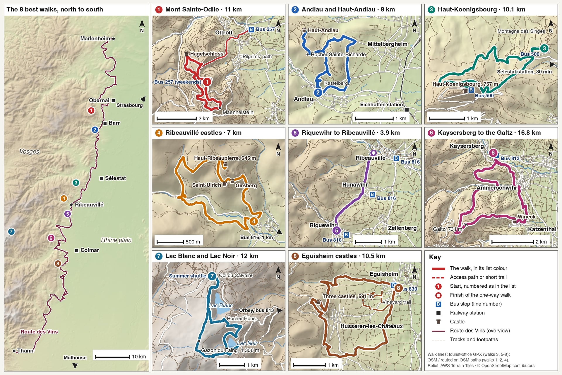
Walk | Distance | Elevation gain | Time | Start |
Mont Sainte-Odile and the Pagan Wall | 11 km, two loops | 419 m | 3 h 45 | Sanctuary car park |
Andlau and Haut-Andlau | 8 km loop | About 300 m | 3 h | Andlau town hall |
Haut-Koenigsbourg from Kintzheim | 10.1 km loop | 361 m | 3 h 30 | Montagne des Singes car park |
Ribeauvillé's three castles | 7 km loop | 380 m | 2 h 30 | Place de la République |
Riquewihr to Ribeauvillé | About 3.9 km one way | About 95 m | About 1 h 15 | Dolder gate, Riquewihr |
Kaysersberg to the Galtz | 16.8 km loop | 860 m | 4 h 30 | Kaysersberg town hall |
Lac Blanc and Lac Noir | 12 km loop | 648 m | 3 h 30 | Col du Calvaire car park |
Eguisheim's three castles | 10.5 km loop | 370 m | Half a day | Eguisheim tourist office |
Choose by the day you have in mind:
A short morning: Riquewihr to Ribeauvillé through the vines, with the bus back, or the 1.8 km Zotzenberg trail at Mittelbergheim
A full day: Kaysersberg to the Galtz, 16.8 km with 860 m of climbing
A Sunday without a car: walks 4 and 5, on bus 816, the only vineyard line from Colmar that runs on Sundays
Cooler air in summer: Lac Blanc and Lac Noir, between 955 and 1,306 m
Castles: Haut-Koenigsbourg, Ribeauvillé's three ruins and the three towers above Eguisheim
1. Mont Sainte-Odile and the Pagan Wall
Route: Le Mur Païen, two loops from the sanctuary on the summit round the old stone wall, on the Club Vosgien's yellow chevalet, an X-shaped sign
Distance: 11 km in two loops, about 3 hours 45; the northern loop alone is 6.3 km in 2 hours 30
Elevation gain: 270 m on the northern loop and 149 m on the southern loop
Highest point: about 820 m at the Maennelstein viewpoint
Terrain: forest paths over sandstone rocks, with short, steep steps; graded intermediate
Getting there: bus 257 from Obernai station to the convent in 40 minutes, at weekends and on public holidays from Easter to 1 November
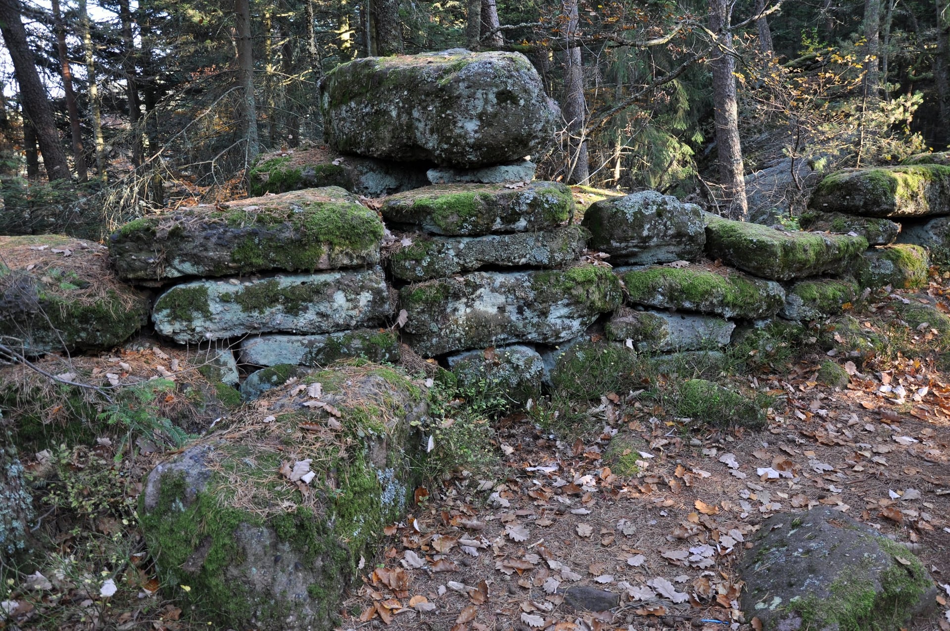
Mont Sainte-Odile is the holy mountain of Alsace, crowned by a convent at about 760 m where the 8th-century sarcophagus of St Odile lies. The Pagan Wall runs round the summit plateau for 10 to 11 km, built from about 300,000 sandstone blocks and up to 3 m high.
Nobody agrees on when or why the wall was built, and proposed dates range from about 1000 BC to the 7th century. The Pagan Wall loops pass the Koeberlé gate, wide enough for one person at a time, and the Hagelschloss, a 13th-century castle built from the wall's own stones.
On weekdays the bus stops in Ottrott, 14 minutes from Obernai, and the Pilgrims' path climbs from there to the convent: 463 m in 4.1 km, about 1 hour 30 on foot.
2. Andlau and the Haut-Andlau Castle
Route: Le château du Haut Andlau, from the town hall up through the Kastelberg and Wiebelsberg vineyards to the Rocher Sainte-Richarde and the castle, back on the GR5
Distance: 8 km loop, about 3 hours
Elevation gain: about 300 m
Highest point: about 450 m at the castle
Terrain: steep vineyard tracks, then forest paths on red disc, yellow ring and red rectangle marks; graded intermediate
Getting there: train from Strasbourg to Eichhoffen in 45 to 60 minutes, then 2.5 km on foot; Andlau has no regular bus
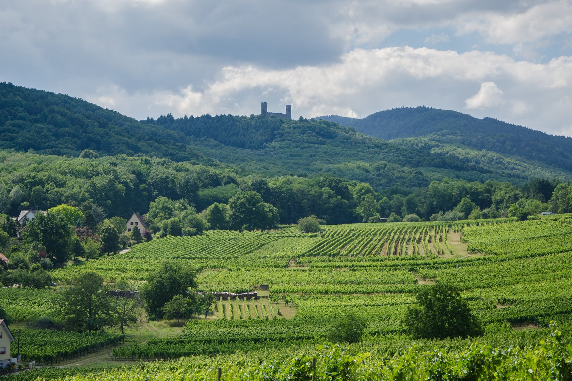
Andlau lies at the mouth of its valley, with two Grand Cru slopes rising behind its houses. The Kastelberg is the smallest Grand Cru in Alsace at 5.82 ha, and its shale slopes are the steepest climb of the loop, up to 45 degrees. The Wiebelsberg next to it is pink sandstone.
The lords of Andlau built the castle between 1337 and 1344, and forest guards still lived in it until 1796. The Barr tourist office's walk sheet asks walkers not to climb on the fragile ruins. The Rocher Sainte-Richarde, on the way up, is named after the empress who founded Andlau's abbey.
Mittelbergheim, a Plus Beau Village about 3.6 km away on the GR5, adds a short vineyard trail of 1.8 km with 42 m of climbing. Its Zotzenberg is the one Grand Cru where Sylvaner is allowed, so taste it there.
3. Haut-Koenigsbourg From Kintzheim
Route: À l'assaut du Haut-Koenigsbourg, from the Montagne des Singes car park above Kintzheim up through the forest to the castle and back
Distance: 10.1 km loop, about 3 hours 30
Elevation gain: 361 m
Highest point: the castle, at 757 m
Terrain: forest paths and tracks on red rectangle, yellow diamond and red cross marks; graded for all walkers
Getting there: shuttle bus 500 from Sélestat station, which stops 430 m from the start on its 30-minute run to the castle
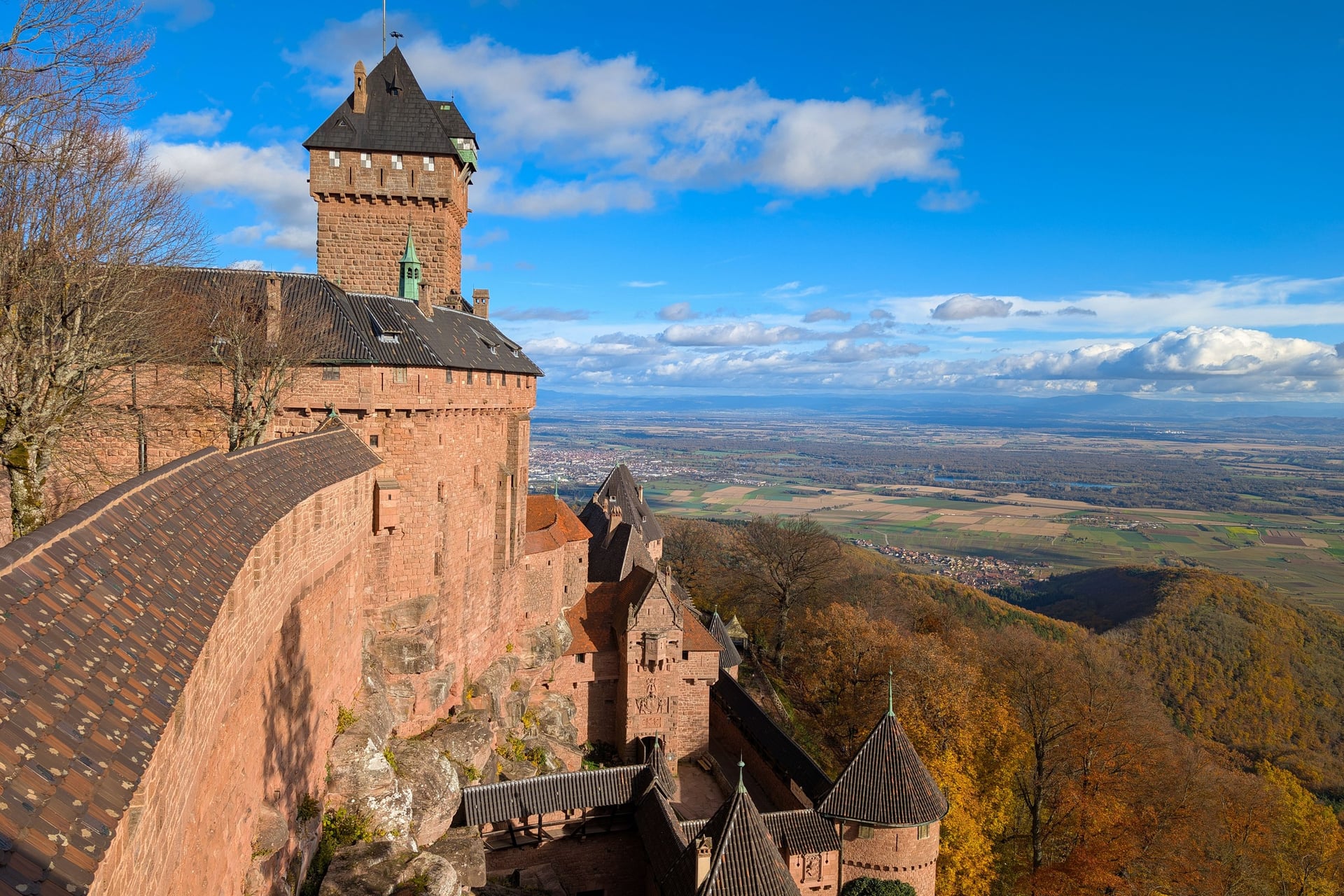
Haut-Koenigsbourg stands on a spur of the Vosges at 757 m, looking east over the Alsace plain. First recorded in 1147 and burned in 1633, it lay in ruins until Sélestat gave it to Emperor Wilhelm II in 1899. The castle you visit today is an 8-year restoration, completed in 1908.
Of the walks around the castle, this loop is the one you can reach by bus. A record 596,708 visitors came in 2023, so leave time for the visit and its 300 steps before the last bus down.
A shorter loop from the Col du Schaentzel reaches the castle in about 1 hour: 4.5 km in all with 139 m of climbing, but no bus serves the pass.
4. The Three Castles Above Ribeauvillé
Route: from Place de la République up the GR5 to Saint-Ulrich, past the Girsberg to Haut-Ribeaupierre, down on the yellow cross
Distance: 7 km loop, about 2 hours 30
Elevation gain: 380 m
Highest point: 645 m at Haut-Ribeaupierre
Terrain: stony forest paths with steady climbs; red rectangle on the way up, yellow cross on the way down
Getting there: bus 816 from Colmar in 39 minutes, every day, or a coach from Sélestat station in 20 to 26 minutes
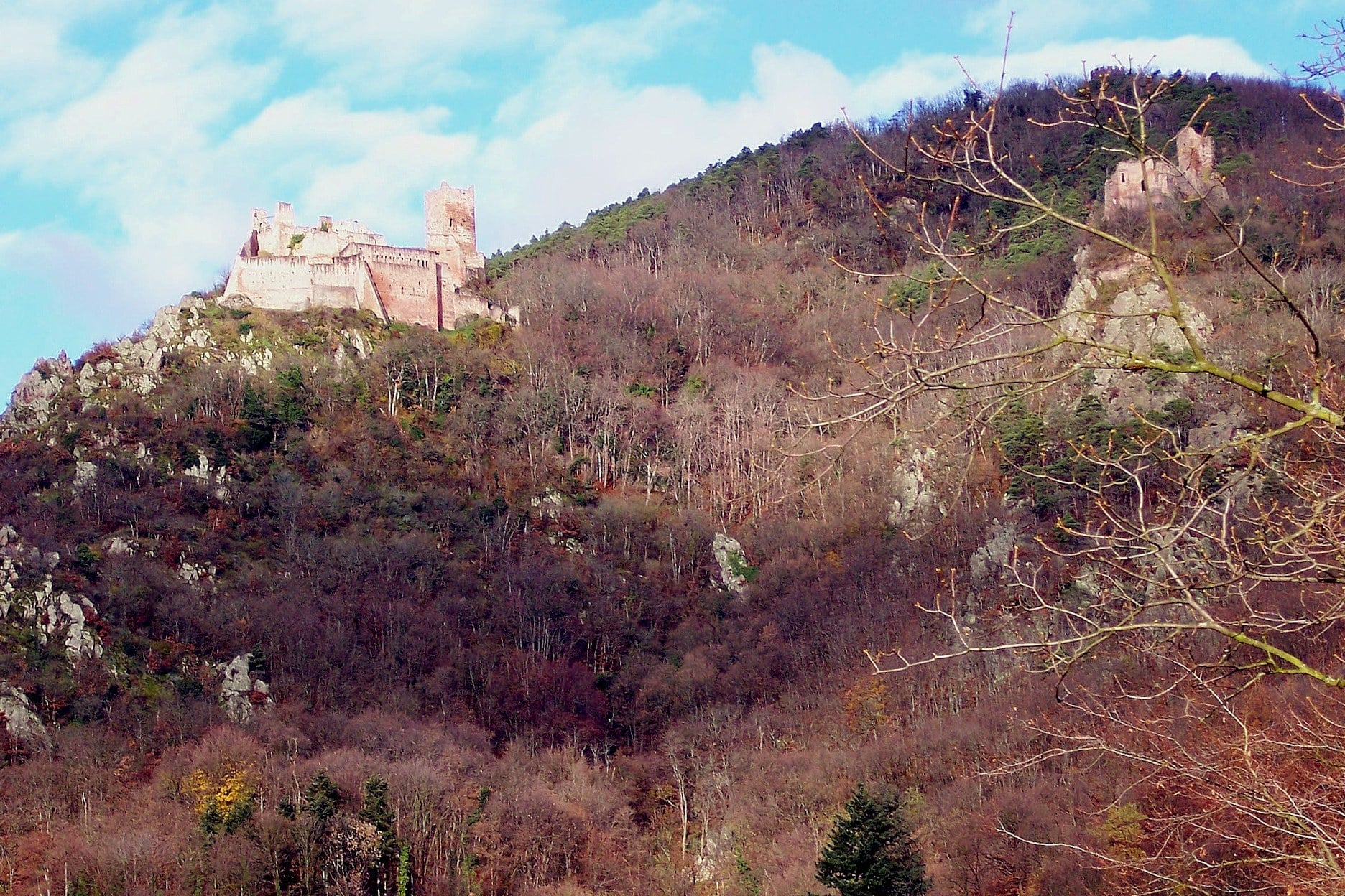
Three ruined castles of the Ribeaupierre lords stand above the Strengbach valley behind Ribeauvillé. Saint-Ulrich, at 520 m, was built around the middle of the 13th century on a rocky spur, and later gained a wing with two huge halls, one above the other.
The Girsberg, on a rock facing it, has a pentagonal keep from about 1250 and was never lived in by the Ribeaupierre. The three castles loop tops out at Haut-Ribeaupierre, first called Altenkastel, with a round tower and a vaulted cistern.
For a longer day, the Kutzig circuit from Hunawihr covers 10.7 km with 650 m of climbing in about 3 hours.
5. Riquewihr to Ribeauvillé via Hunawihr
Route: the Géovino trail from Riquewihr's Dolder gate through the vineyards to Hunawihr's fortified church and on to Ribeauvillé
Distance: about 3.9 km one way, about 1 hour 15
Elevation gain: about 95 m
Highest point: about 380 m, in the vineyards above Riquewihr
Terrain: vineyard tracks, short paved lanes and a path, waymarked as part of the Géovino Grande Boucle
Getting there: bus 816 from Colmar to Riquewihr in 28 minutes, every day; the same line brings you back from Ribeauvillé
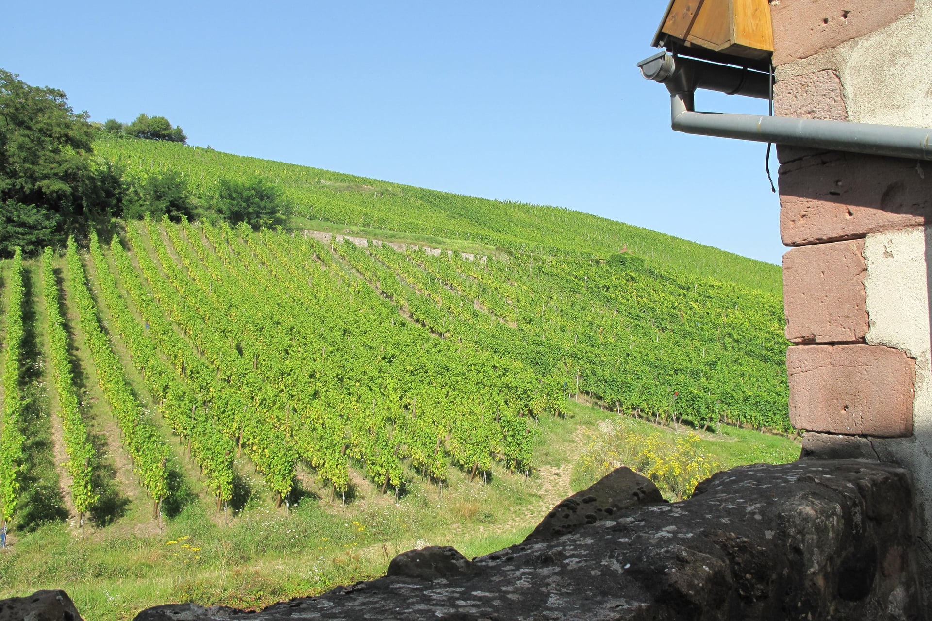
Riquewihr is a Plus Beau Village inside a double ring of walls, with houses from the 15th to the 18th century and the 13th-century Dolder tower at its gate. Its Schoenenbourg and Sporen Grands Crus have been named since the Middle Ages, and Riesling is king on the Schoenenbourg's 53 ha.
The Géovino trail links 11 villages and 13 Grand Cru hillsides in a 35.77 km loop. This stretch drops to Hunawihr, another Plus Beau Village, whose 15th-century church stands in a fortified churchyard among the vines.
Bus 816 stops in all three villages, so you can walk one way and ride back. Combined with walk 4, the day comes to about 11 km.
6. Kaysersberg, Ammerschwihr and the Galtz
Route: the official loop from Kaysersberg town hall through Ammerschwihr and Katzenthal to the Galtz monument, back past the Flieger chapel
Distance: 16.8 km loop, about 4 hours 30
Elevation gain: 860 m
Highest point: 731 m at the Galtz monument
Terrain: vineyard tracks, a stretch of the Way of St James and forest paths; graded challenging
Getting there: bus 813 from Colmar in 24 to 47 minutes, Monday to Saturday only
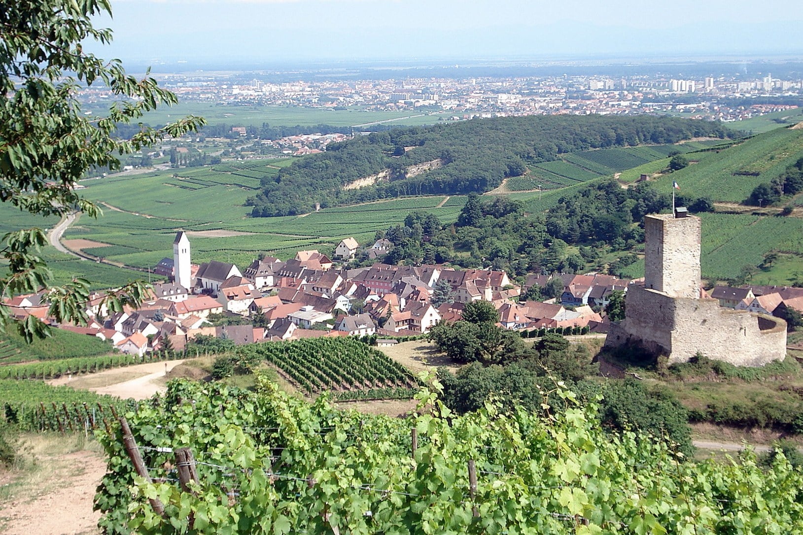
This is the longest day on the list, from Kaysersberg's walls up to a summit at 731 m. The town's castle was built around 1200 to block the roads from Lorraine, and its round keep has walls over 4 m thick. Kaysersberg was voted the French public's favourite village in 2017.
Beyond Ammerschwihr and its Kaefferkopf Grand Cru, the path climbs past the Wineck, known as the castle of the vines, to the Galtz. The Christ statue on the top blesses the whole plain, a 1930s memorial to the Alsatians killed in the First World War.
If 16.8 km is too far, the Galtz loop has a shorter version: Kaysersberg to Ammerschwihr and back, 7 km with 335 m of climbing.
7. Lac Blanc and Lac Noir Above Orbey
Route: Le tour des lacs Noir et Blanc, from the Col du Calvaire car park along the GR5 on the crest, round Lac Noir and back above the Rocher Hans
Distance: 12 km loop, about 3 hours 30
Elevation gain: 648 m
Highest point: about 1,306 m at the Gazon du Faing
Terrain: mountain paths with a stretch of boulders on the rock wall above Lac Blanc; graded challenging; open 1 March to 15 November
Getting there: the Navette des Crêtes shuttle from Colmar station in 55 minutes; in 2026 it ran at weekends in June and September and daily in July and August
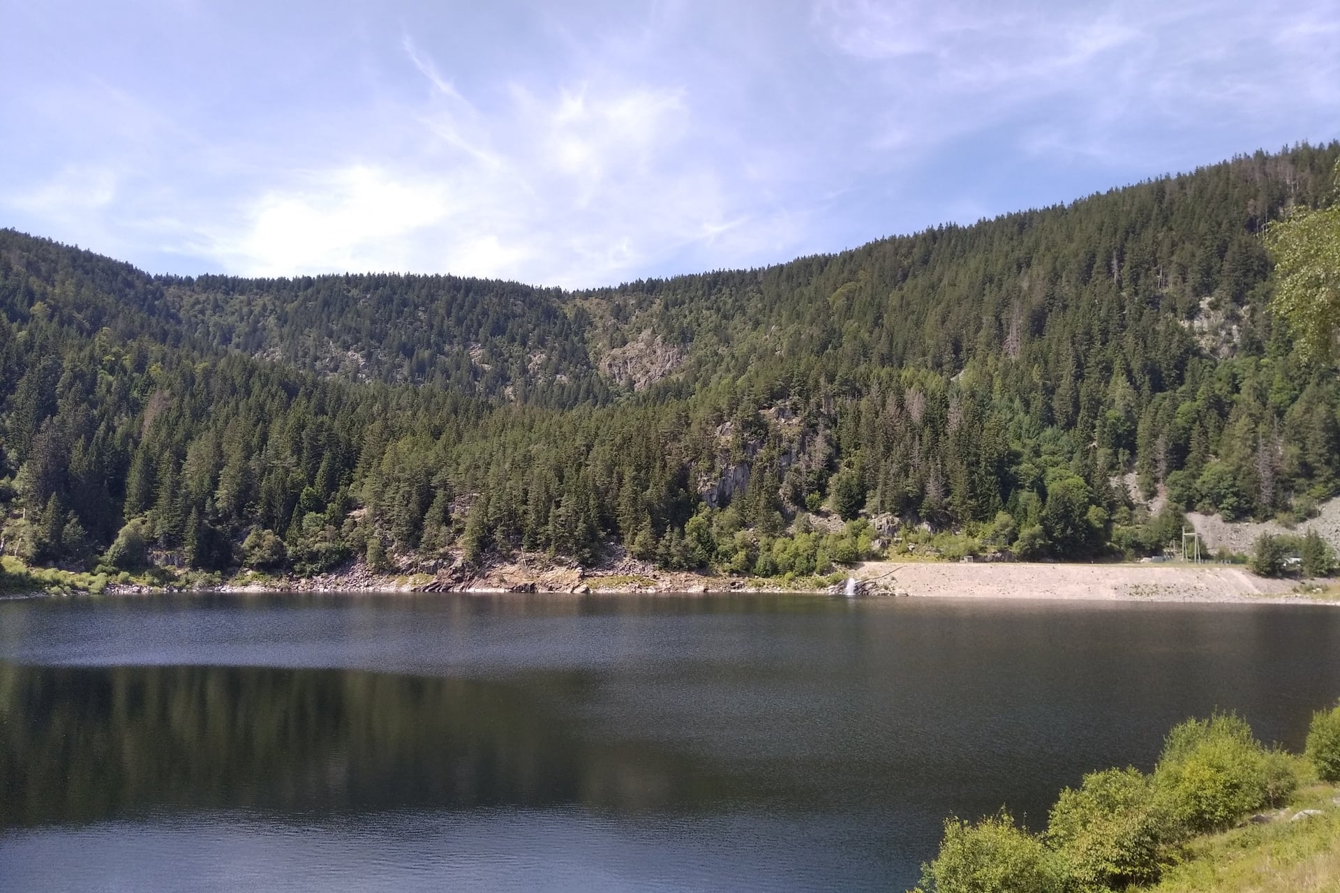
The two glacial lakes lie in cirques under the main Vosges ridge, about 100 m apart in height. Lac Blanc, at 1,055 m, covers 29 ha and is 72 m deep, and takes its name from the colour of its crystalline sand. The Rocher Hans rises above it, topped by a statue of the Virgin.
Lac Noir, at 955 m, covers 14 ha and is 45 m deep. Under a decree of 1938 the lakes worked as a pumped-storage power plant until flooding stopped it in 2002. The two lakes loop is the one true mountain walk on this list.
Outside the shuttle season, the year-round way in is bus 813 to Orbey, from Monday to Saturday. The official loop from Orbey town hall covers both lakes in 19.2 km, with 1,050 m of climbing, in about 6 hours.
8. Eguisheim's Vineyards and the Three Castles
Route: Circuit Vignoble et Châteaux, from the Eguisheim tourist office up through the vineyards and the forest to the three castle towers and back
Distance: 10.5 km loop, half a day
Elevation gain: 370 m
Highest point: 591 m at the three castles
Terrain: vineyard tracks and forest paths; graded intermediate
Getting there: bus 830 from Colmar in 16 minutes, Monday to Saturday
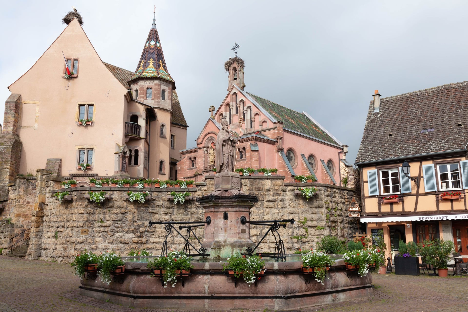
Eguisheim was built in rings round its castle on the Place Saint-Léon, where Count Bruno, the future Pope Leo IX, was born in 1002. It has been a Plus Beau Village since 2003. The castles walk climbs from its streets to three pink sandstone keeps on the ridge, built in the 11th and 12th centuries.
The Dagsbourg, the Wahlenbourg and the Weckmund are free to visit. From 15 November to 15 March the road closes, and the castles can only be reached on foot.
For a short walk, the Grands Crus vineyard trail loops 3.1 km through the Eichberg and Pfersigberg, with 60 m of climbing. It starts between the campsite and the stork park, and its panels explain the seven grape varieties of Alsace.
How Hard Is Walking the Alsace Wine Route?
Walking on the Alsace Wine Route is easy to moderate, with gentle vineyard tracks between the villages and the real climbs on the castle and mountain paths above them.
Climbs and Ground
The vineyard walk from Riquewihr climbs less than 100 m, while the castle loops, such as the one from Ribeauvillé to Saint-Ulrich, climb 300 to 420 m and the Galtz loop 860 m. Most of the climbing comes in one long pull from the village to the ridge, on stony forest paths.
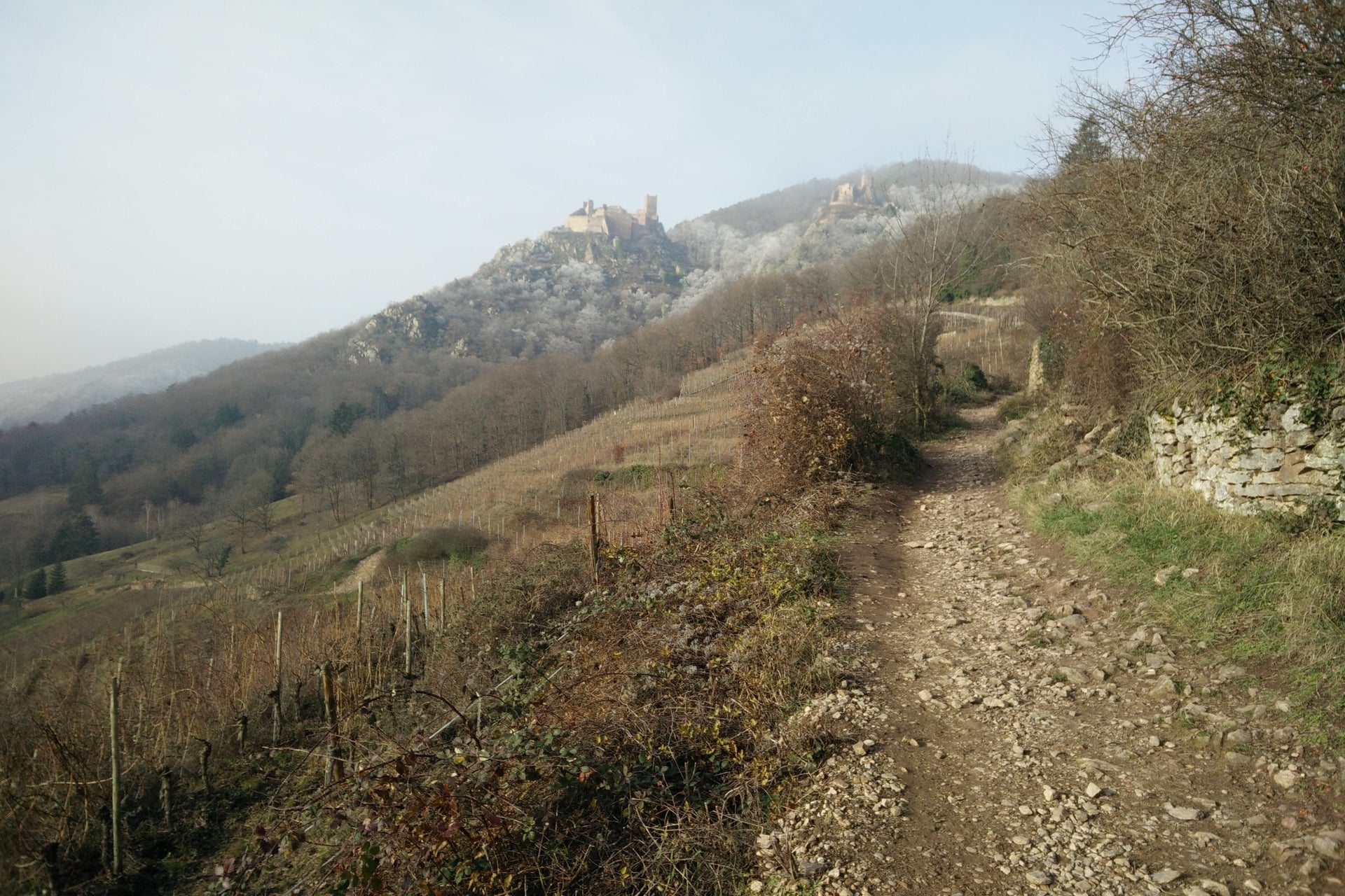
The lakes loop above Orbey is the one mountain walk, between 955 and 1,306 m. On the rock wall above Lac Blanc, the tourist office warns of a stretch of boulders where good fitness and proper footwear are essential.
Heat and Shade
Summer heat matters more than the hills, because the vines give no shade. Colmar is one of the least rainy towns in France, with 595 mm a year. Its Colmar-Meyenheim weather station records about 21 days a year above 30 °C, most of them in July and August.
The Club Vosgien advises avoiding the hours between noon and 4 pm in a heatwave and carrying 1.5 to 2 litres of water each. Walk the vineyards in the morning and keep the forest loops for the afternoon.
Waymarks and Maps
The Club Vosgien, founded in 1872, marks more than 20,000 km of paths in Alsace and the Vosges with geometric signs in four colours. The colour says nothing about difficulty, while the shape tells you the kind of route:
Red rectangle: the GR5 and GR53, the long routes along the Vosges
Diamond: routes of a week or more across the region
Disc: loops of half a day or more
Ring: loops of 3 to 4 hours
Cross, triangle or chevalet: short links and local paths
Signposts give walking times at 3.5 to 4 km an hour without breaks, so allow extra time for stops and climbs. On paper, the IGN 1:25,000 sheets carry the Club Vosgien marks: 3716ET for Mont Sainte-Odile, 3717ET for Andlau, 3718OT for Haut-Koenigsbourg, Ribeauvillé and Kaysersberg, and 3719OT for Colmar.
Best Time to Walk the Alsace Wine Route
The walking season on the Alsace Wine Route runs from April to October, and the vineyards change through it, from fresh leaves in spring to the harvest in September and October.
Average highs and rainy days at Météo-France's Colmar-Meyenheim station, 1991 to 2020:
Months | Average high | Rainy days | What changes |
April and May | 17 to 21 °C | 9 to 11 a month | Bus 257 starts its weekend runs to Mont Sainte-Odile at Easter |
June | 25 °C | 9 | The longest days, and about 4 days above 30 °C |
July and August | 27 °C | 9 | About 7 days a month above 30 °C; daily shuttle to Lac Blanc |
September | 22 °C | 8 | The harvest; Ribeauvillé's Pfifferdaj parade on the first Sunday |
October | 16 °C | 9 | Late-harvest picking from mid-October |
November to March | 6 to 13 °C | 7 to 8 | Christmas markets from late November; Eguisheim's castles on foot only |
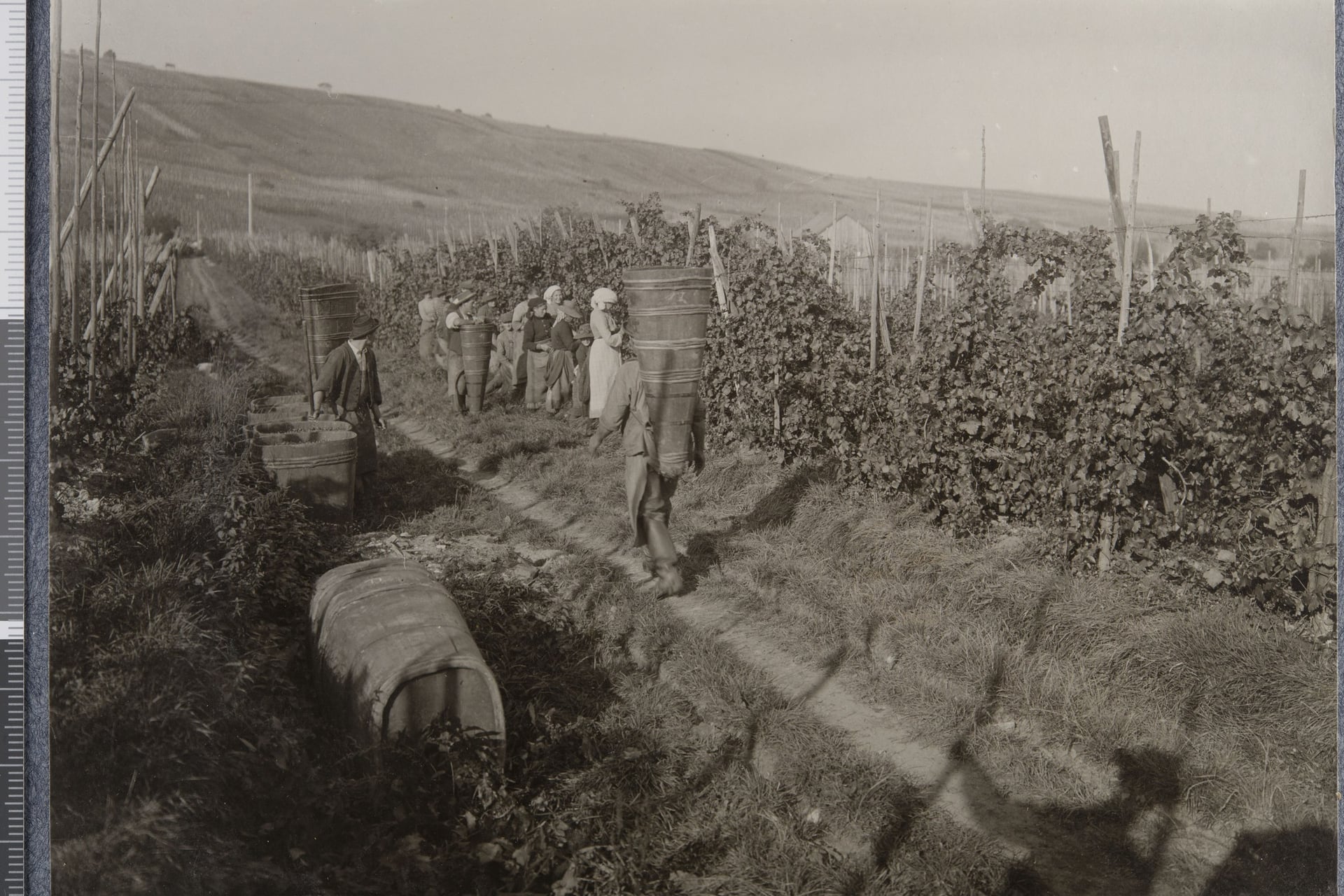
The harvest starts about 100 days after the vines flower, on a date the prefecture sets each year. Crémant grapes usually come first, around 15 September, but in 2026 picking opened on 18 August, the earliest on record.
The Grand Cru trail around Riquewihr stays open during the harvest if you keep to the marked paths, says the Ribeauvillé-Riquewihr tourist office. In the Haut-Rhin the hunting season runs from late August to 1 February, and drives can take place on any day, so stay on marked paths in the forest.
In winter, Colmar's Christmas markets run from 23 November to 29 December 2026, and Eguisheim's from 27 November to 30 December. The official lakes loop above Orbey closes from 16 November to the end of February.
Know Before You Arrive
Colmar is the transport hub for the wine villages, with trains from Strasbourg and Paris and the regional buses into the vineyards.
Getting There and Around Without a Car
The train journey from Paris takes 2 hours 20 to Colmar, and Strasbourg's trains reach Colmar in 26 to 42 minutes. From Colmar station, regional Fluo buses climb into the vineyards, but only one of them runs on Sundays.
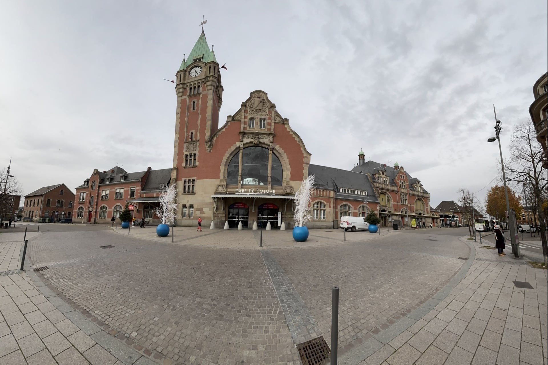
By train:
London to Paris: Eurostar in 2 hours 16
Paris Est to Colmar: TGV in 2 hours 20 at the fastest; Paris to Strasbourg in 1 hour 45
From the USA: six direct TGVs a day from Paris Charles de Gaulle airport to Strasbourg, the fastest in 1 hour 50
Strasbourg to Colmar: regional trains in 26 to 42 minutes, every 30 minutes on weekdays
Strasbourg to Obernai and Barr: line C23 in about 30 and 40 minutes, hourly on Sundays
EuroAirport Basel-Mulhouse: bus 11 to Saint-Louis station in 10 to 15 minutes, then 34 to 39 minutes by train to Colmar
By bus:
Bus 813: Colmar to Kaysersberg in 24 to 47 minutes and Orbey in 46 to 77, Monday to Saturday
Bus 816: Colmar to Riquewihr in 28 minutes and Ribeauvillé in 39, every day, with four buses each way on Sundays and holidays
Bus 830: Colmar to Eguisheim in 16 minutes, Monday to Saturday, with no bus between 7:30 and 12:30 on weekdays
Sélestat coach: Sélestat station to Ribeauvillé in 20 to 26 minutes, five runs on Sundays
Shuttle 500: Sélestat station to Haut-Koenigsbourg in 30 minutes, hourly until 1 November, then at weekends until 3 January
Bus 257: Strasbourg and Obernai to Ottrott, and on to Mont Sainte-Odile at weekends from Easter to 1 November
On the Fluo network, the Colmar lines took their 800 numbers on 1 September 2026, so older timetables show them as 68R013, 68R016 and 68R030. Check the last bus back before you set off: on Saturdays it leaves Eguisheim at 17:13 and Riquewihr at 18:13.
Where to Base Yourself
Where you sleep decides which walks you can reach without a car, and Colmar puts every bus line at the station door.
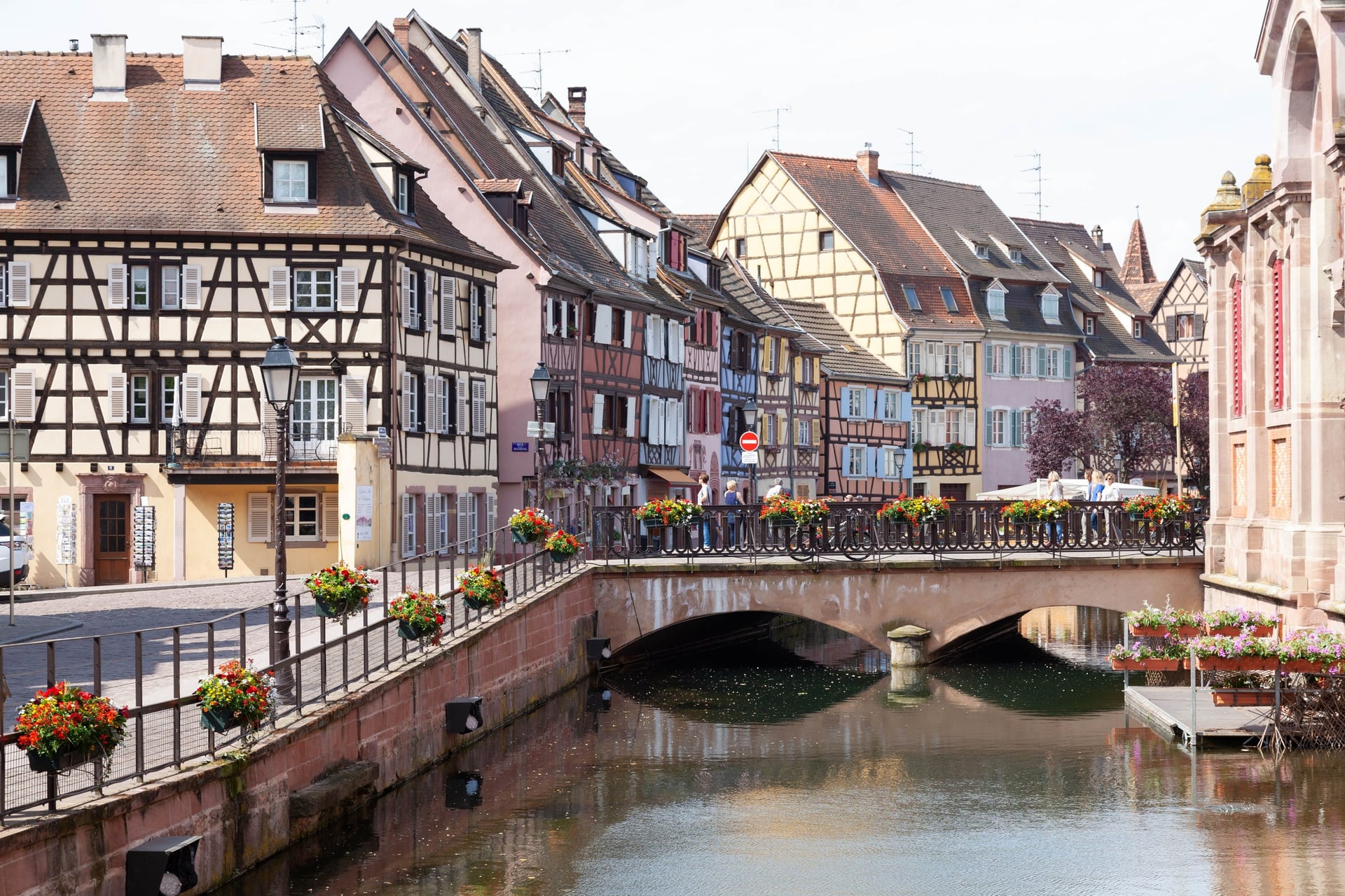
Colmar: 31 hotels with 1,751 rooms, trains to Strasbourg and Sélestat, and the buses to walks 4 to 8
Riquewihr and Ribeauvillé: seven hotels with 244 rooms and nine with 241; walks 4 and 5 start in their streets, and bus 816 runs on Sundays
Kaysersberg: five hotels with 159 rooms, the start of walk 6 and a stop on the summer shuttle to Lac Blanc
Eguisheim: eight hotels with 157 rooms, with walk 8 from the tourist office
Obernai: 11 hotels with 418 rooms, a station on line C23 and bus 257 to Mont Sainte-Odile for walks 1 and 2
Village hotels are small, with 20 to 35 rooms on average. At Christmas the Kaysersberg tourist office reports very high demand for Friday to Sunday nights, and some hotels prefer guests who stay several nights, so book December weekends early.
Food and Wine on the Way
A winstub serves the dishes of Alsace with the village's own wine, and the Ribeauvillé-Riquewihr tourist office says most cellar tastings are free. These five turn up on menus and in cellars between Obernai and Eguisheim.
How Much It Costs
The walks themselves cost nothing, so the money goes on castle tickets, buses, beds and a few bottles. These are 2026 prices for adults:
Haut-Koenigsbourg: €12, or €6 with a bus 500 ticket; free on the first Sunday of each month from November to March
Château du Hohlandsbourg: €7, or €10 on event days, on the castles road above Eguisheim
Castle ruins: free at Kaysersberg and at Eguisheim's three castles
Wine tastings: mostly free at the cellar door
Buses: €4 for a Fluo single in the Haut-Rhin, valid for 4 hours; €3 in the Bas-Rhin and on shuttle 500, cash only
Trains: Strasbourg to Colmar from €6 one way
Tourist tax: €1.85 a night in a 3-star hotel in Colmar, €1.76 in Kaysersberg and €1 in Riquewihr and Ribeauvillé
Maps: €14.30 for an IGN 1:25,000 sheet
What to Pack
Sun on the open vineyards, stony castle paths and a mountain loop at 1,300 m set the kit for these walks.
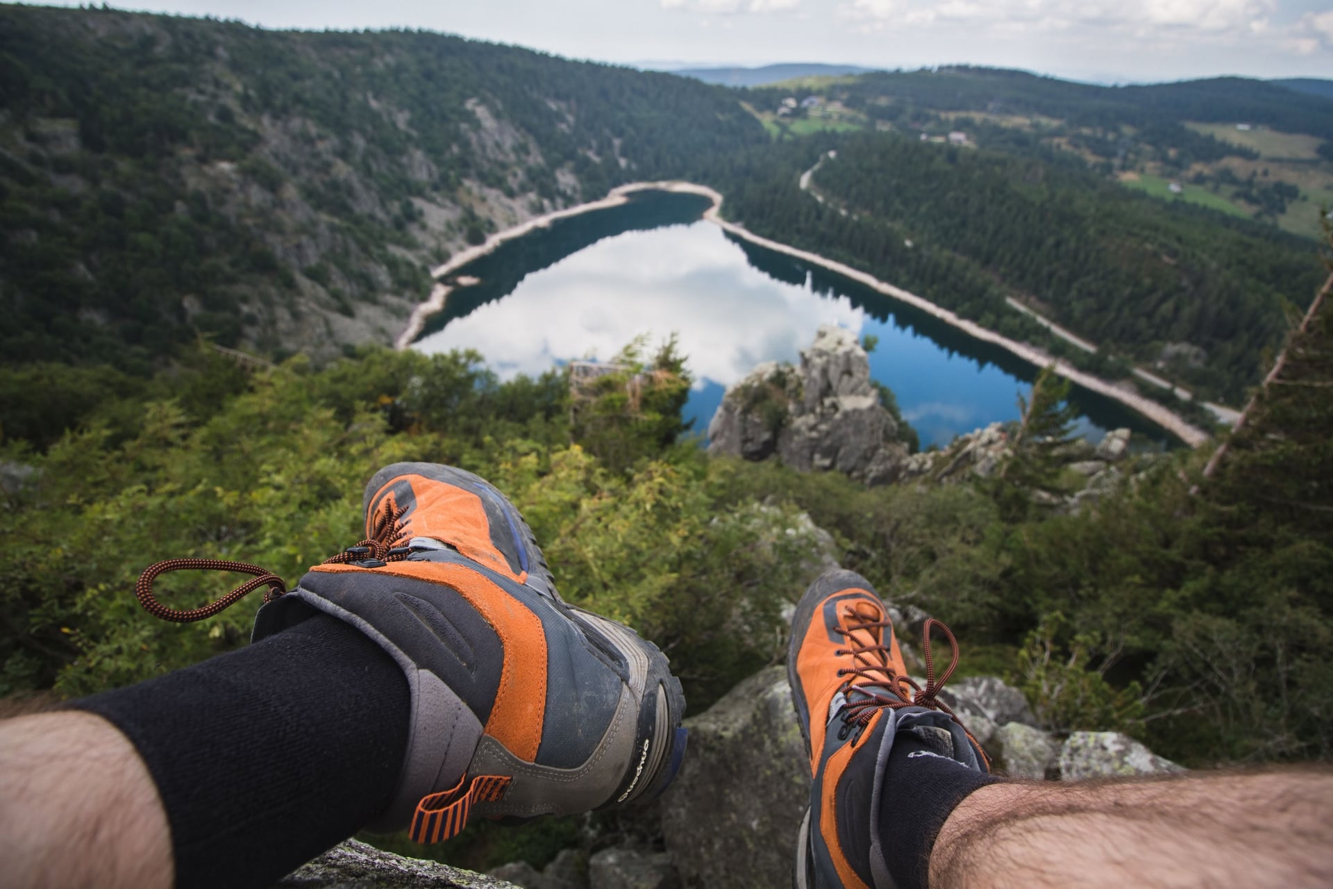
For any walk:
Trail shoes or light boots with a good grip for the castle paths
A sun hat and sun cream for the vineyards, which have no shade
A 20 to 25 litre day pack with a rain jacket
A phone with the walk's GPS track and a power bank
For the Alsace Wine Route:
1.5 to 2 litres of water each, the Club Vosgien's advice for hot days
Walking poles for the 860 m of the Galtz loop and the boulders above Lac Blanc
A warm layer for the crest above Lac Blanc, 1,100 m higher than Colmar
Long trousers and tick repellent, as Alsace had more than 100 Lyme disease cases per 100,000 people in 2024
Cash for shuttle 500 and the smaller cellars
A padded bottle bag if you buy wine at a cellar door
Day Walks From Colmar, or Inn to Inn?
Day walks from Colmar work well from Monday to Saturday, but on Sundays only bus 816 runs into the vineyards, and you come back to the same bed every night.
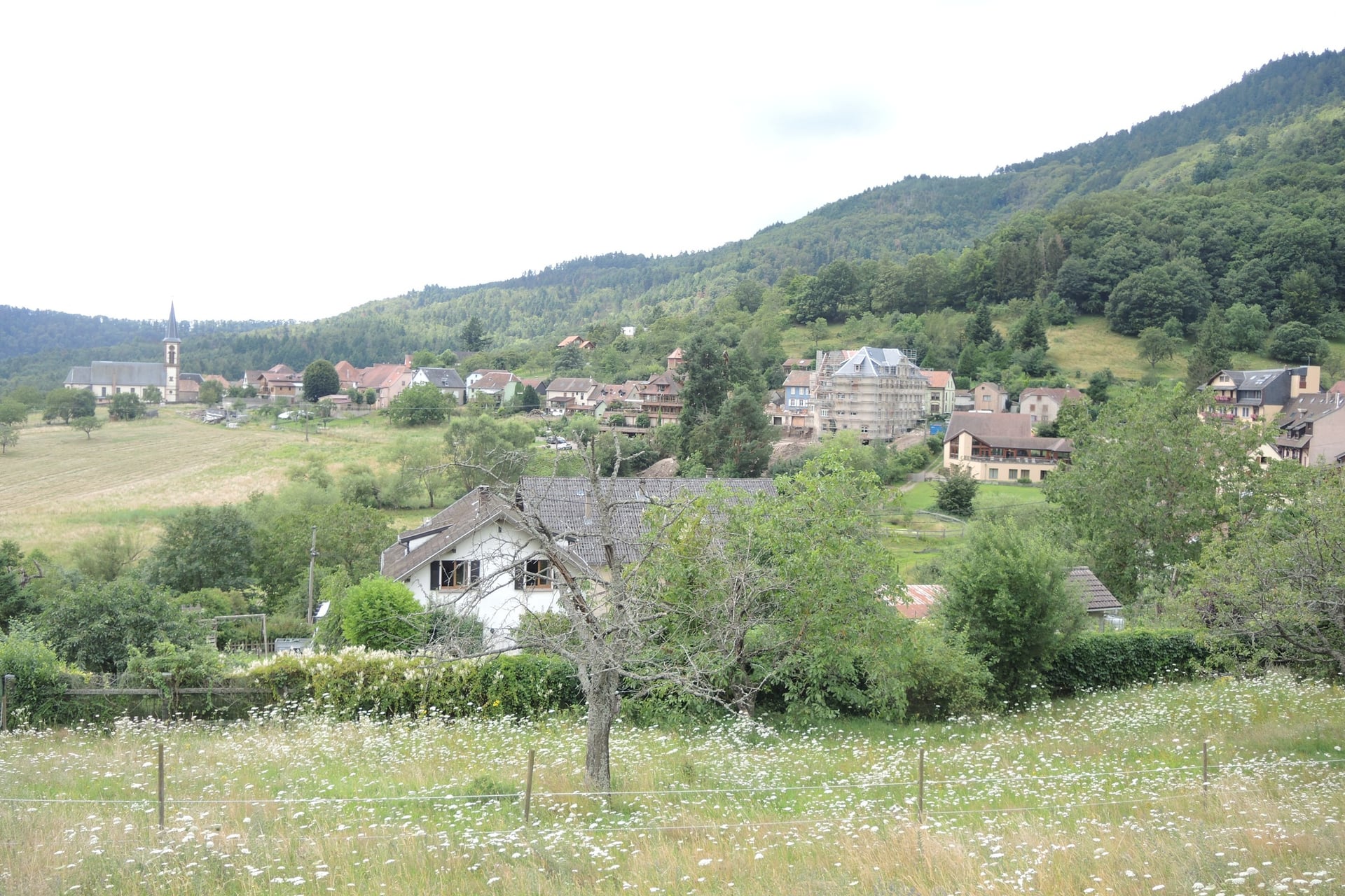
Walking from village to village is the classic way to see the wine route, but it means booking small hotels in each village, and someone has to move your bags between them.
Our self-guided Alsace Walking Holidays tour solves that. We book the hotels, move your luggage each day and give you a GPS app, a digital guidebook and support while you walk.
Duration: 8 days / 7 nights, April to October
Route: Thannenkirch to Eguisheim, through Ribeauvillé, Kaysersberg and Turckheim
Walking: six days of 8 to 19 km, 72 km and 2,375 m of climbing in all, with a day round Lac Noir in the Vosges
Nights: 3-star hotels with breakfast, two in Kaysersberg and two near Eguisheim; the tourist tax is paid locally
Ask us about dates for next season, or see the full list of our walking holidays in France.
On the last walking day the loop climbs from Eguisheim to the three pink sandstone keeps at 591 m, with the vineyards and the Rhine plain spread out below.
Frequently Asked Questions



Plan with a hiking expert
Free advice from a team that knows these routes inside out - real people, not a bot

HASSLE-FREE
We handle itineraries, accommodations, and anything else you prefer not to deal with, so you can enjoy a carefree hike.

TRUSTED BY MANY
We are a financially protected company, fully bonded and insured, keeping your money safe and allowing you to travel with confidence.

TRIED & TESTED ADVENTURES
Only the best walking tours in France, cherry-picked by our team with an in-depth knowledge of the region.

UNBEATABLE SUPPORT
Our 24/7 customer support is where we show our passion, bringing you a better experience by making your well-being our number one priority.