Walking in Provence: 9 Best Walks, From the Luberon to the Sea
Nine of the best walks in Provence, from Saint-Rémy and the ochre trails to the Calanques and Moustiers, with distance, climb and summer fire rules.
Quick links
Don't want to read all this?
We've planned 2,000+ hiking trips. Send your dates, fitness and group size — we'll map the route and book every night.



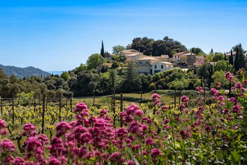
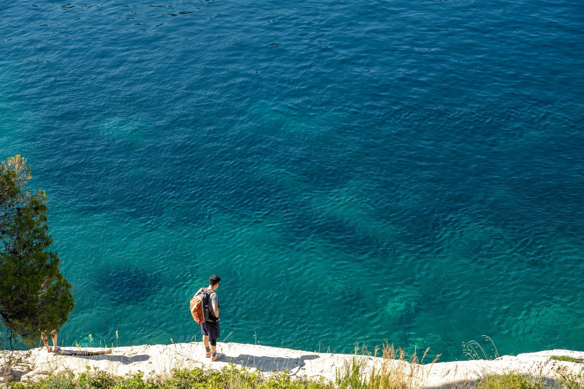
Walking in Provence takes you along mule tracks between dry-stone walls to villages on their hilltops. Paths cut through old ochre quarries that run from yellow to deep red, and on the coast white limestone drops straight into a blue sea. Lunch comes from the morning market, eaten in the shade of a pine.
The best walks in Provence are short: the nine below run from 3.4 to 15.5 km, with up to 600 m of climbing. Heat and summer fire closures decide the timing, so April to June and September to October suit every walk.
Provence is one of the most varied regions for walking in France, and all but one of these walks can be reached without a car.
The 9 Best Walks in Provence
The nine walks run west to east, from the Alpilles near Avignon to the Verdon, and range from a 3.4 km chapel path to a 15.5 km loop over the hills. Each one starts in a village or a car park reached by bus or train, except the cedar forest.
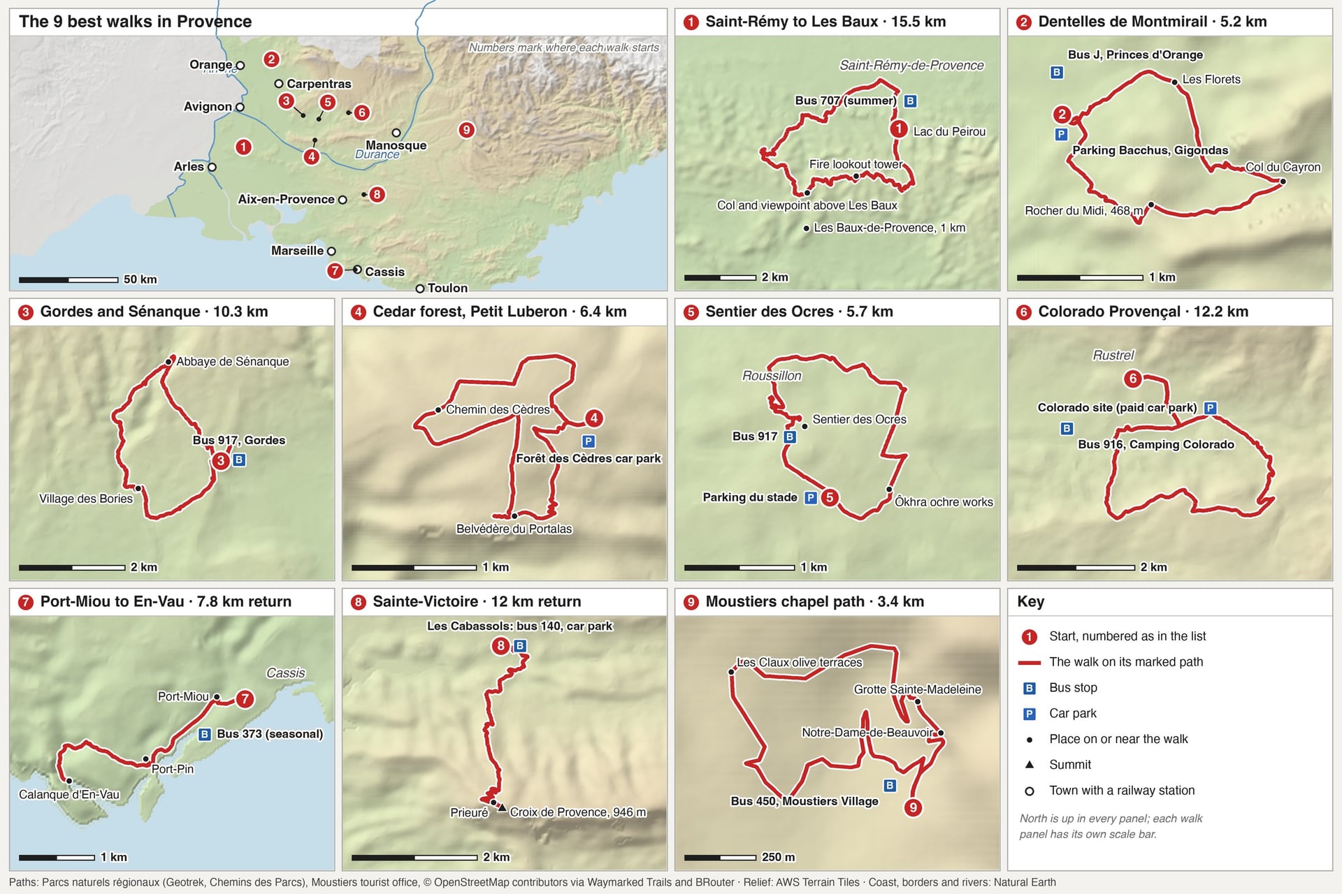
Six use the figures of Provence's regional nature parks. The other three come from the Calanques National Park, the Sainte-Victoire Grand Site and the Gigondas tourist office.
Walk | Distance | Elevation gain | Time | Start |
Saint-Rémy to Les Baux | 15.5 km loop | 392 m | 5 h | Saint-Rémy-de-Provence |
Dentelles de Montmirail | 5.2 km loop | 200 m | 1 h 45 | Gigondas |
Gordes and Sénanque | 10.3 km loop | 405 m | 3 h 30 | Gordes |
Cedar forest, Petit Luberon | 6.4 km loop | 147 m | 2 h | Forêt des Cèdres car park |
Sentier des Ocres | 5.7 km loop | 151 m | 1 h 30, plus the ochre trail | Roussillon |
Colorado Provençal | 12.2 km loop | 361 m | 4 h | Rustrel |
Port-Miou to En-Vau | 7.8 km return | 360 m | 3 h | Cassis |
Sainte-Victoire | 12 km return | 600 m | 4 h | Vauvenargues |
Moustiers chapel path | 3.4 km loop | 156 m | 2 h | Moustiers-Sainte-Marie |
1. The Alpilles: Saint-Rémy to Les Baux
Route: a loop from the Lac du Peirou in Saint-Rémy-de-Provence over the Alpilles to the col above Les Baux-de-Provence, partly on the GR6
Distance: 15.5 km, about 5 hours
Elevation gain: 392 m
Terrain: old tracks, forest roads and stony limestone paths through pine woods
Summer rules: Bouches-du-Rhône, 1 June to 30 September
Getting there: Zou! bus 707 from Avignon to Saint-Rémy in about 50 minutes
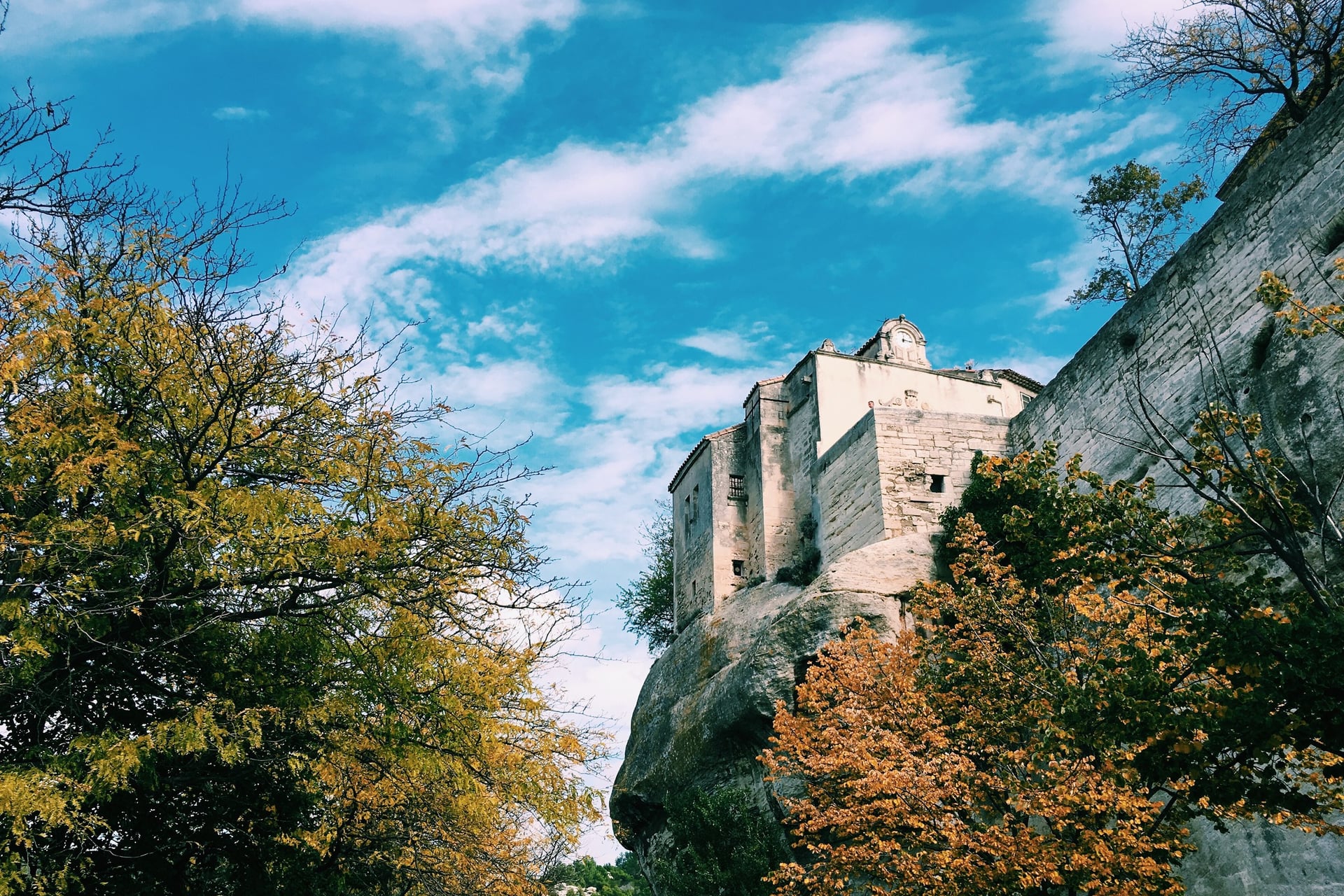
Saint-Rémy sits at the foot of the Alpilles, a low range of white crags and pine woods. Van Gogh lived in its Saint-Paul-de-Mausole asylum from May 1889 to May 1890 and painted about 150 works there. A 1.5 km trail through the town marks 19 of his scenes, about 1 hour on foot.
The regional park's loop climbs a pine valley to the GR6 and the col on the road to Les Baux, and its highest point is only 287 m. A viewpoint table at the col looks over the village on its rock, one of the Plus Beaux Villages de France, about 1 km to the south. Cars may not drive to the lake from 15 April to 15 September.
2. The Dentelles de Montmirail From Gigondas
Route: Gigondas village to the Rocher du Midi viewpoint and the Col du Cayron, back by Les Florets
Distance: 5.2 km, about 1 hour 45
Elevation gain: 200 m
Terrain: stony paths and tracks through oak and pine below the limestone ridges
Summer rules: Vaucluse, 15 June to 15 September
Getting there: train from Avignon to Carpentras in about 32 minutes, then Trans'CoVe bus J to Gigondas in about 45 minutes, Monday to Saturday
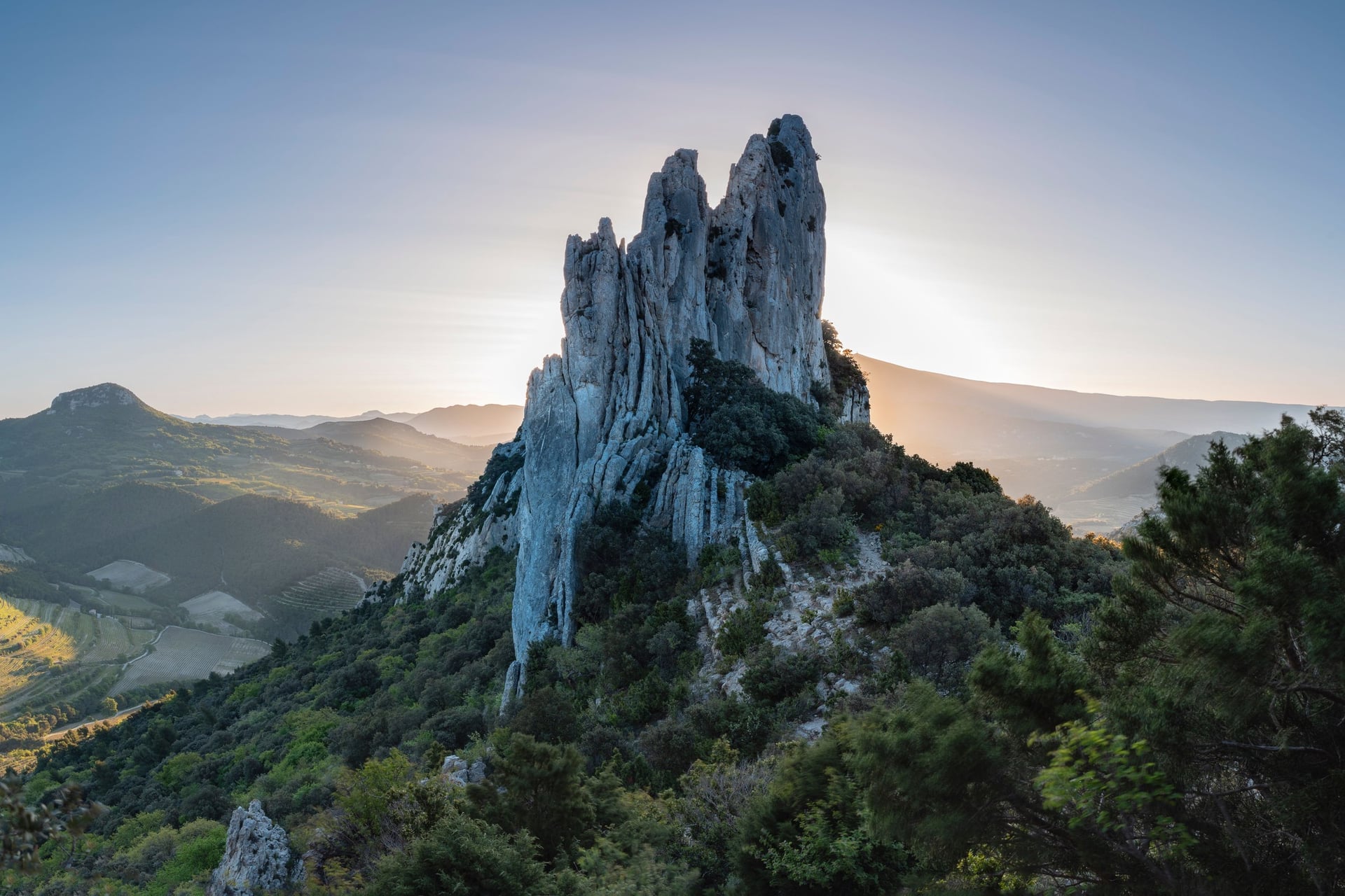
Above the Gigondas vineyards, beds of Jurassic limestone stand on end and have weathered into a jagged edge, the "lace" that gives the Dentelles their name. The highest point is the Crête de Saint-Amand at 732 m, and the Gigondas vines climb to 430 m on the lower slopes.
This tourist-office walk climbs to the viewpoint table on the Rocher du Midi at 468 m, then follows the ridge to the Col du Cayron. The road to the col is closed to cars all year, and drivers park at Les Florets, 500 m below it. For a longer day, the Tour Sarrasine from Gigondas covers 12 km with 400 m of climbing in about 4 hours 30.
3. Gordes and the Abbaye de Sénanque
Route: a loop from Gordes past the Village des Bories and down the Sénancole valley to the Abbaye de Sénanque, back on the GR
Distance: 10.3 km, about 3 hours 30
Elevation gain: 405 m
Terrain: stone-paved mule tracks, stony paths and oak woods, slippery in places
Summer rules: Vaucluse, 15 June to 15 September
Getting there: Zou! bus 917 from Apt or Coustellet to Gordes, not on public holidays
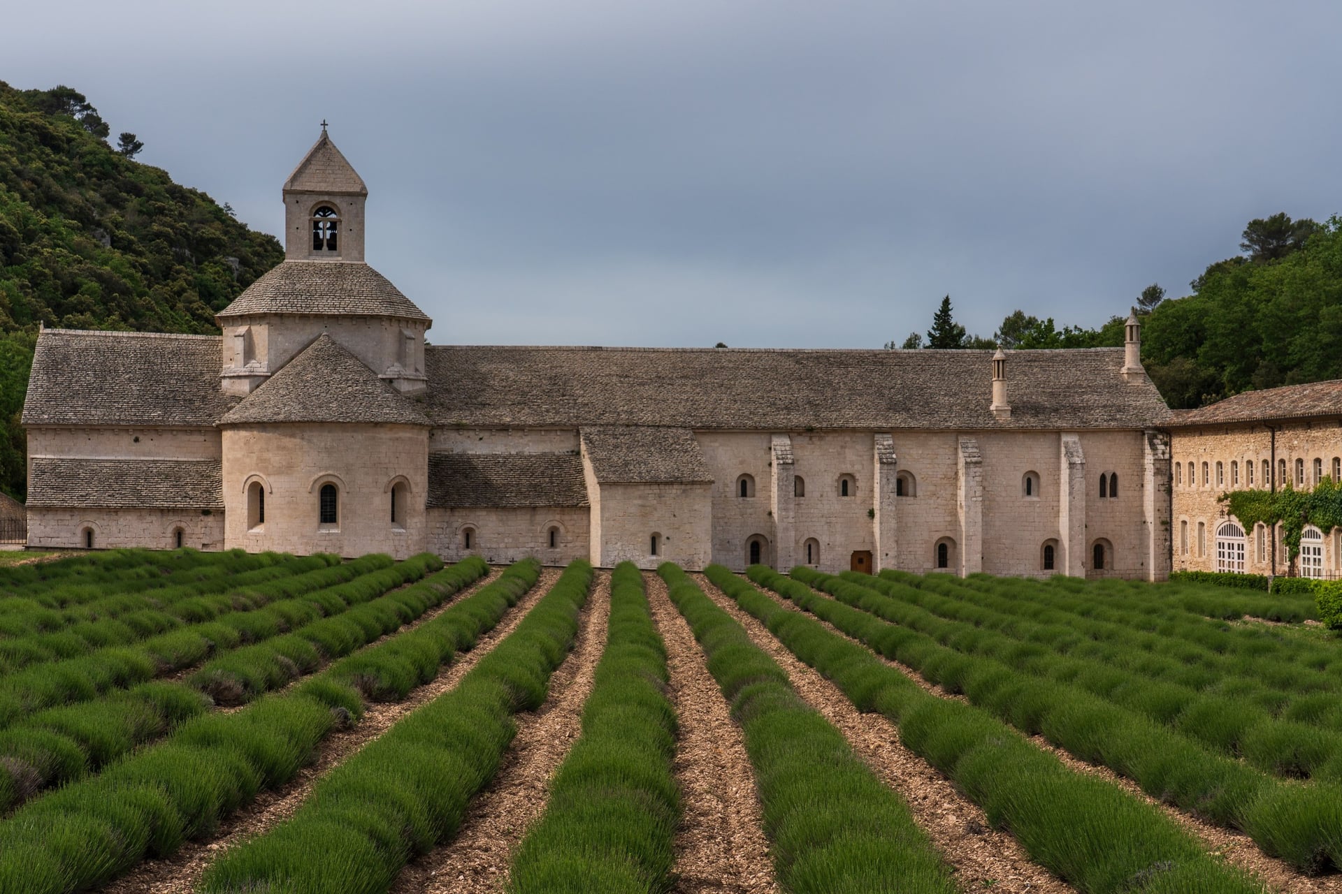
Gordes stands on its hill above the Luberon valley, one of the Plus Beaux Villages de France. The park's loop, a memorial trail to the Resistance fighters of 1942 to 1944, drops into the Sénancole valley to Sénanque, an abbey founded by Cistercian monks in 1148. Its lavender is at its best from 20 June to 10 July.
The abbey is 3 km from Gordes, 30 to 60 minutes on foot. Monks have lived there again since October 1988, the guided visit is in French, and visitors may not walk into the lavender. Nearby, the Mur de la Peste, built from March to July 1721 against the plague, has its own 7.5 km loop with 264 m of climbing.
4. The Cedar Forest of the Petit Luberon
Route: a loop from the Forêt des Cèdres car park on the Petit Luberon ridge, by the Chemin des Cèdres, the Pré de Roustan and the Portalas viewpoint
Distance: 6.4 km, about 2 hours
Elevation gain: 147 m
Terrain: forest tracks and paths at about 700 m, rocky in a few places
Summer rules: Vaucluse; the marked paths stay open on red days and close only at Red E
Getting there: 8 km from Bonnieux by the D36; no bus reaches the car park
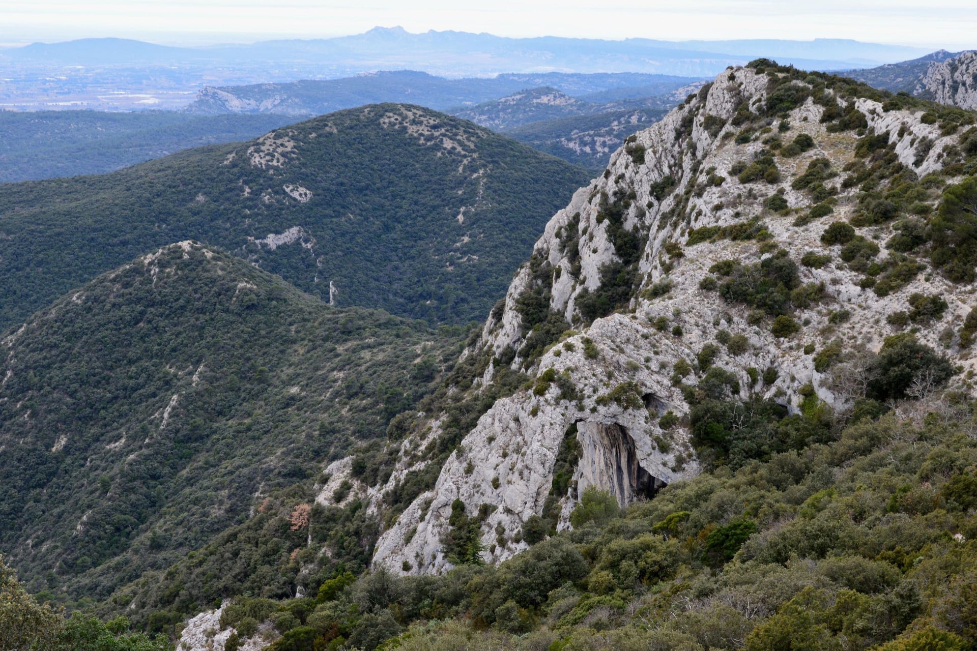
Foresters sowed Atlas cedars from Algerian seed on the Petit Luberon in 1861, and the forest now covers about 250 ha of the ridge. A fire in July 1952 burned 2,030 ha around it but spared its heart. It is one of the few forests open on red days.
The Chemin des Cèdres, a flat 1.2 km path with five information stops, suits wheelchairs and takes about 30 minutes. From March to September walkers must keep to the marked paths while protected birds nest. In September 2026 the tourist office reported the access road closed for works, so check with Bonnieux before you go.
5. The Sentier des Ocres, Roussillon
Route: a loop from Roussillon past the Ôkhra ochre works and through the village to the Sentier des Ocres
Distance: 5.7 km, about 1 hour 30, plus 30 or 50 minutes on the ochre trail
Elevation gain: 151 m
Terrain: lanes and sandy paths, then steps and boardwalks through the quarries
Summer rules: Vaucluse; the ochre trail closes only at Red E, or for storms announced at 18:00 the evening before
Getting there: Zou! bus 917 from Apt or Gordes to Roussillon
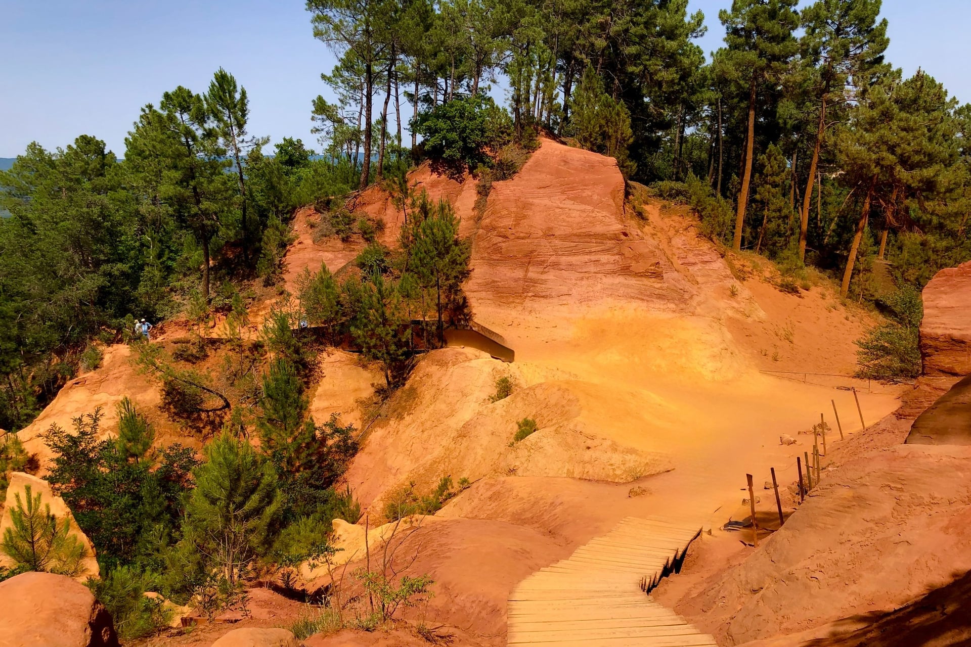
Roussillon's houses are painted in the colours of the ochre cliffs below the village, one of the Plus Beaux Villages de France. The park's loop starts at Ôkhra, a former ochre works, and climbs through the village to the Sentier des Ocres, a paid trail through the old quarries.
Inside, two loops of 30 and 50 minutes wind along steps and boardwalks. The trail opens from the February holidays to the end of the Christmas holidays. In July and August it opens at 9am, and the first hour is the coolest and quietest; the last entry is at 7.30pm.
6. The Colorado Provençal, Rustrel
Route: a loop from Rustrel village round the Colorado Provençal on the GR and local paths
Distance: 12.2 km, about 4 hours; the Belvédères circuit inside the site is 3.9 km
Elevation gain: 361 m
Terrain: sandy ochre tracks and pine woods, with two fords on the Dôa
Summer rules: Vaucluse; at red only the short Sahara circuit opens, and at Red E the site closes
Getting there: Zou! bus 916 from Apt to the Rustrel Camping Colorado stop, Monday to Saturday
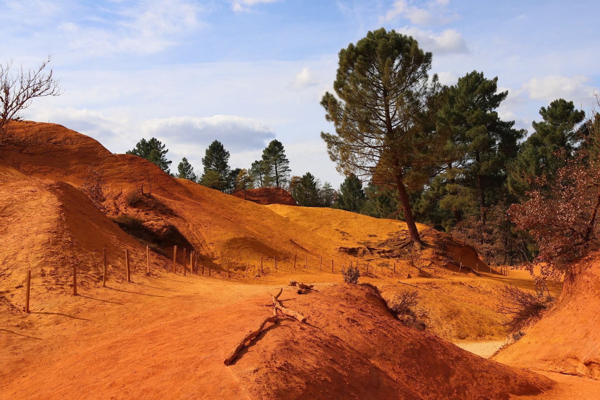
Rustrel's Colorado is a former ochre quarry of orange cliffs, white sand and rock pillars, worked from 1871 to 1991. The park's loop circles the site on the GR from the village, and the two fords on the Dôa are hard after storms.
The paid site is 1.5 km from the village, about 20 minutes on foot. Inside, the Sahara circuit is 2.1 km and takes 40 minutes, and the Belvédères circuit is 3.9 km with 70 m of climbing, about 1 hour 45. Picnics are not allowed inside, and the site closes from 12 November 2026 to 5 February 2027.
7. The Calanques: Port-Miou to En-Vau
Route: Cassis to the calanques of Port-Miou, Port-Pin and En-Vau, back the same way
Distance: 7.8 km return, about 3 hours
Elevation gain: 360 m
Terrain: rocky limestone paths with steep, slippery descents; the park grades it difficult
Summer rules: Bouches-du-Rhône, 1 June to 30 September; on a red day the park is closed on land
Getting there: train from Marseille to Cassis in 16 minutes, then bus 371 into the town
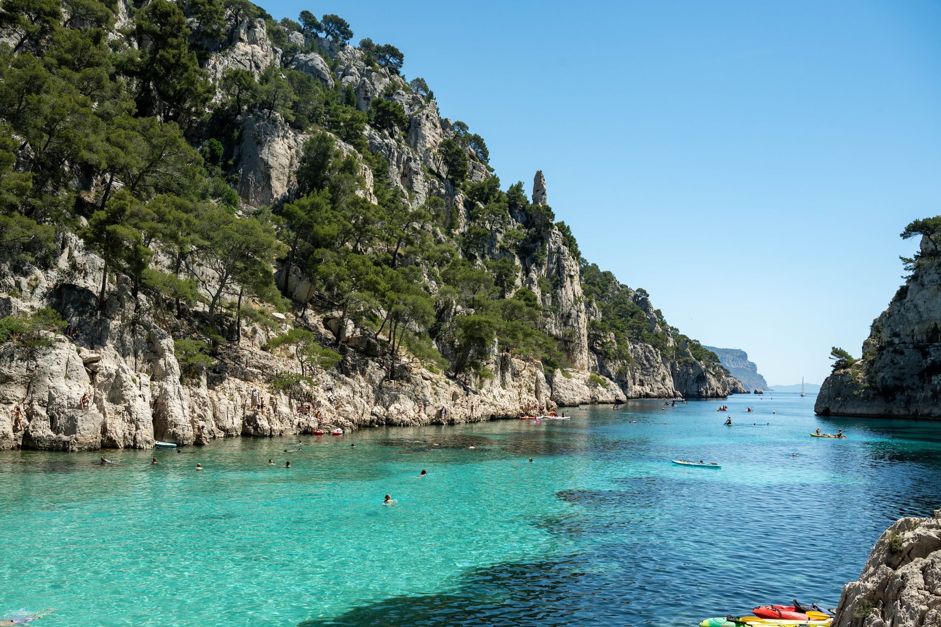
Between Marseille and Cassis, the calanques are narrow sea inlets cut into white limestone, protected by a national park since April 2012. From the centre of Cassis it is 30 minutes on foot to Port-Miou, a 1,400 m inlet with an old quarry, then 15 minutes to the pebble beach at Port-Pin and about 1 hour more to En-Vau.
The park asks walkers to carry at least 2 litres of water each and shoes with grip. Until June 2027, building work for a water reservoir disrupts the Port-Miou area, so follow the signed diversions. Sugiton, further west, is the only calanque that needs a booking, daily from 27 June to 30 August in 2026.
8. Montagne Sainte-Victoire and the Croix de Provence
Route: Les Cabassols car park in Vauvenargues up the GR9 to the Prieuré and the Croix de Provence, and back
Distance: 12 km, about 4 hours
Elevation gain: 600 m
Terrain: a steady path, paved in places, then zigzags across open scrub to the ridge
Summer rules: Bouches-du-Rhône, 1 June to 30 September
Getting there: bus 140 from Aix-en-Provence to Les Cabassols in about 30 minutes
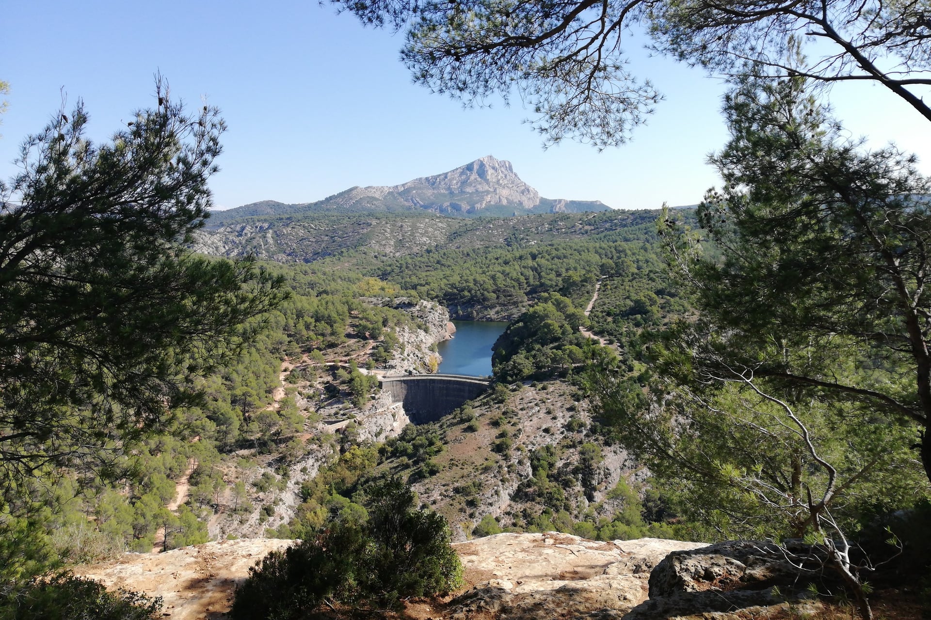
Cézanne painted the mountain in 87 works, and from Aix it fills the eastern sky. The Grand Site's walk follows the pilgrims who have climbed to the Prieuré since the 15th century. Above a platform at 710 m the path zigzags up, and the chapel courtyard looks straight down the south face.
The Croix de Provence stands a few hundred metres further along the crest, at 946 m. From 1 October to 27 November 2026, the stretch between the Prieuré and the cross is closed on weekdays for repairs. The steeper Imoucha path from the Bimont dam climbs almost 700 m in about 5 km.
9. Moustiers-Sainte-Marie and Its Chapel Path
Route: from the village centre up the 262 steps to Notre-Dame-de-Beauvoir, then round the village by the olive terraces of Les Claux
Distance: 3.4 km, about 2 hours
Elevation gain: 156 m
Terrain: cobbled steps lined with small shrines, then village paths; slippery when wet
Summer rules: Alpes-de-Haute-Provence, mid-June to mid-September
Getting there: train to Manosque-Gréoux, bus 132 to Riez, then Zou! 450 to Moustiers in about 25 minutes
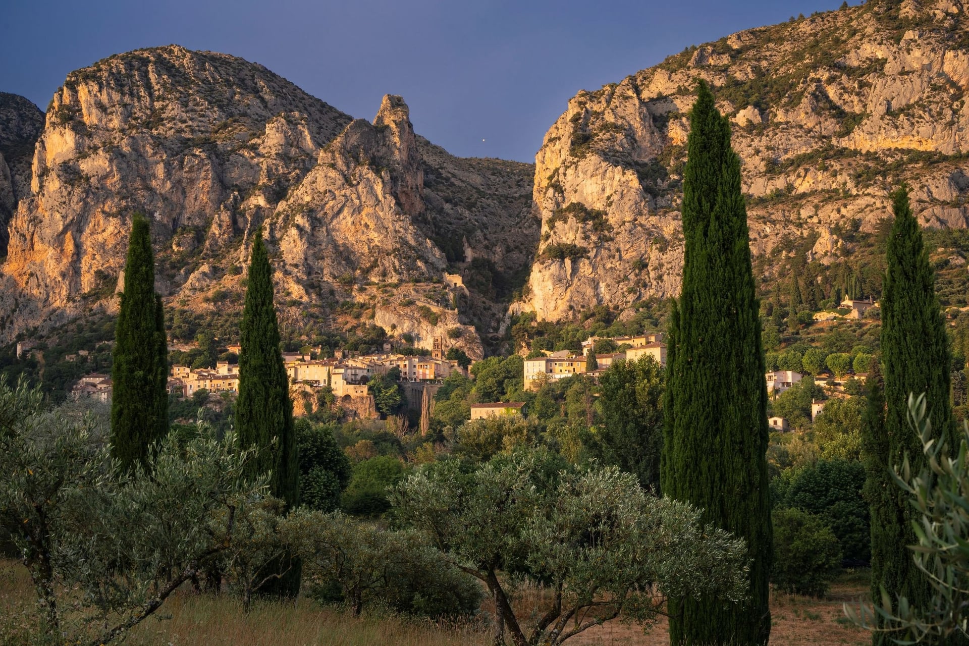
Moustiers-Sainte-Marie, one of the Plus Beaux Villages de France, sits in a gap in the cliffs at the entrance to the Verdon. The star above it hangs on a 135 m chain; the current one, 1.25 m across, went up in 1995. The chapel path follows the Stations of the Cross to a nave of the 12th century.
Below the village, the Lac de Sainte-Croix fills 22 square kilometres behind a dam first filled in 1973. The park's Sentier de Courchon, 8.6 km with 548 m of climbing and about 3 hours, is the longer walk from Moustiers. The Verdon gorge trails are mountain hikes, covered in our sister site's guide to hiking in Provence.
How Hard Is Walking in Provence?
Walking in Provence is mostly easy to moderate: the longest walk here is 15.5 km, and the effort comes from heat and loose limestone.
Heat, Limestone and Little Shade
The walks on this list run from 3.4 to 15.5 km, and only Sainte-Victoire climbs more than 405 m. The Calanques path is the hardest underfoot: the park grades it difficult because of the steep descents on polished rock.
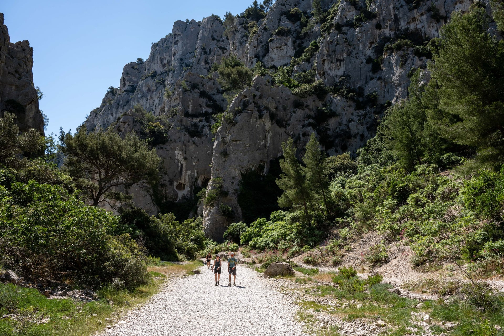
Heat is the main danger. Avignon averages 22 days above 30 °C in July, and the limestone ridges have little shade. Start at first light in summer, carry 2 litres of water each and finish by midday.
Summer Fire Closures
From June to September, each département can close its forest massifs on days of high fire risk. The map for the next day appears at 18:00 on the state fire-risk site, and the rules differ from one département to the next.
Département | Season | What the levels mean | Walks on this list |
Vaucluse | 15 June to 15 September | Green: open. Yellow: go early. Red: closed except listed sites. Red E: all closed | Dentelles, Gordes, cedar forest, ochre trail, Colorado |
Bouches-du-Rhône | 1 June to 30 September | Each of 25 massifs is open or closed for the whole day | Alpilles, Calanques, Sainte-Victoire |
Alpes-de-Haute-Provence | Mid-June to mid-September | Four levels, from open to closed in every massif | Moustiers |
Red E, the Vaucluse's level for extreme risk, closes every massif. On red days, the ochre trail and the cedar forest's marked paths stay open, as does the Colorado's short Sahara circuit. In the Bouches-du-Rhône a red massif is closed all day, sea access included, and the park's free Mes Calanques app shows what is open in the Calanques.
Waymarks and Maps
Walking routes in Provence follow the national waymarking code: white over red for a GR, yellow over red for a GR de Pays and a single yellow bar for a local PR walk. The Dentelles add blue dots on local paths.
The regional parks publish their routes with maps and GPX files on Chemins des Parcs, which covers six walks on this list. Download the GPX before you set off, as the phone signal drops in the hills.
Best Time to Walk in Provence
The walking seasons in Provence are spring and autumn, when Avignon's afternoons stay between 20 and 26 °C and the summer fire rules are not in force.
Average highs come from Météo-France's Avignon station, 1993 to 2020:
March: 17 °C and 4 rainy days, with gusts over 58 km/h on about 10 days
April and May: 20 and 24 °C, about 6 rainy days a month; every path is open
June: 29 °C; the fire rules start on 1 June in the Bouches-du-Rhône and 15 June in the Vaucluse
July and August: 32 and 31 °C, with 20 to 22 days above 30 °C; walk early and expect closures
September: 26 °C; the Vaucluse rules end on 15 September and the Bouches-du-Rhône rules on 30 September
October: 21 °C and 6 rainy days, but about 89 mm of rain in heavy autumn storms
November to February: 11 to 15 °C, quiet paths and short days; the Colorado closes from mid-November
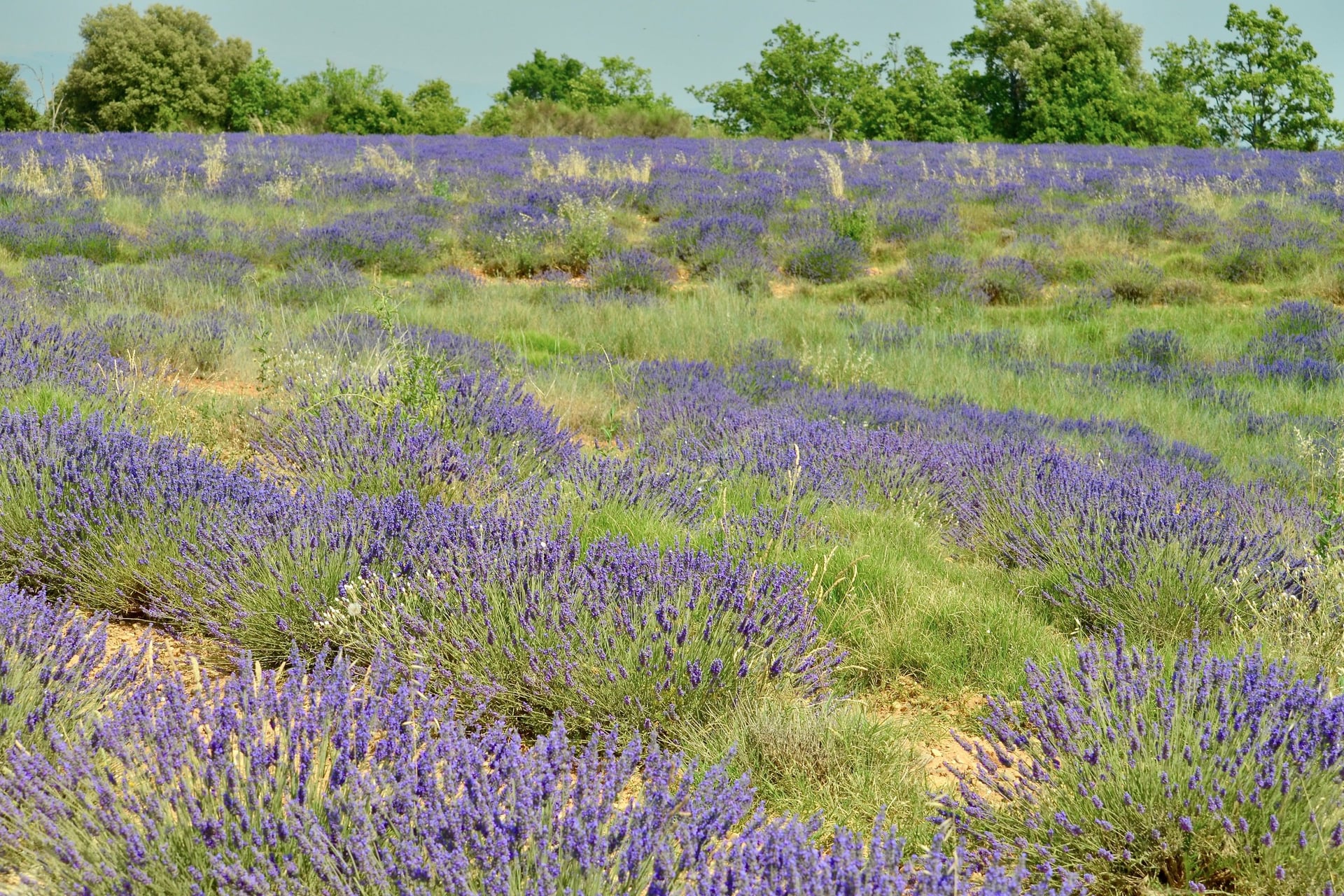
For most walkers, May and late September are the best months. The lavender flowers in late June and early July, just as the fire rules begin, and the hunting season runs from 13 September to the end of February, so stay on marked paths.
The mistral, a cold north wind down the Rhône valley, averages 50 km/h, and its gusts reach 80 to 100 km/h. It is strongest in winter and spring and can blow for several days in a row.
Know Before You Arrive
Provence is easy to walk without a car if you stay in a town on a bus or train line and walk from there.
Getting There and Around Without a Car
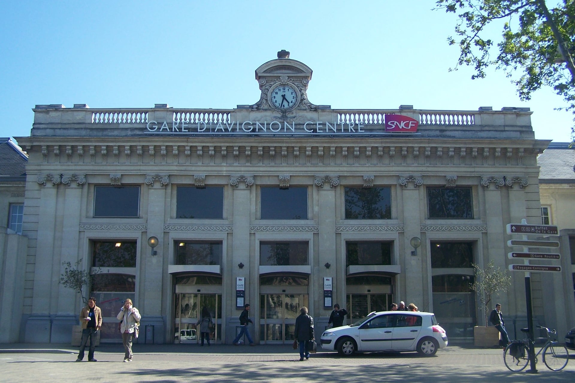
Most walkers arrive by train at Avignon, which has two stations. TGVs stop at Avignon TGV, 6 km south of the city, and a shuttle train runs to Avignon Centre in about five minutes.
From London: Eurostar to Paris in 2 h 16, then the TGV to Avignon TGV in 2 h 33; there is no direct train
From the USA: direct TGVs from Aéroport Charles de Gaulle 2 TGV to Avignon TGV in about 2 h 50
From Marseille airport: the LeBus 13 shuttle to Vitrolles-Aéroport station, then a TER to Avignon in about 1 h 30; bus A2 reaches Aix-en-Provence in about 30 minutes
Luberon buses: Zou! 915 runs from Avignon to Apt in about 1 hour 10, 917 links Apt, Roussillon and Gordes, 918 serves Bonnieux and 916 serves Rustrel
Alpilles and Aix: Zou! 707 runs from Avignon to Saint-Rémy, and bus 140 runs from Aix to Vauvenargues
Coast: about 30 trains a day run from Marseille to Cassis in 16 minutes
Village buses are few, so check the Zou! timetables before you plan a day around one. Most Luberon lines do not run on public holidays.
Where to Base Yourself
Each base below puts at least one walk within reach without a car.
Saint-Rémy-de-Provence: walk 1 starts in the town, and bus 707 runs to Avignon in about 50 minutes
Gordes or Roussillon: walks 3 and 5 start in these villages, linked by bus 917; both are Plus Beaux Villages de France
Apt: the Luberon's bus hub, with lines to Roussillon, Gordes, Bonnieux and Rustrel, and a Saturday market
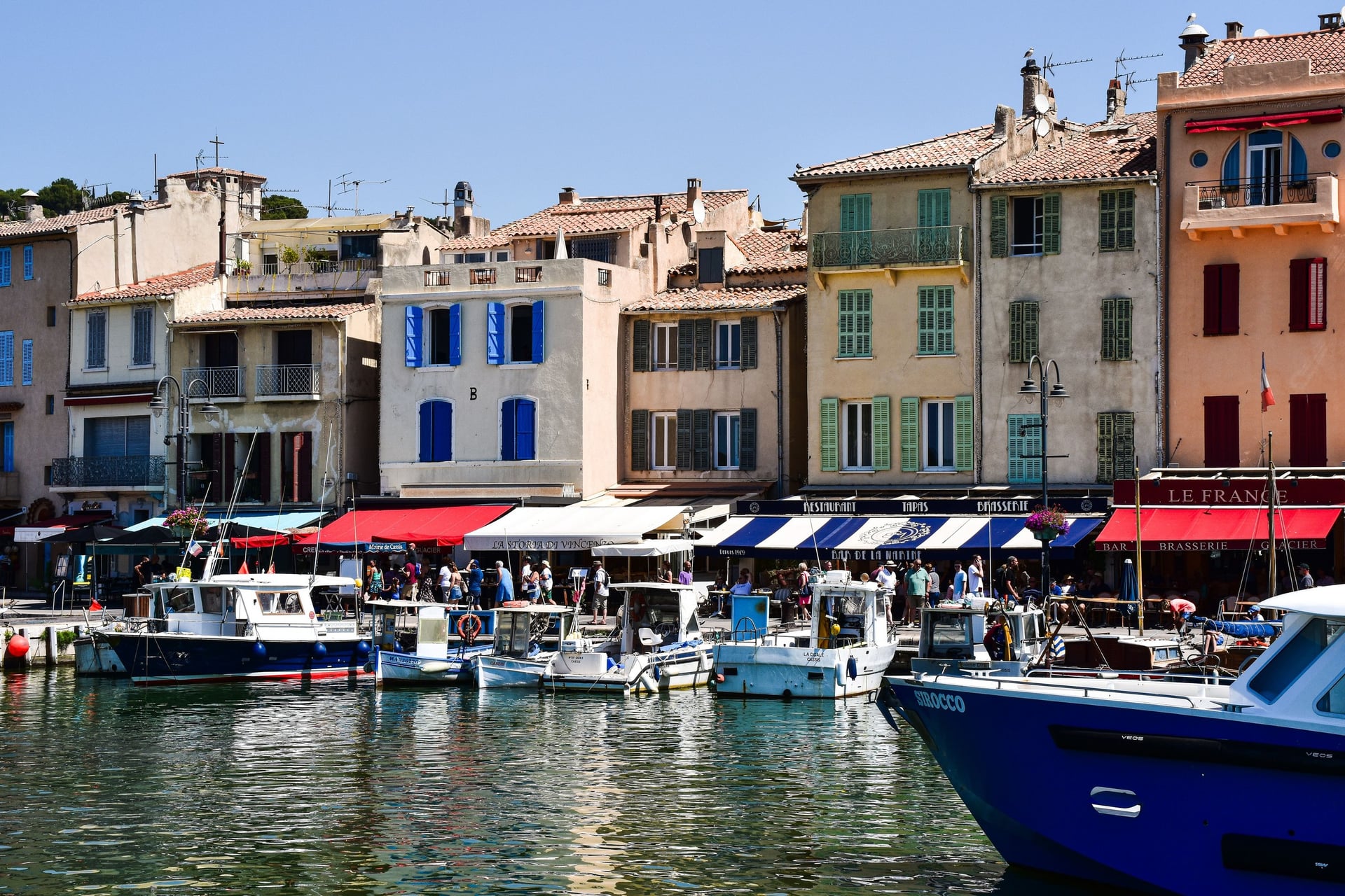
Cassis: the start of walk 7, with a station 3 km from the harbour
Aix-en-Provence: bus 140 to Sainte-Victoire and TGVs to Paris in 2 h 54
Moustiers-Sainte-Marie: walk 9 starts in the village; buses run most often in July and August
A chambre d'hôtes, the French B&B, may have at most five rooms by law, so book village rooms for July and August early.
Food and Wine on the Way
A picnic from the market is the usual walker's lunch here. Apt's market fills the old town every Saturday morning, and the farmers' market at Coustellet runs on Sunday mornings from 29 March to 27 December 2026.
How Much It Costs
The paths are free, and the fees are for the ochre sites, the abbey and parking. These are 2026 prices:
Sentier des Ocres: €3.50 for adults, free for under-10s
Colorado Provençal: €9 per car from May to September, €6 in spring and autumn; €3 on foot, €2 out of season
Abbaye de Sénanque: €8 for adults, €4 for ages 6 to 17
Calanques: free entry; the Gorguettes car park in Cassis is free, and its bus costs €1.70 return
Musée de la Faïence, Moustiers: €5
Buses and trains: a Zou! bus ticket costs €2.20, or €2.60 on board; Marseille to Cassis by train is €8.40
Tourist tax: €0.50 to €1.70 a night in a 3-star hotel, set by each commune
What to Pack
The weather that sets the kit here is summer sun on bare limestone and the cold mistral in spring.
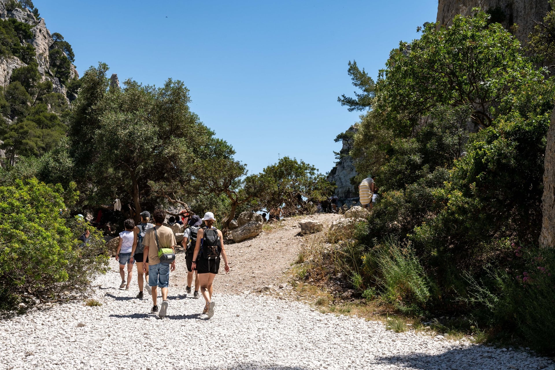
For any walk:
Trail shoes or light boots with a good grip
A sun hat, sun cream and sunglasses
A 20 to 25 litre day pack for water, lunch and a layer
A phone with the GPX file and a power bank
For Provence:
Two litres of water each in summer, as the Calanques park advises
A windproof layer for the mistral, even on sunny days
Walking poles for the steps at Moustiers and the descents to the coves
The fire-risk map, checked at 18:00 the evening before
Coins and small notes for village markets and bus tickets bought on board
Inn to Inn, or a Base in Saint-Rémy?
From July to mid-September, one base with short morning walks is the easier plan: closures are announced the evening before, and you can switch walks without losing a booked room. In spring and autumn, walking from village to village is the better way to see the Luberon, but it needs a room every night and your bags moved.
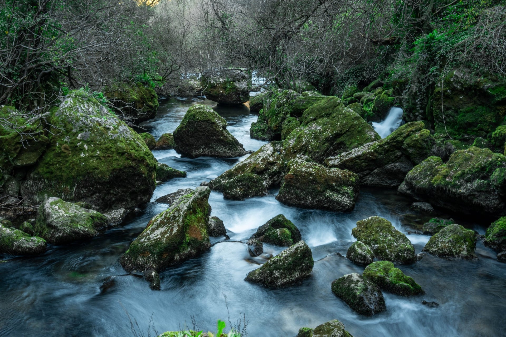
Our self-guided walking holidays in Provence solve that second problem. We book the hotels, move your luggage each day and give you a GPS app, a digital guidebook and support while you walk:
Walking Holidays in Provence: 8 days / 7 nights from Apt to Fontaine-de-Vaucluse, April to October; six walking days of 8 to 16 km, 71 km and 2,010 m of climbing in all
Van Gogh's Pathways in Provence: 7 days / 6 nights from Avignon to Arles through Saint-Rémy and the Alpilles, March to November; five walking days of 7 to 20 km, 76 km and 840 m of climbing
Both stay in 3-star hotels with breakfast, and the tourist tax is paid locally. Ask us about dates for next season.
At Fontaine-de-Vaucluse the Sorgue rises at the foot of a 230 m cliff, the largest spring in mainland France, and the last walk of the week ends beside it.
Frequently Asked Questions



Plan with a hiking expert
Free advice from a team that knows these routes inside out - real people, not a bot

HASSLE-FREE
We handle itineraries, accommodations, and anything else you prefer not to deal with, so you can enjoy a carefree hike.

TRUSTED BY MANY
We are a financially protected company, fully bonded and insured, keeping your money safe and allowing you to travel with confidence.

TRIED & TESTED ADVENTURES
Only the best walking tours in France, cherry-picked by our team with an in-depth knowledge of the region.

UNBEATABLE SUPPORT
Our 24/7 customer support is where we show our passion, bringing you a better experience by making your well-being our number one priority.