Walking in Corsica: 8 Best Walks From Cap Corse to Bonifacio
Eight Corsica walks from Cap Corse to Bonifacio's cliffs, with official distances, climbs, a map and how to reach each start by train, bus or boat.
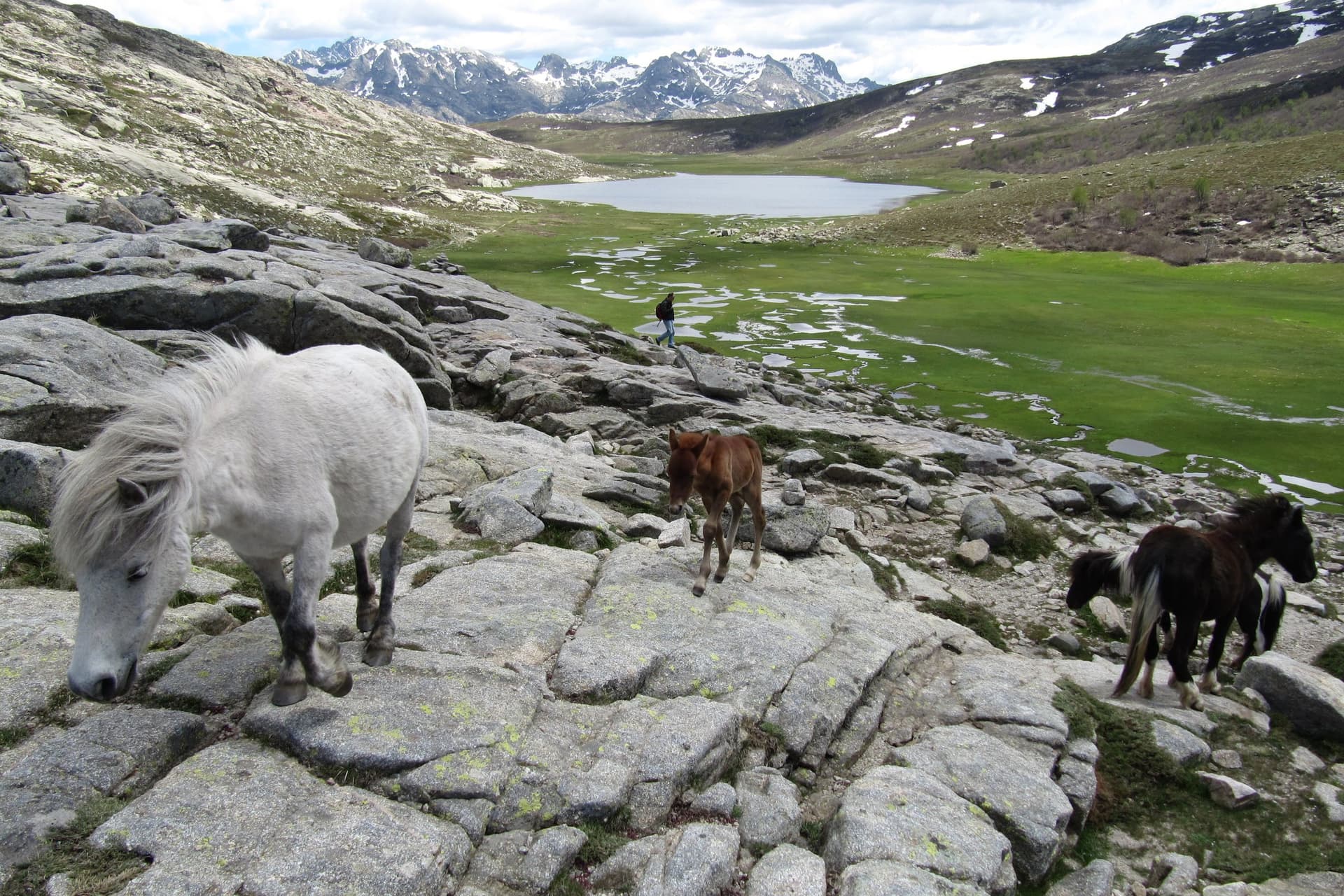
Quick links
Don't want to read all this?
We've planned 2,000+ hiking trips. Send your dates, fitness and group size — we'll map the route and book every night.



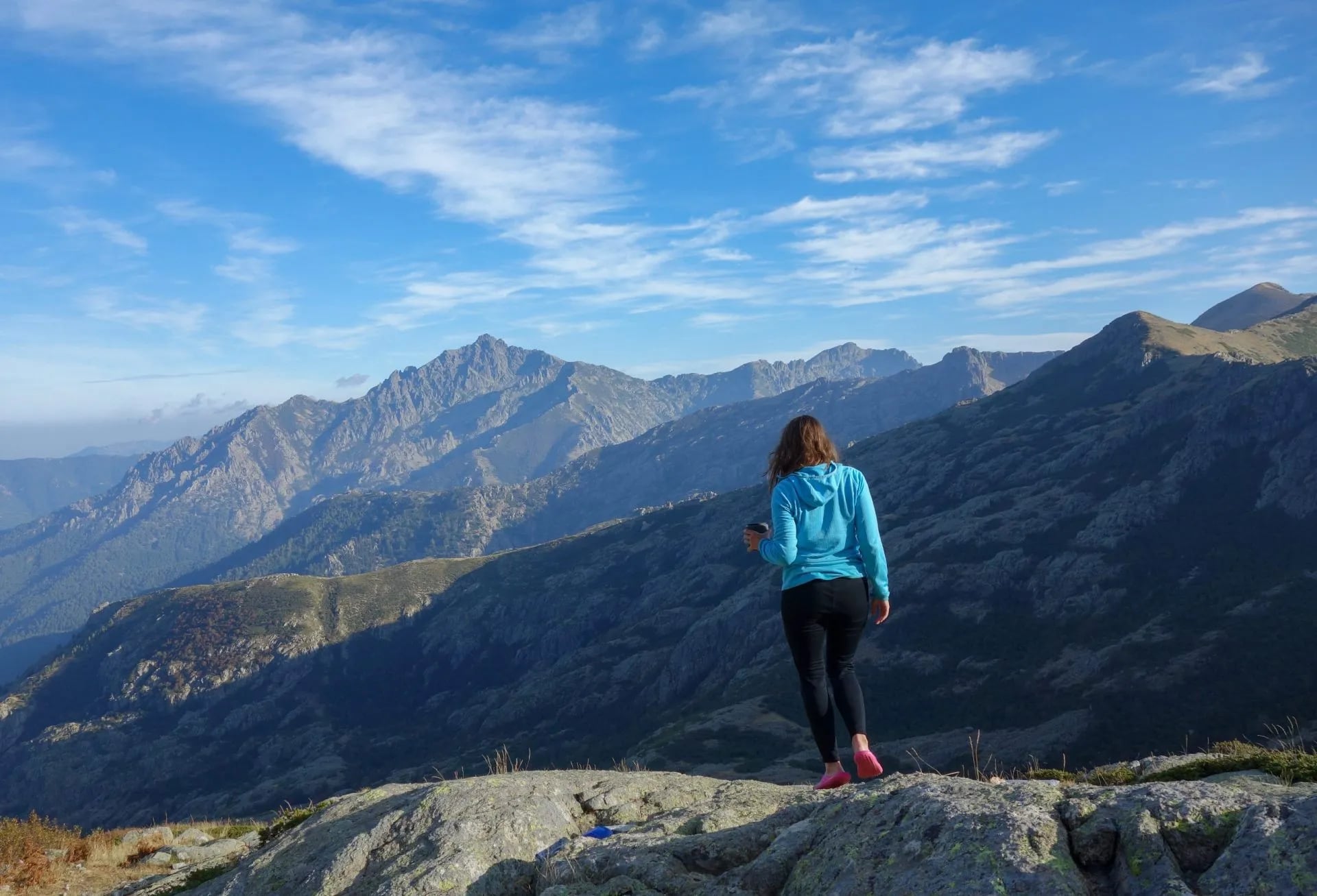
Walking in Corsica means mountains and sea in the same day. Granite ridges rise above 2,000 m a short way inland from the beaches, and old mule tracks, customs paths and forest trails link the two. In spring the maquis, the island's dense scrub of cistus and myrtle, scents every path.
The eight walks below run from Cap Corse in the north to the cliffs of Bonifacio in the south. They take from 45 minutes to a full day, with up to 730 m of climbing, and all eight can be done without a hire car.
The island's famous hut-to-hut trek, the GR20, crosses the mountains in 16 stages and needs a refuge booking for every night. Corsica is also one of the regions in our guide to walking in France.
The 8 Best Walks in Corsica
These Corsica walking routes and trails are marked paths from 3 to 19 km long, numbered from north to south. Five follow the coast and three climb into the mountains.
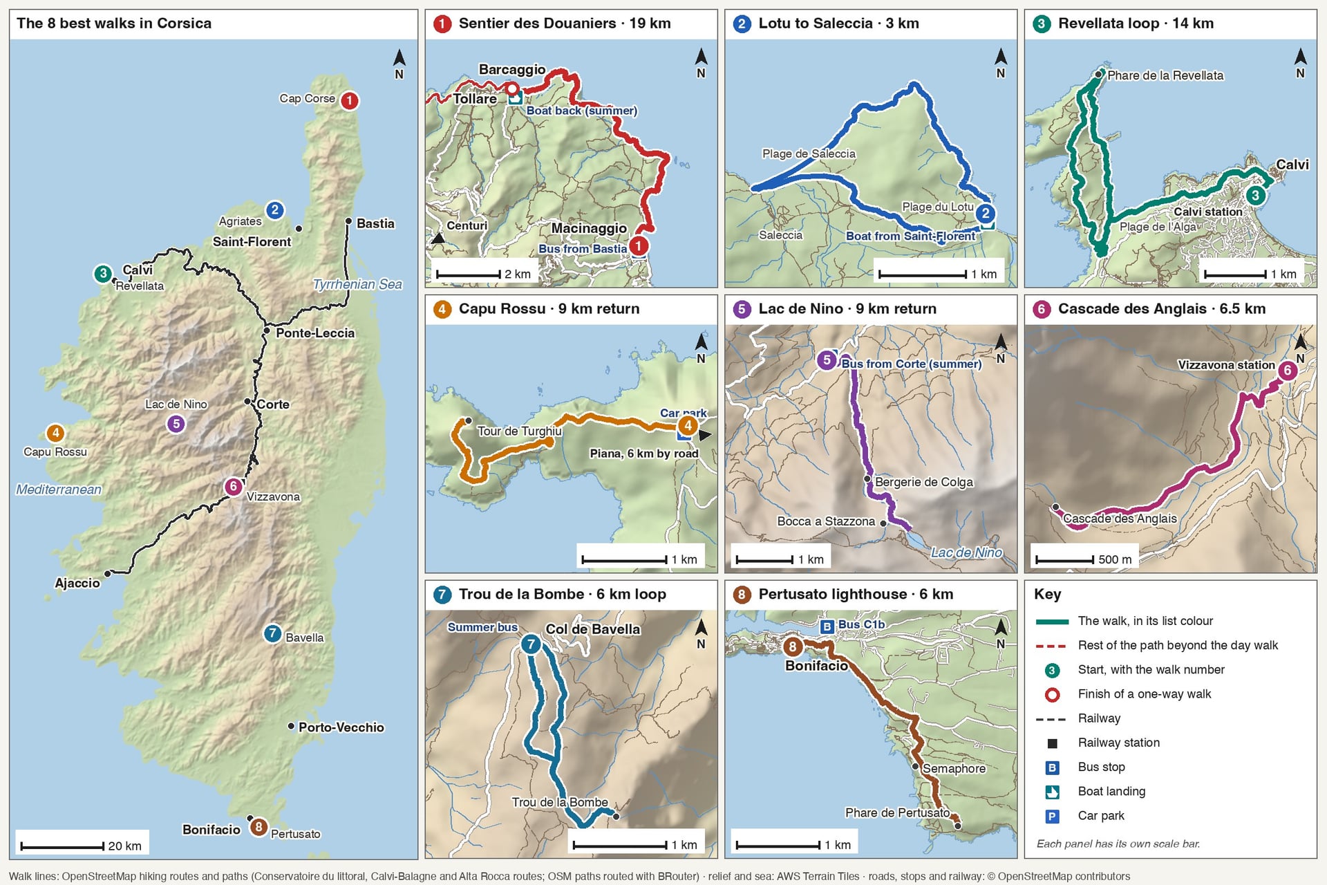
Figures come from the tourist office, park or landowner that publishes each walk; "about" marks a figure measured on the OpenStreetMap path.
Walk | Distance | Elevation gain | Time | Without a car |
Sentier des Douaniers | 19 km one way | About 270 m to Barcaggio | 3 to 3 h 30 to Barcaggio | Bus from Bastia |
Lotu to Saleccia | About 3 km each way | About 50 m | 45 min each way | Boat from Saint-Florent |
Revellata | 14 km loop | 350 m | 4 h 30 | Calvi station |
Capu Rossu | About 9 km return | About 500 m | 3 h 50 | Bus to Piana, then taxi |
Lac de Nino | About 9 km return | 730 m | 4 to 6 h | Summer bus from Corte |
Cascade des Anglais | About 6.5 km return | 300 m | 45 min each way | Vizzavona station |
Trou de la Bombe | About 6 km loop | 200 m | 2 to 3 h | Summer bus to Bavella |
Pertusato lighthouse | About 6 km return | 282 m | About 2 h | On foot from Bonifacio |
Choose by the day you have in mind:
A short morning: Lotu to Saleccia, 45 minutes each way with the boat both ways, or the Cascade des Anglais, 300 m up from Vizzavona station
A full day on the coast: the Sentier des Douaniers, 3 hours 30 from Macinaggio to Barcaggio, with the boat back
A mountain day: Lac de Nino, 730 m of climbing to a lake at 1,743 m
Straight from the train: the 14 km Revellata loop from Calvi station, or the Cascade des Anglais from Vizzavona
With children: the Cascade des Anglais, graded easy, or the 1.2 km Château Fort path above the Calanche de Piana
1. The Sentier des Douaniers on Cap Corse
Route: Macinaggio to Barcaggio round the northern tip of Cap Corse, then past Tollare to Centuri
Distance: 19 km from Macinaggio to Centuri
Elevation gain: about 270 m to Barcaggio, in short climbs over the headlands
Time: 3 to 3 hours 30 to Barcaggio, and more than 8 hours to Centuri
Terrain: a narrow path through maquis and across shingle coves, with little shade
Best months: April to June, September and October
Getting there: bus from Bastia to Macinaggio on Tuesdays and Fridays, and Monday to Saturday in July and August
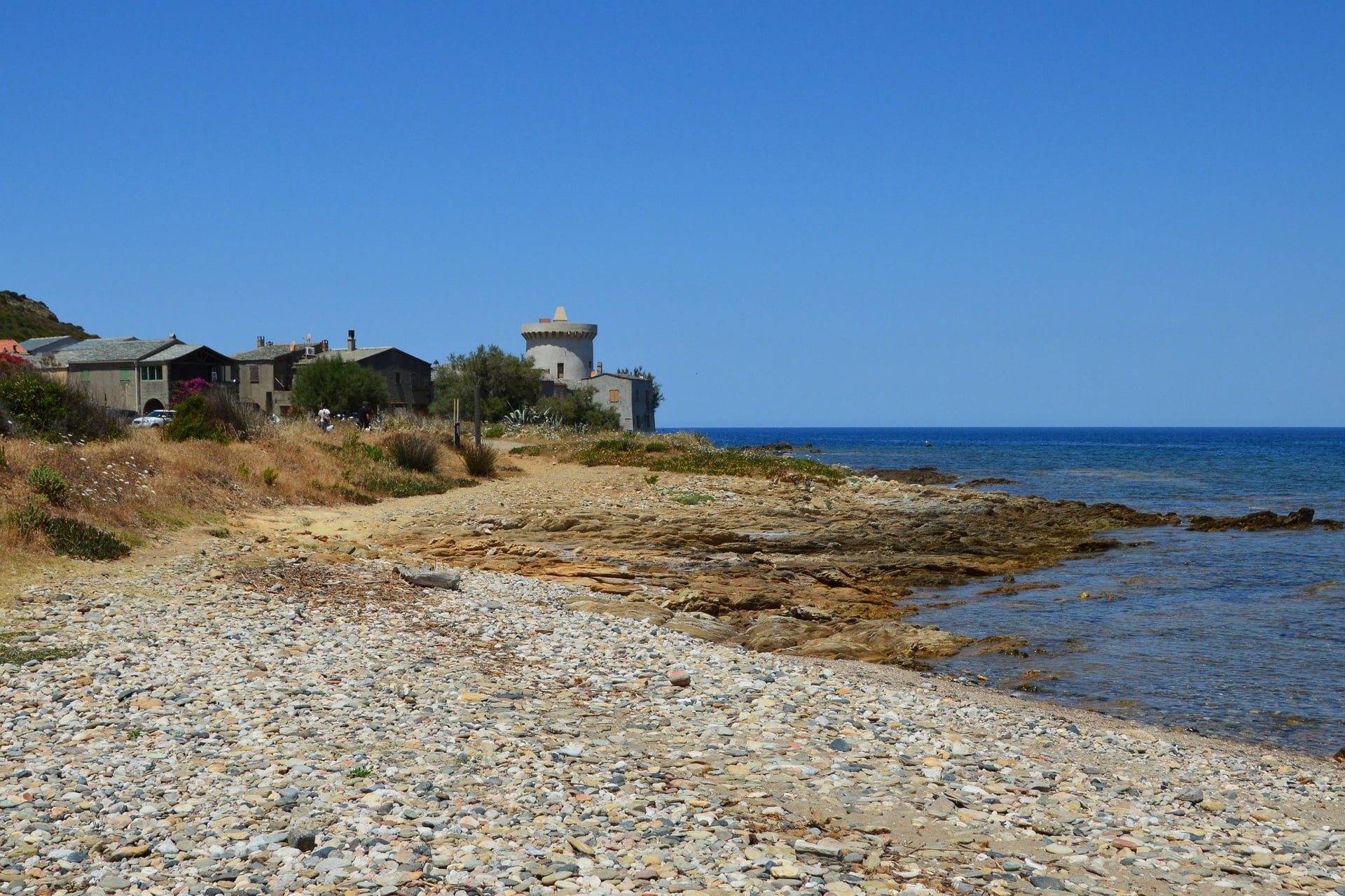
At the tip of Cap Corse, the old customs officers' path passes three Genoese watchtowers built against raiders from the sea: Agnellu, Santa Maria and Tollare. Offshore lie the Finocchiarola islands, a nature reserve where landing is forbidden.
The first stage to Barcaggio is the classic day, and Tollare is 45 minutes further on. The path runs one way, so book the boat back before you set off: the San Paulu boat sails to Macinaggio daily from 10 April to 10 October. Camping, bivouacs and fires are banned.
2. The Désert des Agriates From Lotu to Saleccia
Route: boat from Saint-Florent to the Lotu landing, then the coast path west to Saleccia beach
Distance: about 3 km each way
Elevation gain: about 50 m each way
Time: about 45 minutes each way
Terrain: a sandy path through maquis and juniper dunes, with no shade and no water
Best months: April to June and September
Getting there: boats from Saint-Florent harbour from April to October, in 15 to 20 minutes
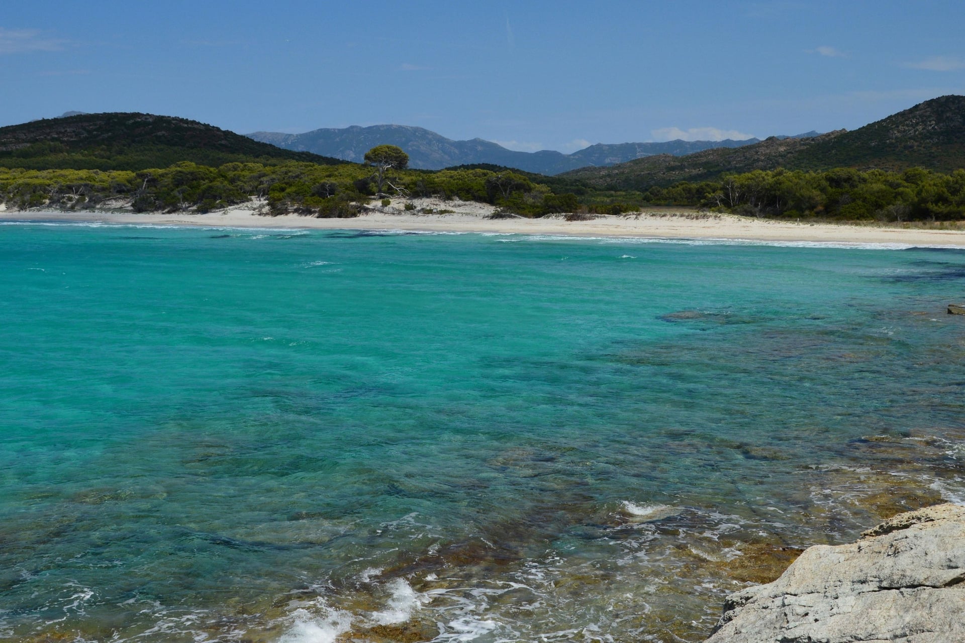
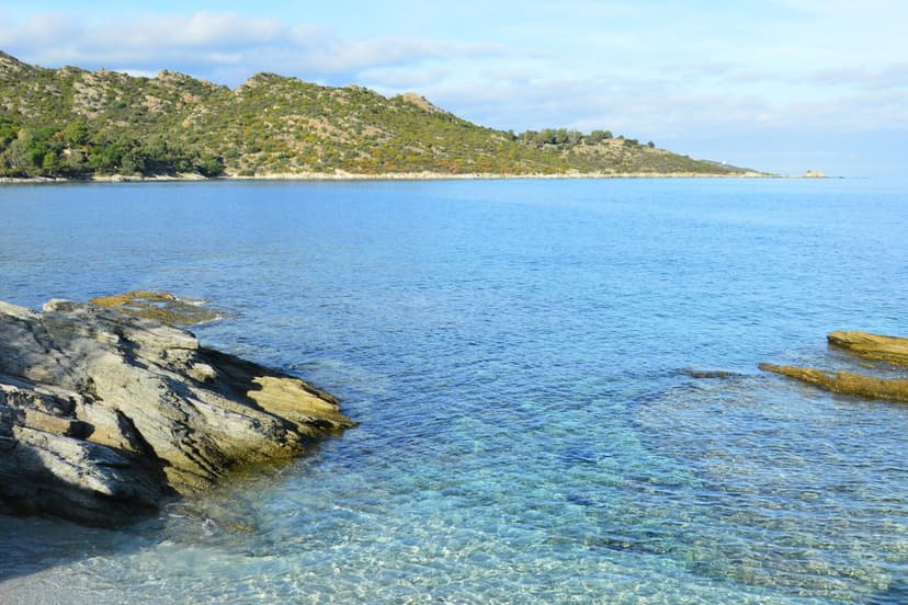
The Agriates is a roadless stretch of maquis west of Saint-Florent, protected since 1979. The Conservatoire du littoral owns nearly 5,700 of its 15,000 ha. Its 37 km of shore have no buildings at all, so the only ways in are by boat, by 4x4 track or on foot.
Saleccia's pine wood was planted in the 19th century, and the beach stood in for Normandy in the film The Longest Day. Boats run to both beaches, so you can walk out and sail back. The full coast path runs 35 km from Saint-Florent to Ostriconi, about 14 hours, with nights at the Ghignu shelters.
3. Calvi to the Revellata Lighthouse
Route: the Boucle H from Calvi along the customs paths round the Revellata peninsula to its lighthouse
Distance: 14 km loop
Elevation gain: 350 m
Time: 4 hours 30
Terrain: yellow-waymarked coast paths and tracks past small beaches, open to the sun
Best months: September to June, and early mornings in July and August
Getting there: Calvi station, beside the start of the marked access path from town
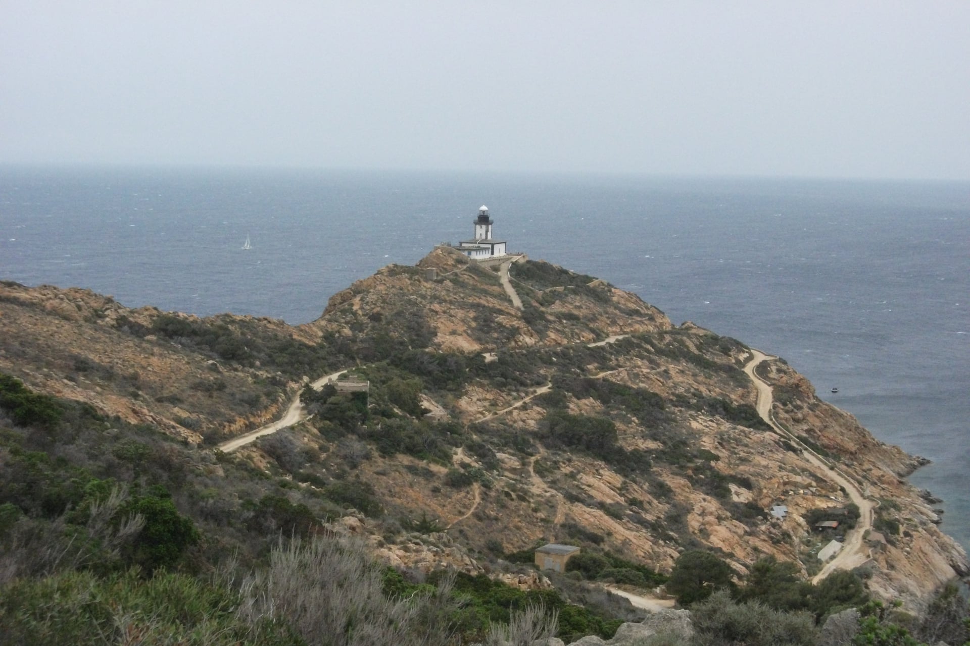
West of Calvi, the Revellata is a rocky peninsula listed as a protected natural site. The customs path passes the ruined convent on the Pointe Saint-François, then drops to the sandy cove of l'Alga halfway round.
The lighthouse has guided ships since 1844 and now houses STARESO, a marine research station founded in 1972. Walkers stop at a viewpoint below its gate, from where the red cliffs of Scandola, a UNESCO site, show to the south.
4. Capu Rossu and the Calanche de Piana
Route: from the car park on the road to Arone beach, a paved mule path along the headland to the Turghiu tower
Distance: about 9 km return
Elevation gain: about 500 m return
Time: 1 hour 45 to the tower, and 2 hours 05 back by the coast variant
Terrain: a paved path between dry-stone walls, then a steep zigzag of about 40 minutes to the tower, in full sun
Best months: April to June, September and October
Getting there: bus C2 from Ajaccio to Piana, twice a day from May to September, then about 6 km by taxi
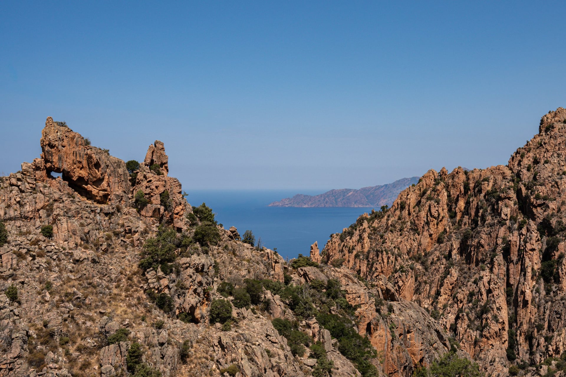
Capu Rossu is a red granite headland at the southern entrance of the Gulf of Porto, a UNESCO World Heritage site since 1983. Its Genoese tower, built in 1608, stands on the edge of a 331 m drop to the sea.
The Conservatoire du littoral warns that the final climb to the tower is very steep, so start early in summer and carry all your water. For a shorter day, the old mule track from Piana covers 3.2 km with 125 m of climbing. The 1.2 km Château Fort path ends on a rock above the gulf.
5. Lac de Nino From Poppaghia
Route: from the Poppaghia forest house up the Colga valley and over the Bocca a Stazzona to the lake, back the same way
Distance: about 9 km return
Elevation gain: 730 m, from 1,076 m to the pass at 1,762 m
Time: 4 to 6 hours return
Terrain: pine forest, then scree, rock slabs and a short chimney below the pass where you need your hands
Best months: June to early October
Getting there: bus from Corte station at 08:45, Monday to Saturday from 18 May to 11 October 2026; it returns from Castel di Vergio at 10:30
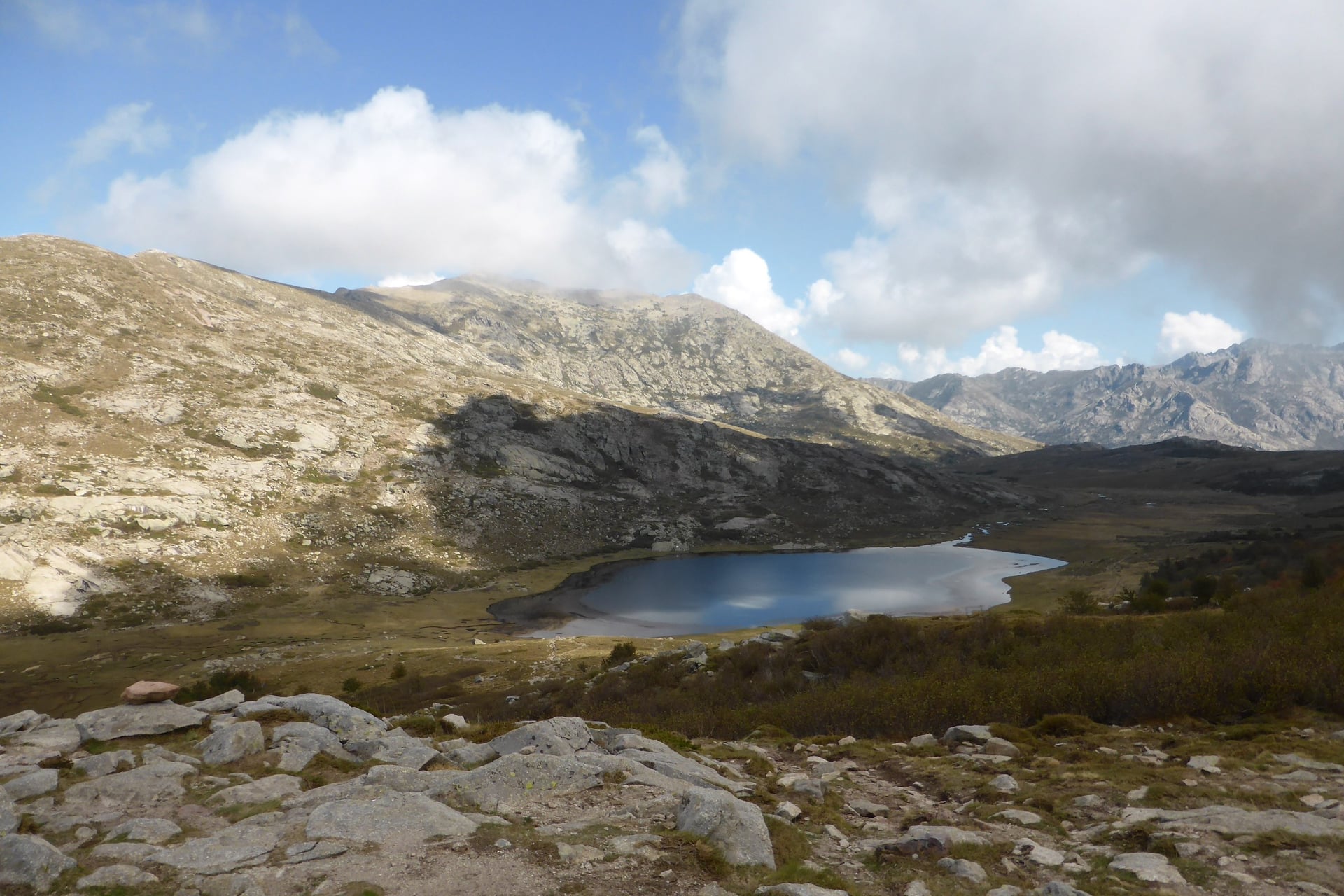
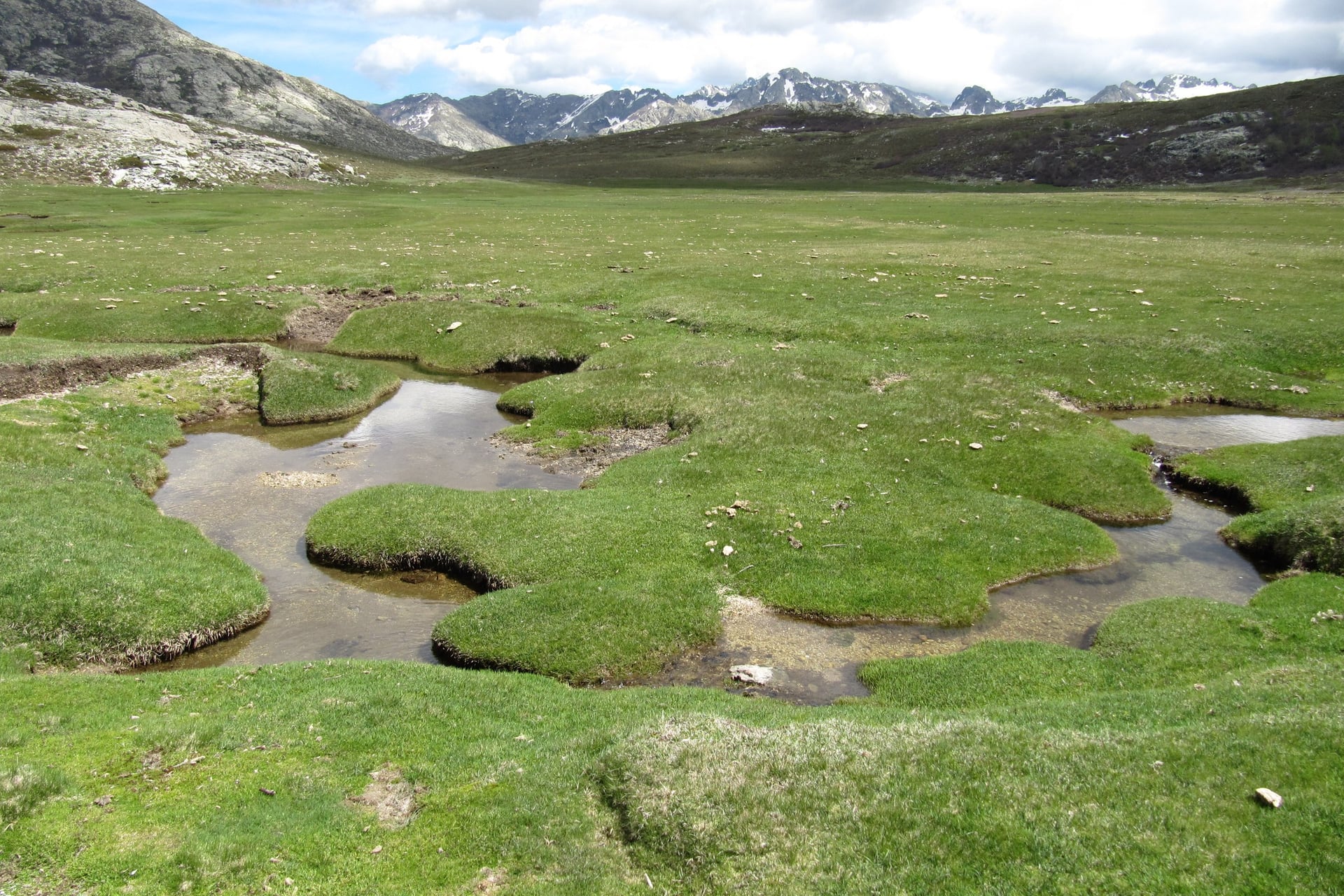
Lac de Nino lies on a high plateau in the Niolu at 1,743 m, and at 6.5 ha it is the second largest lake in Corsica. It is the source of the Tavignano. Around it spread the pozzines, peat lawns cut by small pools, where horses, cows and pigs graze loose.
The path from Poppaghia is gentle for an hour, as far as the Bergerie de Colga at 1,411 m, a stone shepherds' hut. Above it the hardest climbing on this list begins. Follow the yellow marks across the scree, keep off the pozzines, and plan a night at Castel di Vergio for the bus back.
6. Vizzavona and the Cascade des Anglais
Route: from Vizzavona station up the GR20 forest track, over the Fiuminatu and Agnone footbridges to the falls, back the same way
Distance: about 6.5 km return
Elevation gain: 300 m
Time: about 45 minutes each way, plus time at the pools
Terrain: a shaded forest track, then granite slabs beside the water; graded easy
Best months: May to October
Getting there: Vizzavona station, about 1 hour 10 from Ajaccio and 50 minutes from Corte by train
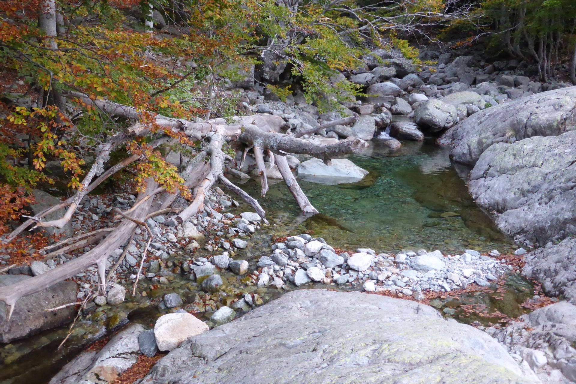
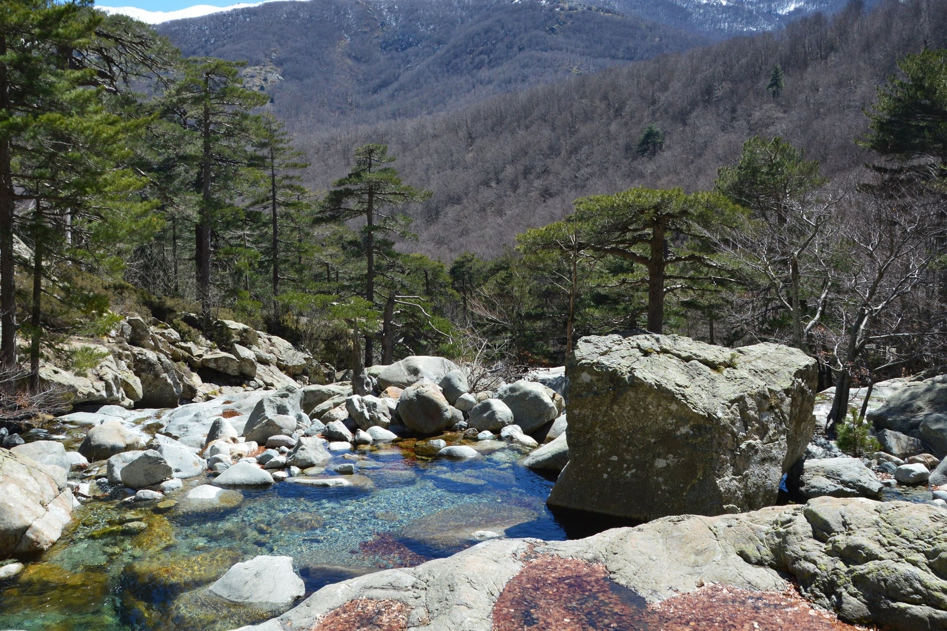
Vizzavona is a forest station at about 900 m on the line from Corte to Ajaccio. Here the GR20 crosses the railway halfway along its route, and its red and white marks lead uphill through beech and laricio pine, the tall native Corsican pine.
At the Cascade des Anglais, the Agnone drops through a chain of clear pools in pale granite. The GR20 carries on upstream past more of them. Monte d'Oro, 2,389 m, rises above the valley, but its summit is a long, steep day for experienced walkers.
7. The Trou de la Bombe at Bavella
Route: a waymarked loop from the Col de Bavella through laricio pine forest to the Trou de la Bombe
Distance: about 6 km loop
Elevation gain: 200 m
Time: 2 to 3 hours
Terrain: a forest path marked in red with cairns, then a delicate final approach over bare rock
Best months: May to September, while the buses run
Getting there: bus C4 from Ajaccio from May to September and C3 in July and August, one a day each way
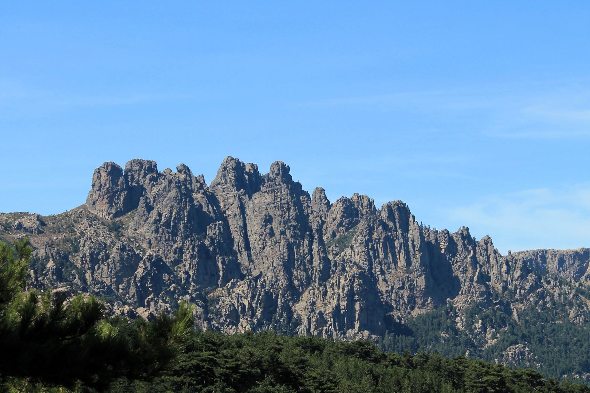
In the south, the Aiguilles de Bavella are jagged granite peaks above a laricio pine forest. The road crosses them at the Col de Bavella, 1,218 m, below Punta Velacu, 1,483 m. The Trou de la Bombe is a hole about 8 m across worn through a rock ridge by wind and rain.
The Zonza tourist office grades the walk easy, and only the last approach to the hole needs care. The bus reaches the col in the evening and leaves in the morning, so sleep at the col. In summer Zonza also runs a free shuttle up from its car park at Viseo.
8. Bonifacio Cliffs to the Pertusato Lighthouse
Route: from the Saint-Roch chapel up the Campu Rumanilu path onto the cliffs, then east on the Pertusatu path to the lighthouse, back the same way
Distance: about 6 km return
Elevation gain: 282 m
Time: about 2 hours
Terrain: a stony cliff-top path through maquis, rocky in places and without shade; graded easy to moderate
Best months: September to June, and early or late in the day in summer
Getting there: on foot from Bonifacio harbour, reached by bus C1b from Figari
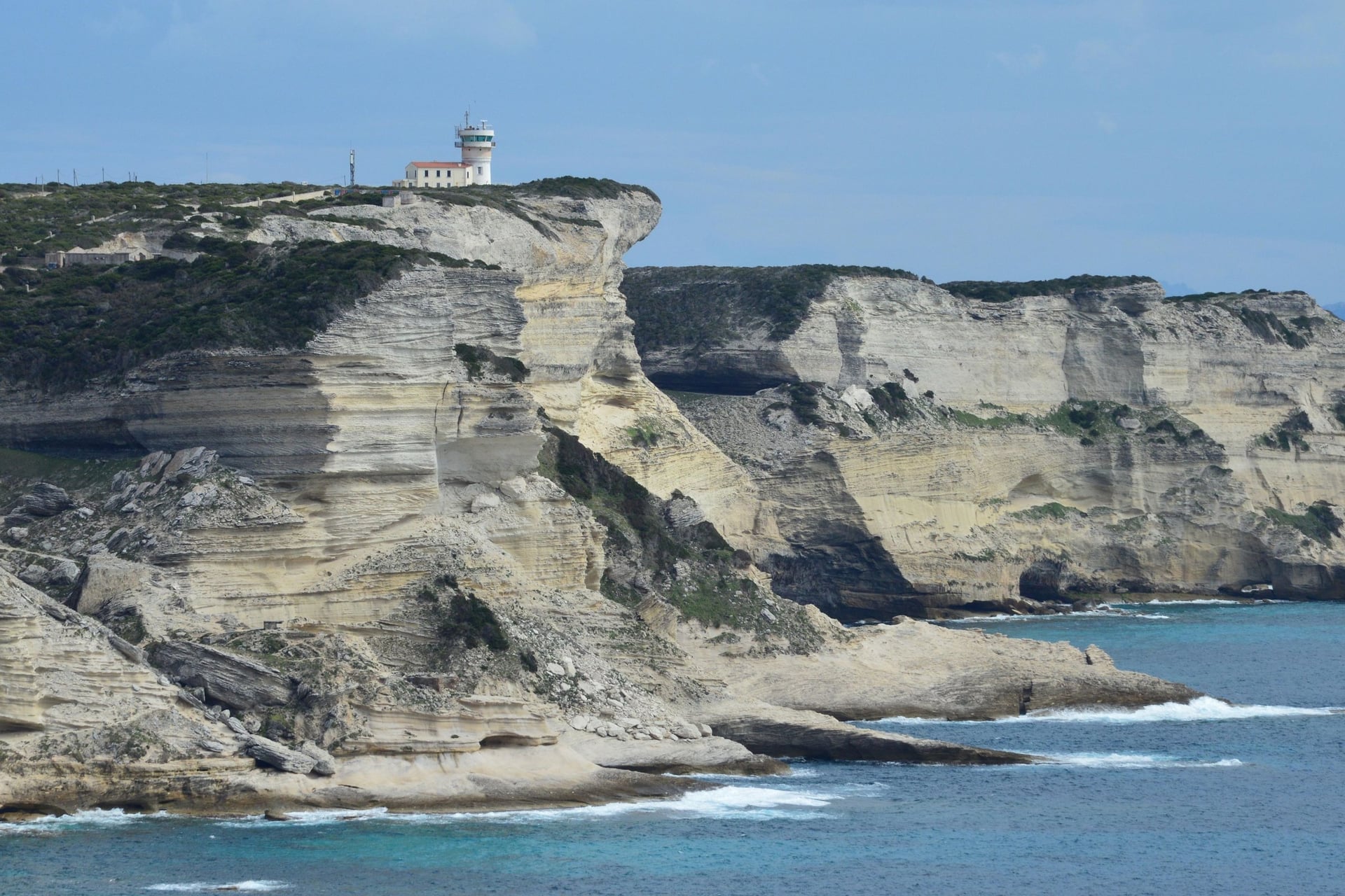
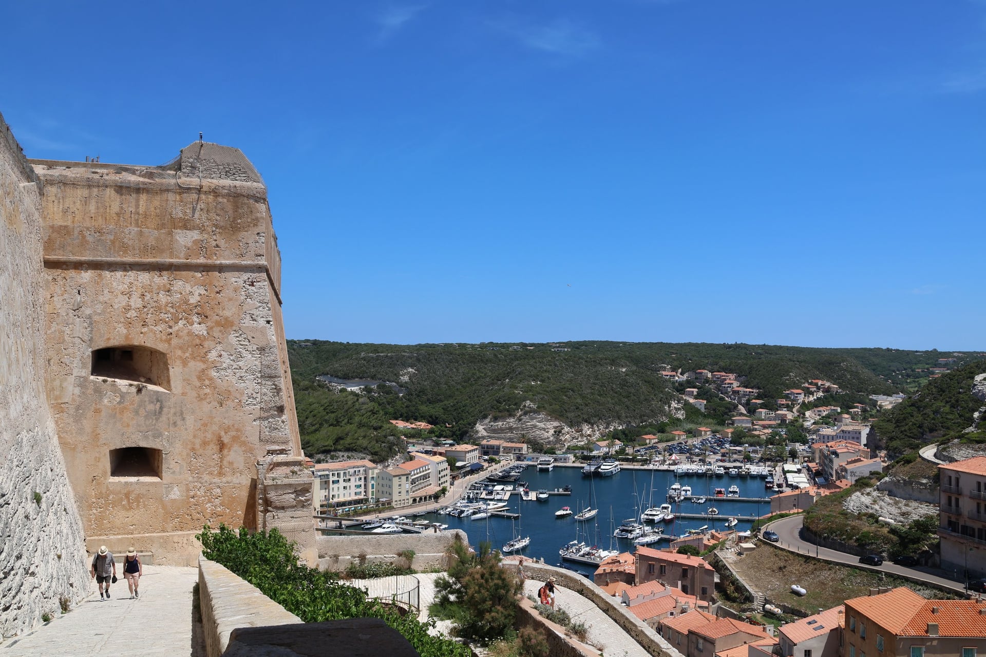
Bonifacio stands on white limestone cliffs at the southern tip of Corsica, and the path stays about 100 m above the sea for most of the way. The Campu Rumanilu section, whose name probably means field of rosemary, is a 2 km loop on its own, with stone balconies over the water.
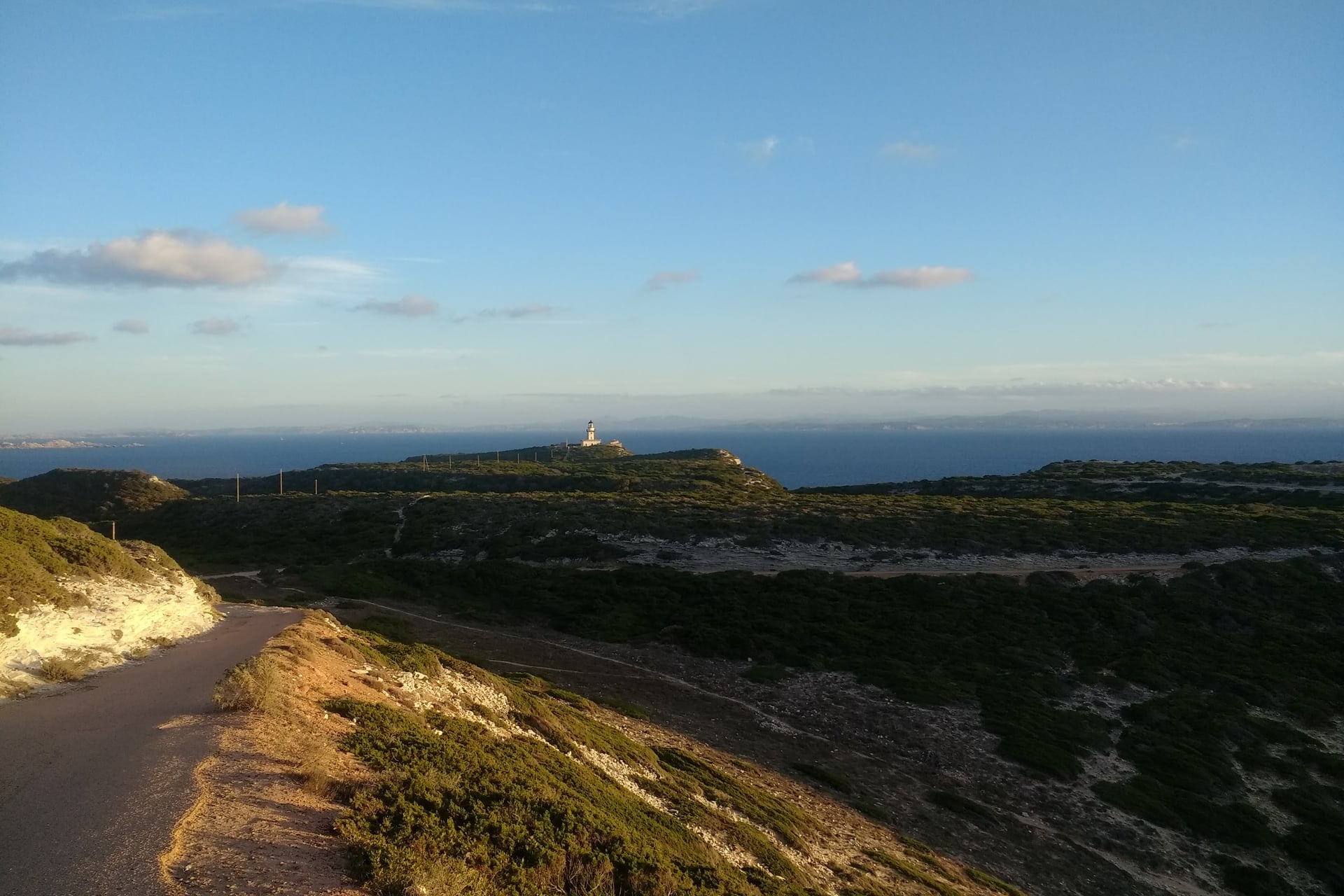
The Pertusato lighthouse has watched over the Strait of Bonifacio since 1844, beside a semaphore that still watches the shipping. From the Pertusatu path, Sardinia and the Lavezzi islands fill the view to the south. Saint-Antoine beach, below the cliffs, is the place for a swim on the way back.
How Hard Is Walking in Corsica?
Corsica's walks are moderate by the numbers. The ground is rough granite and there is little shade, so allow more time than the distance suggests.
Terrain and Scrambles
Most walks on this list climb between 50 and 730 m, on paths of loose stone, granite slabs and sandy maquis. Three include a short stretch where you will use your hands or need a steady foot.
The first is the chimney below the Bocca a Stazzona on the way to Lac de Nino. The others are the approach to the Trou de la Bombe and the last 40 minutes up to the Turghiu tower. The coast paths are easier underfoot, rocky only in places.
Heat and Fire Closures
Summer heat is the main hazard. Ajaccio averages 28.6 °C in July and 29.2 °C in August, and the paths at Capu Rossu, the Agriates and Bonifacio have almost no shade. Start at first light and carry 1.5 litres of water each.
From mid-June to mid-September the state publishes a daily access map of the forest massifs at 18:00 for the next day. Yellow means take care, orange means leave by 11:00, and red means do not go in. A massif marked closed is off limits to walkers.
The Agriates, Piana, Vizzavona and Bavella are all on the map, and some can close at any time of day. On 18 and 19 July 2026 Bavella and the western Agriates were shut to walkers. Lighting a fire or smoking in forests and maquis is banned from 15 June to 30 September.
Waymarks and Maps
Corsican paths follow a simple colour code. The GR20 is marked red and white, and walk 6 follows it from Vizzavona station. The long Mare e Monti and Mare a Mare trails are orange, and most local paths, such as the Revellata loop, are yellow.
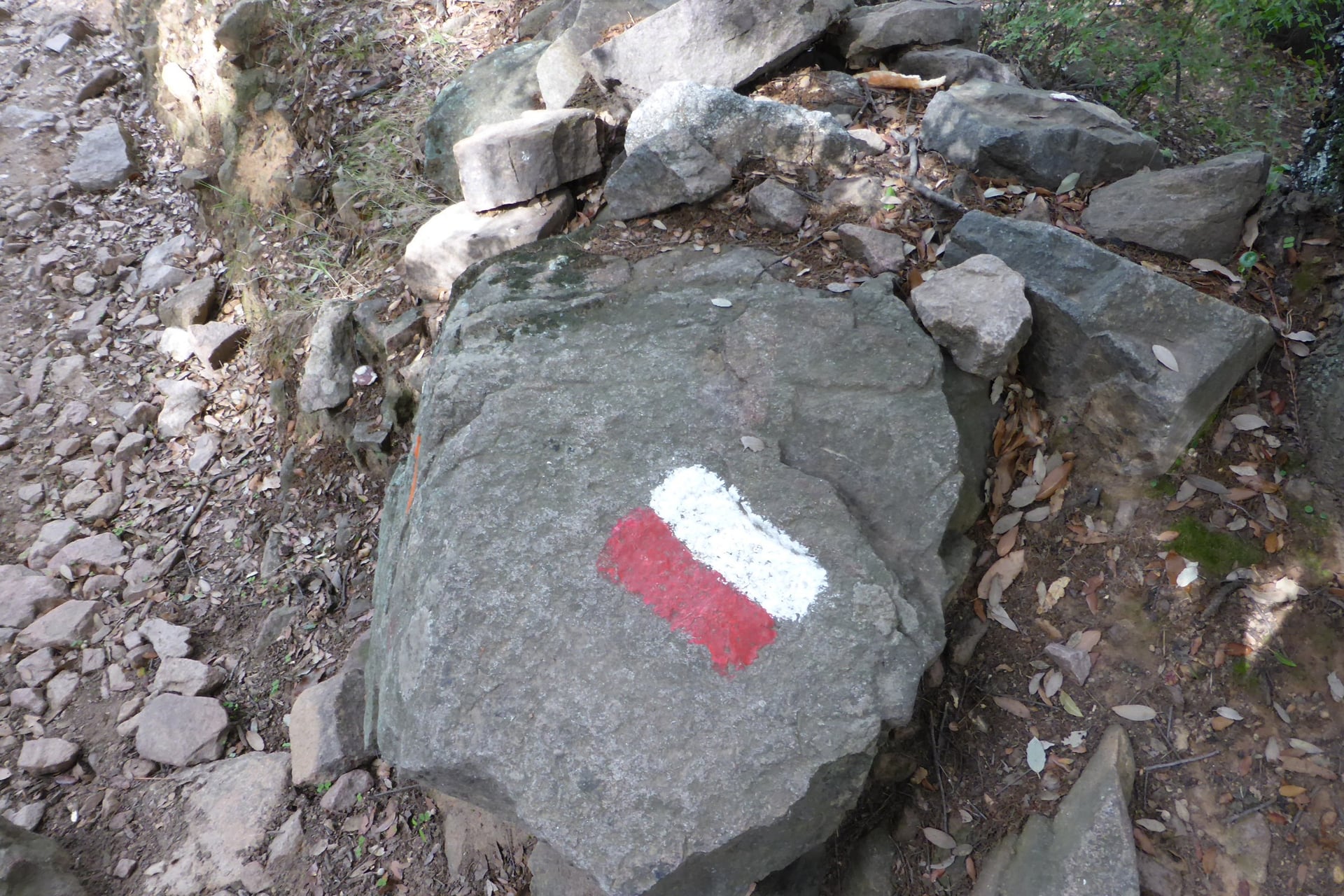
On smaller paths the marks can be sparse and phone signal fades in the mountains, so download an offline map before you set off. For a second visit, the Mare e Monti Nord runs 121 km from Calenzana to Cargèse in 10 days. Walkers sleep in gîtes, simple walkers' hostels.
Best Time to Walk in Corsica
In Corsica the time of year matters as much as the route. Spring and autumn are warm and green on the coast, while July and August bring heat and fire closures.
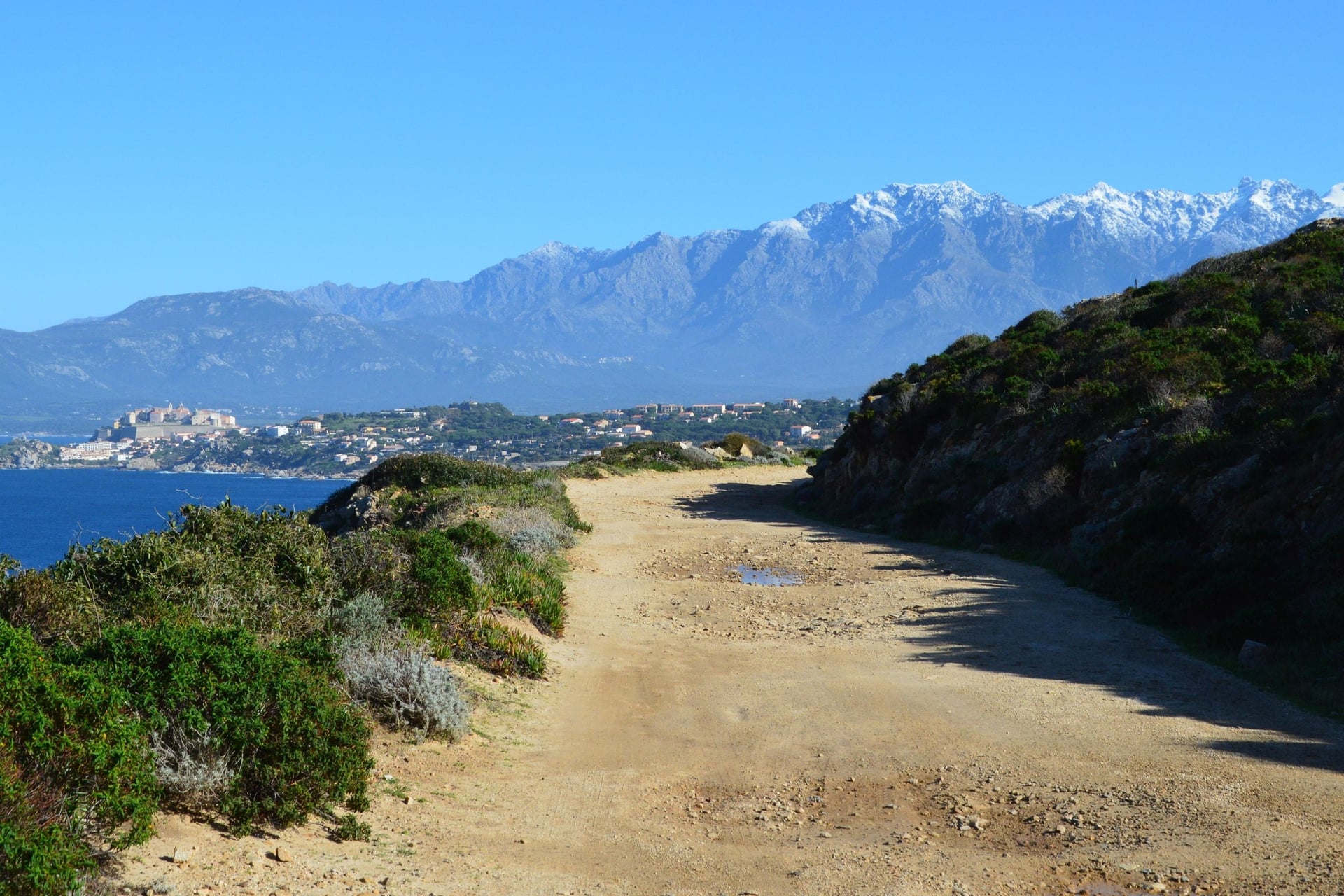
Average highs and rainy days are Météo-France's 1991 to 2020 normals for Ajaccio:
April and May: 18.5 and 22.1 °C, with rain on 7 and 5 days a month; the maquis flowers and the Corte to Vergio bus starts in mid-May
June: 25.9 °C and 3 rainy days, the longest days of the year; the summer fire rules begin on 15 June
July and August: 28.6 and 29.2 °C, with rain on about 1 day a month and the fire map out every evening
September and October: 26.1 and 22.8 °C, with 5 and 7 rainy days; the sea stays warm and the San Paulu boat runs until 10 October
November to March: 14 to 18 °C on the coast and the wettest months, with 112 mm of rain in November; snow covers the high mountains
For most walkers May, June and September are the best months. The days are long, buses and boats are running, and the paths are not yet at their hottest. Visit Corsica lists Lac de Nino as a spring and summer walk.
Getting There and Around Without a Car
Most walkers reach Corsica on an overnight ferry or a short flight. A narrow-gauge railway then climbs through the mountains between Bastia and Ajaccio.
Flights and Ferries
Corsica has four airports: Ajaccio, Bastia, Calvi and Figari. In the 2026 season easyJet flew from London Gatwick to Bastia from 3 May to 28 October and to Figari in summer. British Airways flew to Figari and Calvi, and there are no direct flights from the USA, so connect in Paris or Nice.
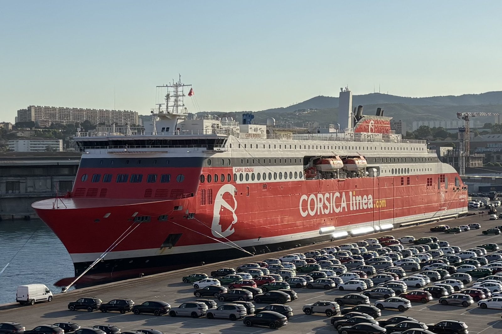
Ferries sail all year from Marseille, Toulon, Nice, Livorno and Savona. Corsica Linea's overnight crossing from Marseille to Bastia takes about 13 hours, and Corsica Ferries crosses from Livorno to Bastia in about 4 hours. From the Marseille and Toulon ports, the mainland walks of Provence are a short train ride away.
The Island Railway
The Chemins de fer de la Corse run two lines. One links Bastia and Ajaccio, 158 km through Corte, Vivario and Vizzavona, and a 73 km branch runs from Ponte-Leccia to Calvi by way of L'Île-Rousse.
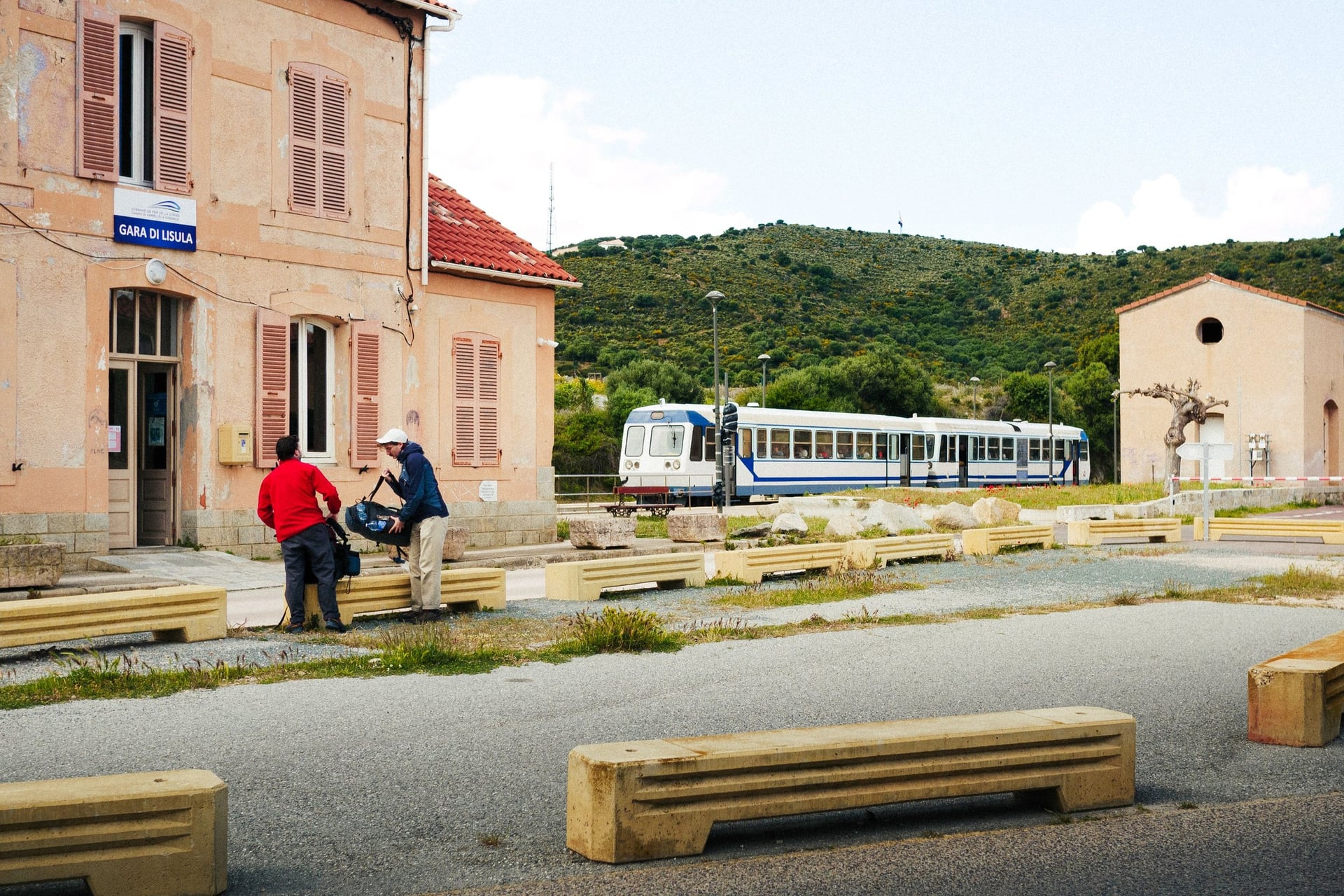
Two of the walks start at a station, the Revellata at Calvi and the Cascade des Anglais at Vizzavona. The Lac de Nino bus also leaves from Corte station. Times are from the timetable valid until 1 November 2026:
Journey | Time | Change |
Bastia to Ajaccio | About 3 h 50 | None |
Ajaccio to Corte | About 2 h | None |
Corte to Vizzavona | About 50 min | None |
Bastia to Calvi | About 3 h | Ponte-Leccia |
Ajaccio to Calvi | About 4 h 40 | Ponte-Leccia |
Trains do not wait for ferries or flights, so leave an hour or more to connect on arrival days.
Buses, Boats and Taxis
Buses and boats reach the starts the railway misses. Most of them run only in summer, once or twice a day, so check the dates in each walk before you plan around them.
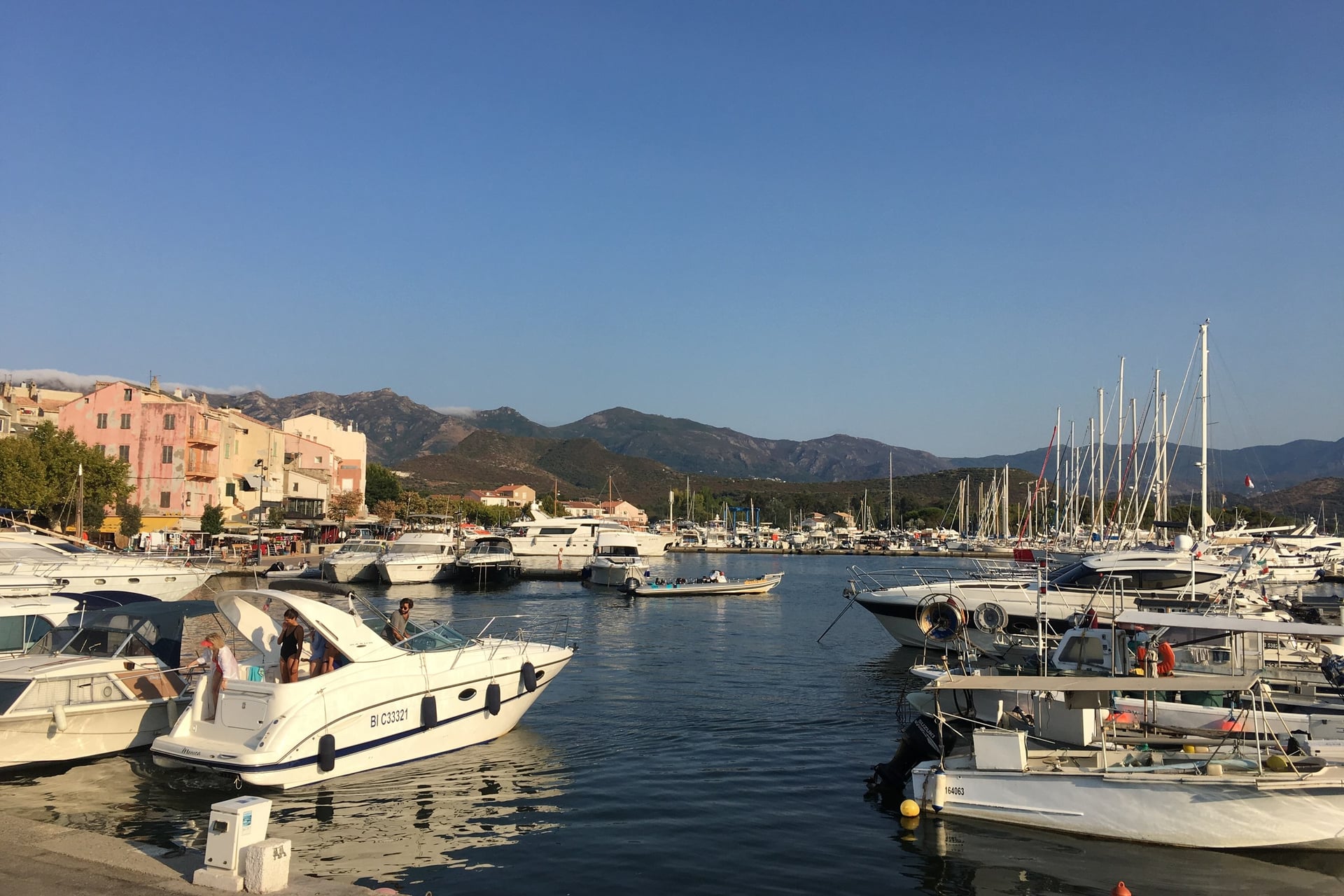
Bastia to Macinaggio: for walk 1, run by Transports Scaniglia, two buses a day each way
Saint-Florent to Lotu and Saleccia: for walk 2, boats from the harbour; Autocars Santini buses link Bastia with Saint-Florent
Ajaccio to Piana: for walk 4, Via Corsica line C2
Corte to Poppaghia and Castel di Vergio: for walk 5, run by Autocars Cortenais
Ajaccio to the Col de Bavella: for walk 7, Via Corsica lines C3 and C4
Figari to Bonifacio: for walk 8, line C1b, which meets the C1 from Ajaccio and Porto-Vecchio at Figari
Taxis: from Macinaggio and Centuri for the one-way Sentier des Douaniers, and for the road from Piana to Capu Rossu
Via Corsica tickets cost less in the Via Corsica app than from the driver, and the Santini bus to Saint-Florent takes cash only.
Know Before You Arrive
Beds near the trailheads are few in Corsica's small villages. Where you sleep decides which walks you can reach without a car.
Where to Base Yourself
Each base below puts one or two walks within reach by bus, boat or train.
Macinaggio: walk 1, with the bus from Bastia and the boat back from Barcaggio
Saint-Florent: walk 2, with the Agriates boats in the harbour
Calvi: walk 3 from the station, and trains to Ponte-Leccia and Corte
Piana or Porto: walk 4 and the shorter Calanche paths, on bus line C2
Corte: walks 5 and 6, with the Vergio bus and trains to Vizzavona in about 50 minutes
Castel di Vergio: a hotel at about 1,400 m on the Vergio bus route, the closest bed to walk 5
Col de Bavella: walk 7; the Auberge du Col de Bavella has dormitories of 6 to 8 beds and private rooms, open all year
Bonifacio: walk 8 from the harbour, with buses to Figari for the C1 line
The auberge at Bavella is also a stop on the GR20, so book ahead for July and August. Its dormitories come with half board.
Food and Wine on the Way
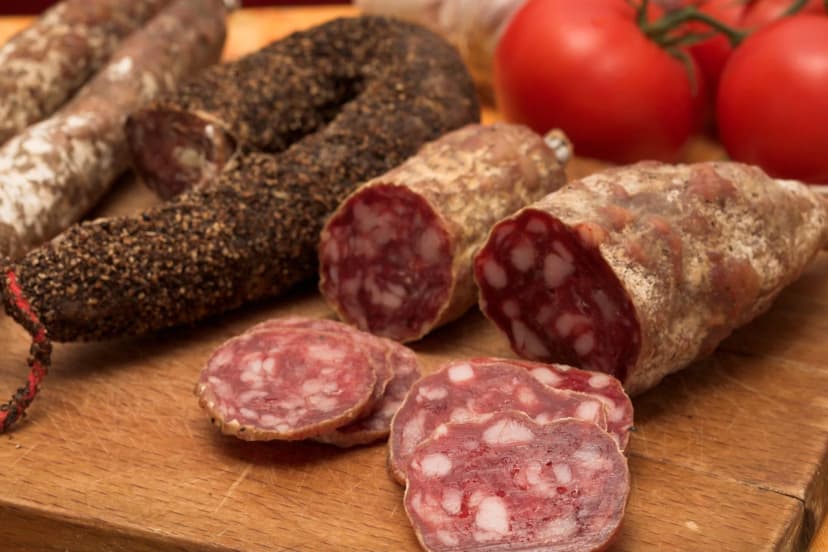
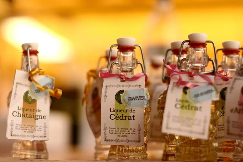
Corsican food comes from the mountains: cured pork from the native Nustrale pig, chestnut flour and wine from small appellations. Village shops sell the makings of a picnic, and these three products turn up on menus all over the island.
How Much It Costs
The walks themselves are free, so the money goes on trains, buses, boats and beds. These are 2026 prices for adults:
Trains: €4.50 from Corte to Vizzavona, €11.50 from Ajaccio to Corte, €16.40 from Bastia to Calvi and €21.60 from Bastia to Ajaccio
Train pass: €50 for the Pass Libertà, seven days on every line; children aged 4 to 12 pay half fare
Buses: €2 to €12 a journey on Via Corsica lines, a little more from the driver, and €20 from Corte to the Col de Vergio
Boats: €19 on the San Paulu boat from Barcaggio to Macinaggio; €20 for the boat to Lotu with the walk to Saleccia from April to June and in September, €22 in July and August
Beds: €58 for half board in a dormitory at the Auberge du Col de Bavella, and €20 for a bunk in a GR20 refuge
What to Pack
Heat on the coast, cool air on the high plateaus and rough granite underfoot set the kit for a Corsican walk.
For any walk:
Trail shoes or light boots with a firm grip on granite
A sun hat and sun cream, as most paths have little shade
A 20 to 25 litre day pack with a rain jacket
A phone with an offline map and a power bank
For Corsica:
1.5 to 2 litres of water each, more in July and August
A water filter or tablets: the health agency advises treating stream water, after 236 walkers on the GR20 fell ill in July 2024
A warm layer and a windproof for Lac de Nino at 1,743 m
Swimming things for Saleccia, Saint-Antoine and the pools of the Agnone
Cash for the Bastia to Saint-Florent bus and for village shops
One Base and the Train, or a Hire Car?
Corsica's mountain roads are slow, and its trailhead buses run once or twice a day. Walkers without a car either move from base to base or stay near the railway. Between Corte and Ajaccio the stations are trailheads, with paths close to the platforms at Vivario, Vizzavona and Bocognano.
Our self-guided Corsica Walking Holidays week is built on that line. You stay in one 3-star hotel in Bocognano and take the train on three of your five walking days. A GPS app and a digital guidebook show the way:
Duration: 8 days / 7 nights, from April to October
Base: Bocognano, with seven nights in a 3-star hotel with breakfast
Walking: five walking days of 8 to 14 km, 56 km in all, with 360 to 825 m of climbing a day
By train: to Vivario for the walk up the Vecchio valley to Vizzavona, to Corte for the Tavignano valley, and to Vizzavona for Bocca Palmente
Day 5: free, with the option of the train down to Ajaccio and the beach
The price includes support during the trip, and the tourist tax is paid locally. Ask us about dates for next season. The full list of our walking holidays in France has more regions.
On the last walking day the path leaves Bocognano for the Richjusa gorge, climbing past granite cliffs to high pastures with a view back across the valley to the village.
Frequently Asked Questions



Plan with a hiking expert
Free advice from a team that knows these routes inside out - real people, not a bot

HASSLE-FREE
We handle itineraries, accommodations, and anything else you prefer not to deal with, so you can enjoy a carefree hike.

TRUSTED BY MANY
We are a financially protected company, fully bonded and insured, keeping your money safe and allowing you to travel with confidence.

TRIED & TESTED ADVENTURES
Only the best walking tours in France, cherry-picked by our team with an in-depth knowledge of the region.

UNBEATABLE SUPPORT
Our 24/7 customer support is where we show our passion, bringing you a better experience by making your well-being our number one priority.