Walking in France: 14 Best Walks, From Coast to Mountains
Fourteen of the best walks in France, from the Étretat cliffs to the Alsace vineyards, each with its distance, elevation gain, best months and nearest station.
Quick links
Don't want to read all this?
We've planned 2,000+ hiking trips. Send your dates, fitness and group size — we'll map the route and book every night.



Walking in France takes you from one village to the next on painted waymarks: over the chalk cliffs of Normandy, through the vineyards of Alsace, past the ochre quarries of Roussillon and round the rocky headlands of the Riviera. Lunch comes from the village bakery, and the day ends with dinner in a family-run hotel.
Days are usually 10 to 20 km, and most of the best walks need no mountain experience. France has about 254,000 km of marked routes. April to June and September to October suit every region except the Alps, where the high paths open in late June.
The 14 best walks below include short cliff walks, a two-week trail through the Cévennes and a week of vineyard paths, and none of them needs a car.
The 14 Best Walks in France
The 14 walks run clockwise round France, from the Normandy coast to the Alsace vineyards. They range from a 7 km mountain walk to a 272 km trail.
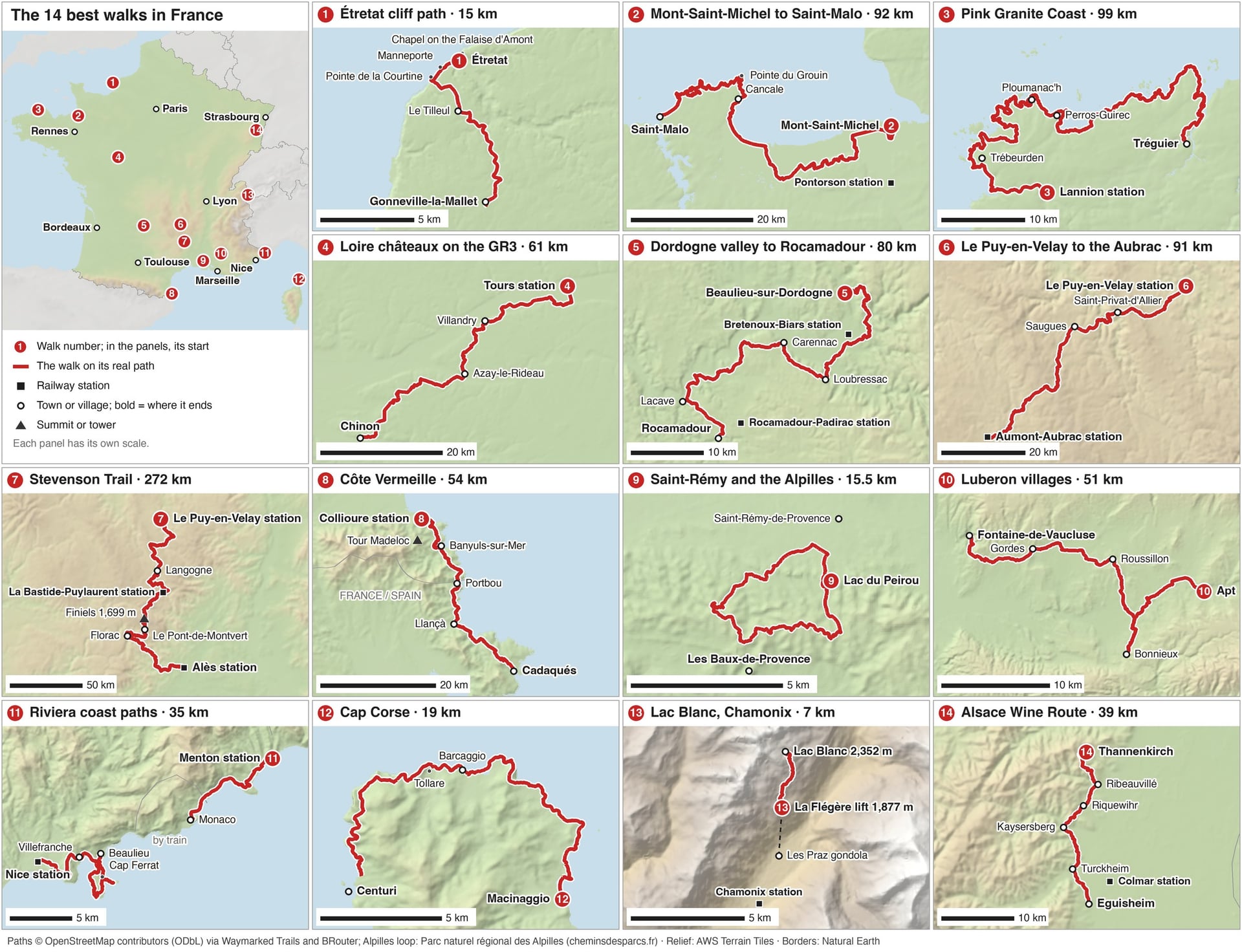
Every walk below starts at a railway station or a short bus ride from one. The table gives the key figures, and each entry has the details.
Walk | Distance | Elevation gain | Best months | Nearest station |
Étretat cliff path | 15 km, 1 day | Clifftops near 100 m | April to October | Bréauté-Beuzeville |
Mont-Saint-Michel Bay to Saint-Malo | 92 km, 5 days | Little | April to October | Pontorson |
Pink Granite Coast | 99 km, 7 days | 1,200 m | May to September | Lannion |
Loire châteaux on the GR3 | 61 km, 3 days | Little | April to June, September to October | Tours |
Dordogne valley to Rocamadour | 80 km, 6 days | 1,850 m | April to June, September to October | Bretenoux-Biars |
Le Puy-en-Velay to the Aubrac | 91 km, 4 days | 2,570 m | Mid-May to June, September | Le Puy-en-Velay |
Stevenson Trail | 272 km, 12 to 14 days | 630 m on Mont Lozère | May, June, September | Le Puy-en-Velay |
Côte Vermeille | 54 km, 5 days | 2,050 m | April to June, September to October | Collioure |
Saint-Rémy and the Alpilles | 15.5 km, 1 day | 392 m | April, May, October | Avignon |
Luberon villages | 51 km, 4 days | 1,300 m | April to June, September to October | Avignon |
Riviera coast paths | 35 km, 3 days | 430 m | October to May | Menton |
Cap Corse | 19 km, 1 or 2 days | Short climbs | April to June, September to October | Bastia |
Lac Blanc, Chamonix | 7 km, 1 day | 500 m | Late June to mid-September | Chamonix |
Alsace Wine Route | 39 km, 4 days | 965 m | April to October | Colmar |
1. The Étretat Cliff Path on the GR21
Route: Étretat over the Falaise d'Aval, past the Manneporte arch and the Pointe de la Courtine, to Gonneville-la-Mallet
Distance: 15 km on the GR21, which runs about 190 km from Le Tréport to Le Havre
Elevation gain: short climbs onto clifftops close to 100 m high
Terrain: grass and chalk paths along the cliff edge; walkers must keep 5 m back, behind a fence line west of the Aiguille
Best months: April to October
Nearest station: Bréauté-Beuzeville on the Paris–Le Havre line, then coach 504 to Étretat in 32 minutes
Best for: a coastal day walk about 3 hours from Paris by train and coach
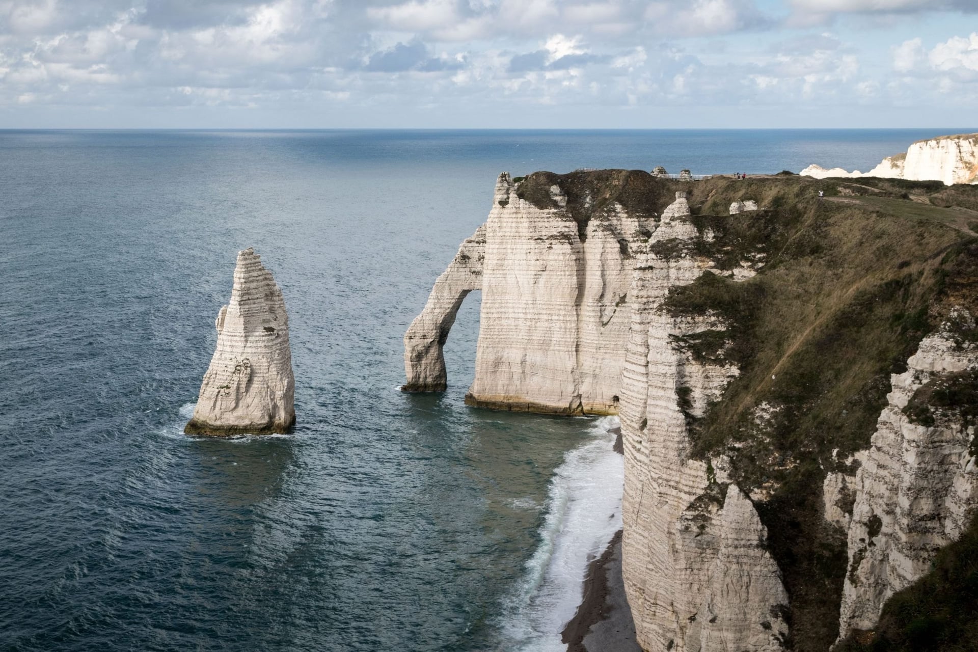
Étretat's chalk arches are the best-known view on the Alabaster Coast, and the GR21 climbs onto the clifftops on both sides of the town. To the west, the Falaise d'Aval path looks down on the 51 m Aiguille. It then passes the Manneporte arch on the way to the Pointe de la Courtine.
East of the town, a shorter climb leads to the sailors' chapel of Notre-Dame-de-la-Garde on the Falaise d'Amont. The cliff path beyond it towards Yport is closed after a cliff fall in February 2026, and the GR21 now runs inland through the Étigues valley. A 2025 town order bans walking within 5 m of the cliff edge and closes the beaches below the cliffs.
2. Mont-Saint-Michel Bay to Saint-Malo
Route: Mont-Saint-Michel to Saint-Malo on the GR34, via Cancale and the Pointe du Grouin
Distance: 92 km, usually in five days; 52 km from the Mont to Cancale
Elevation gain: almost none round the bay, then short climbs over the headlands after Cancale
Terrain: sea dykes, lanes and field edges round the bay, then cliff paths and coves
Best months: April to October
Nearest station: Pontorson, 9 km from the Mont, with bus 2 in about 27 minutes; Saint-Malo, 2 h 29 from Paris
Best for: tides of up to 15 m, oyster villages and a walled town at the finish
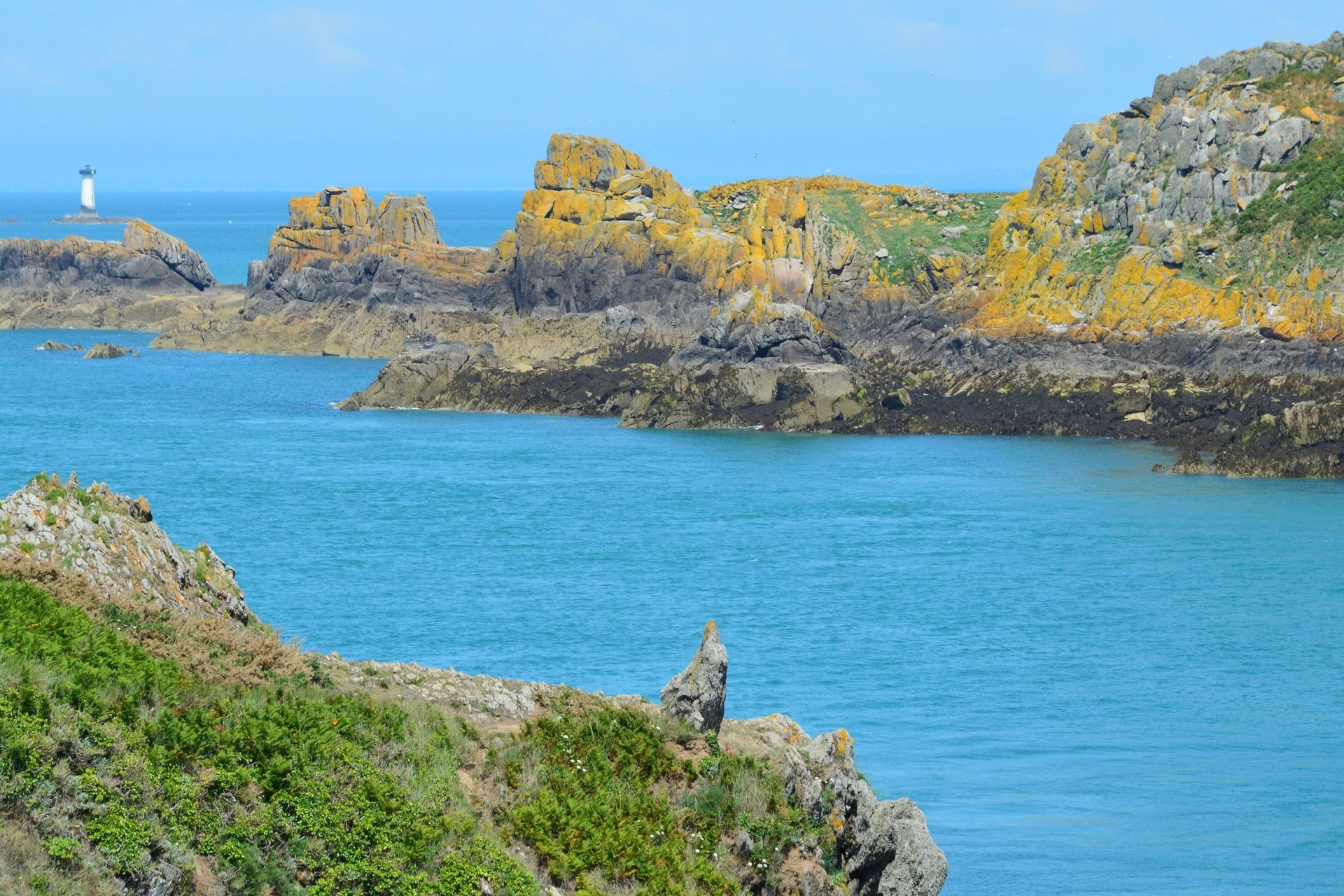
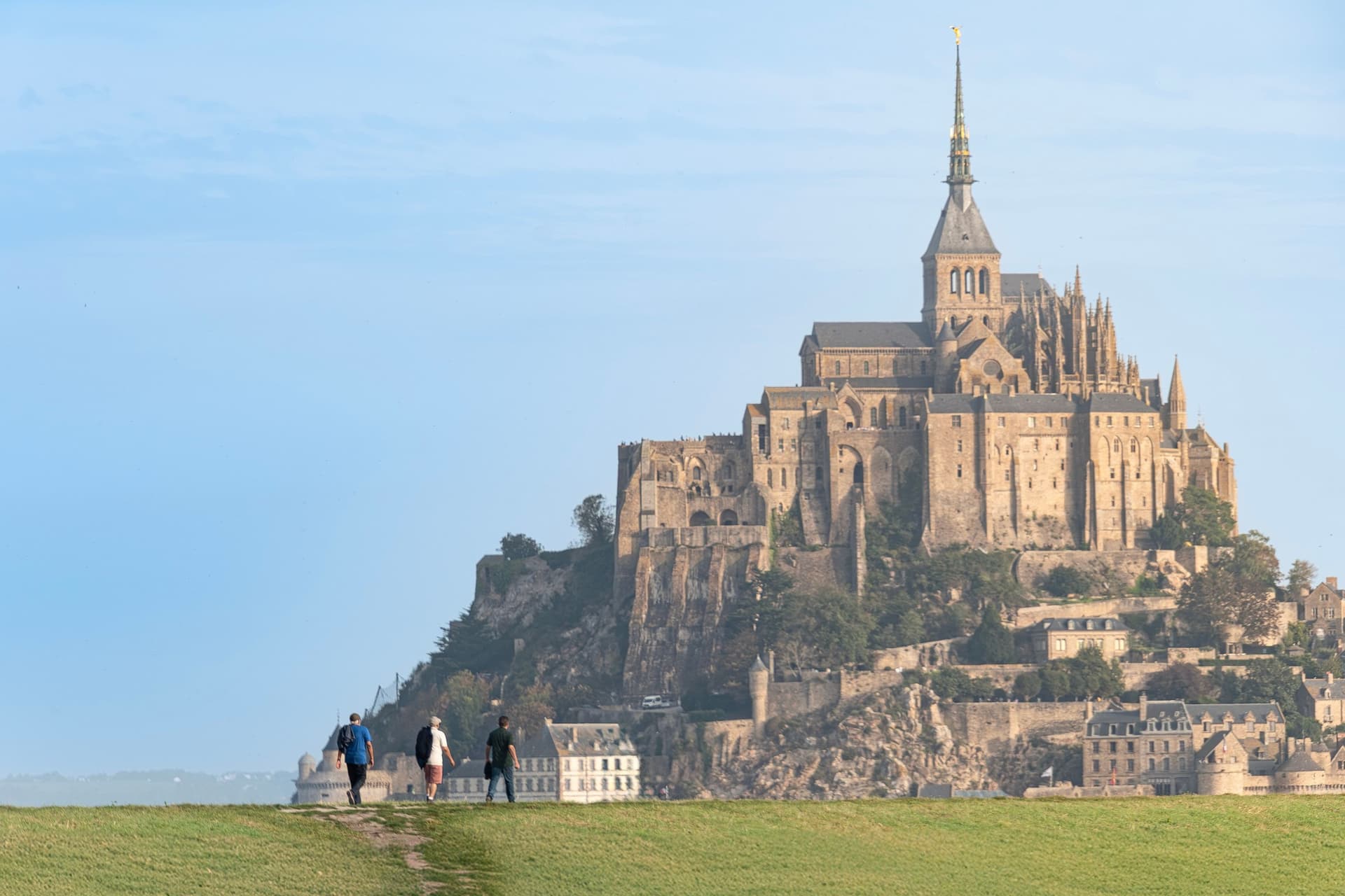
The walk starts at the abbey, reached by a 760 m footbridge that opened to walkers in 2014. From the Mont, the GR34 follows the shore west to Cancale: 52 km of sea dykes and field edges with almost no climbing for the first three days.
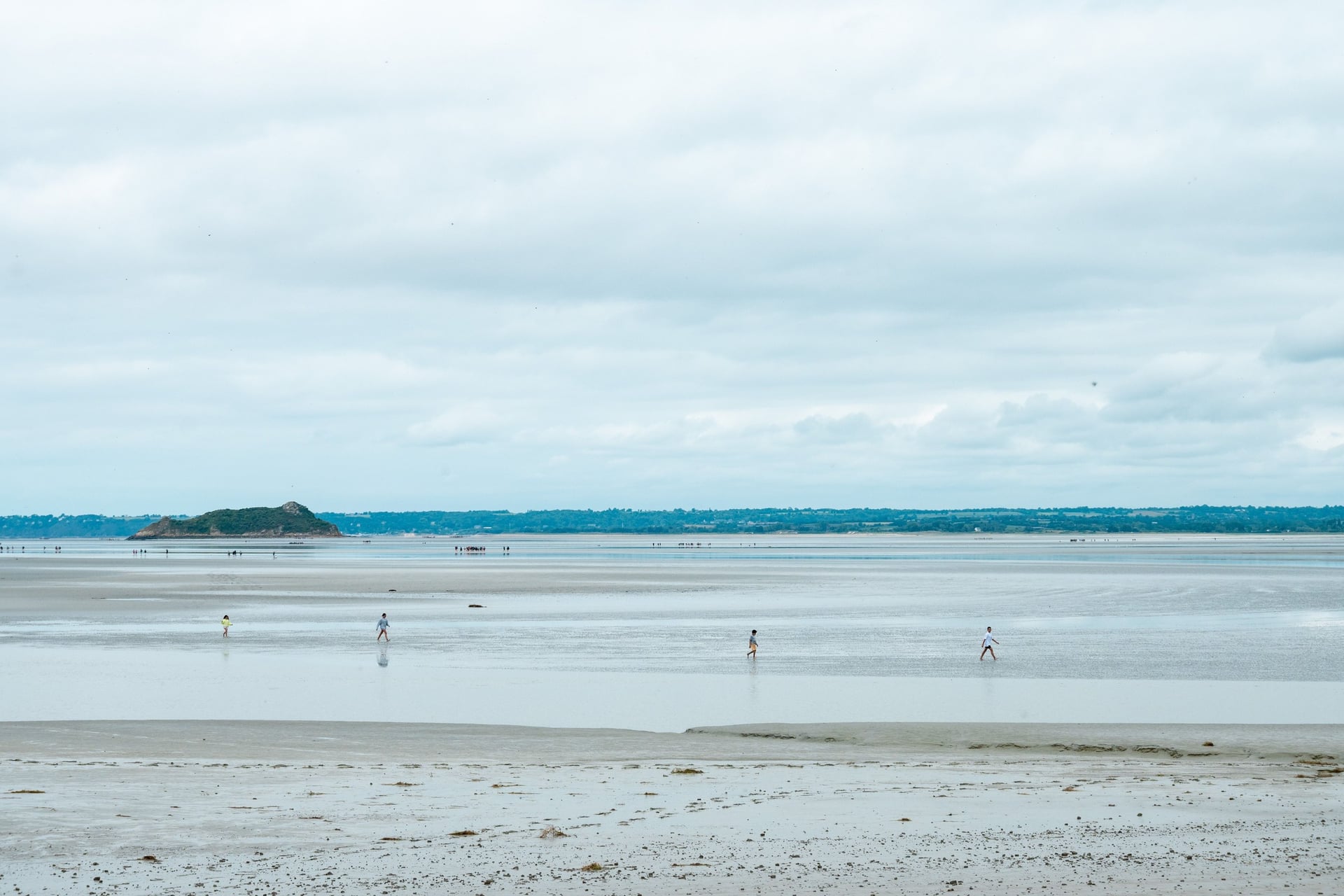
The bay has tides of up to 15 m, and the sea goes out as far as 15 km. Never cross the sands without a certified guide, as the official Mont-Saint-Michel site advises. After the oyster beds of Cancale, the path rounds the Pointe du Grouin and ends on the 2 km circuit of the Saint-Malo ramparts.
3. The Pink Granite Coast on the GR34
Route: Lannion to Tréguier along the GR34, through Trébeurden, Trégastel, Ploumanac'h and Perros-Guirec
Distance: 99 km in seven stages; 9 km return for the classic day from Trestraou beach to Ploumanac'h
Elevation gain: about 1,200 m over the seven stages
Terrain: sandy and rocky coast path among granite boulders, with short climbs between coves
Best months: May to September
Nearest station: Lannion, 3 h 16 from Paris with one change, then TILT bus E to Perros-Guirec in about 31 minutes
Best for: easy coastal days and seabirds
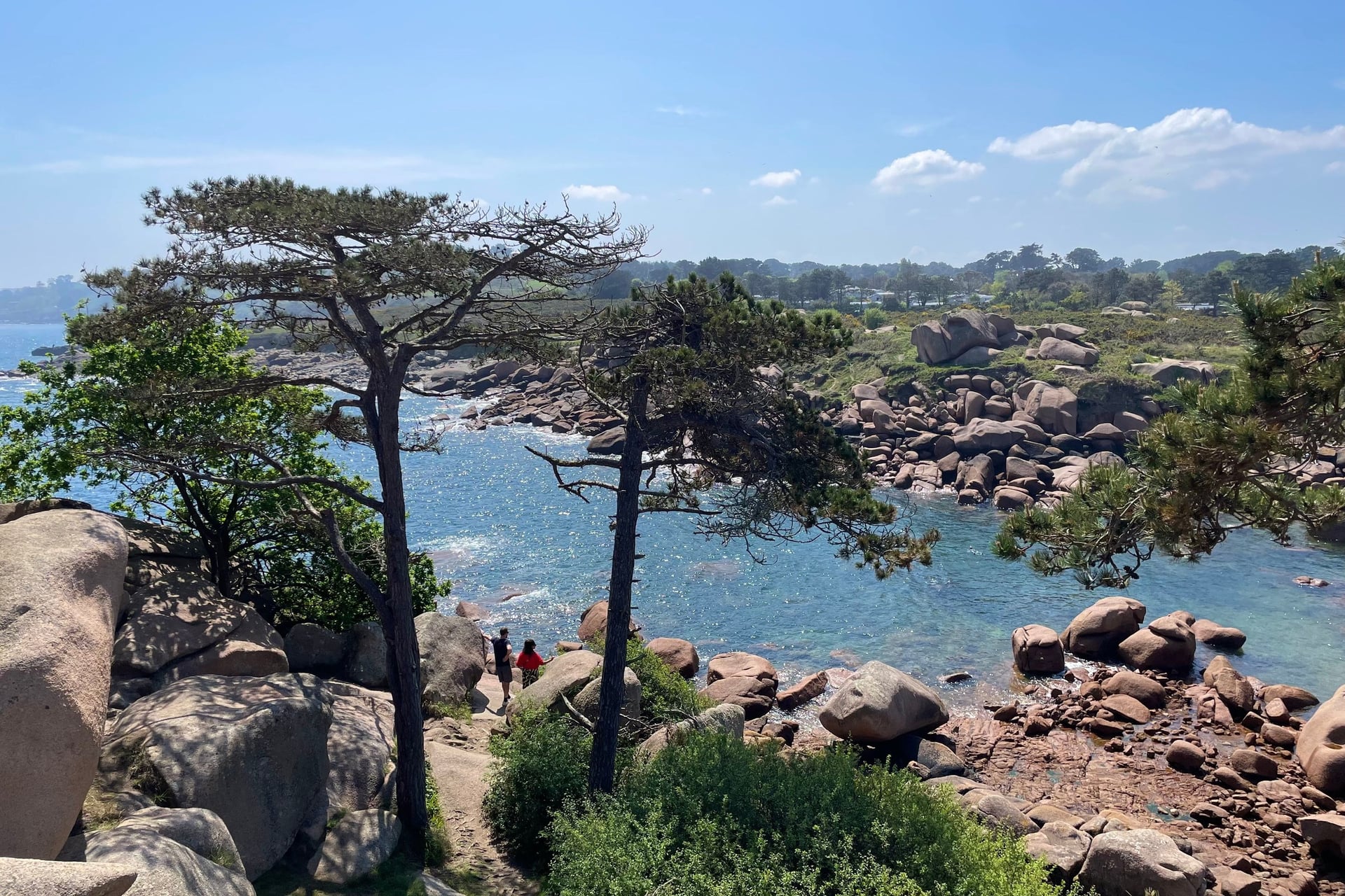
Perros-Guirec's sentier des douaniers, the old customs officers' path, gives this coast its best day walk. From Trestraou beach it winds through pink granite to the Mean Ruz lighthouse at Ploumanac'h, rebuilt in the same stone in 1946 to 1948. The walk there and back is 9 km.
The granite formed about 300 million years ago, and the sea has worn it into rounded piles. Offshore, Rouzic in the Sept-Îles reserve is France's only gannet colony, with 14,124 pairs counted in 2024. Around Brittany the GR34 runs for more than 2,000 km.
4. The Loire Châteaux on the GR3
Route: Tours to Chinon on the GR3, via Villandry and Azay-le-Rideau
Distance: 61 km in three stages: 19.5 km to Villandry, 13.5 km to Azay-le-Rideau and 28 km to Chinon
Elevation gain: little; the path follows the Cher and the Indre, then crosses the forest of Chinon
Terrain: riverbanks, farm tracks and forest paths
Best months: April to June and September to October
Nearest station: Tours or Saint-Pierre-des-Corps, about 1 hour from Paris by TGV
Best for: flat walking between châteaux and gardens
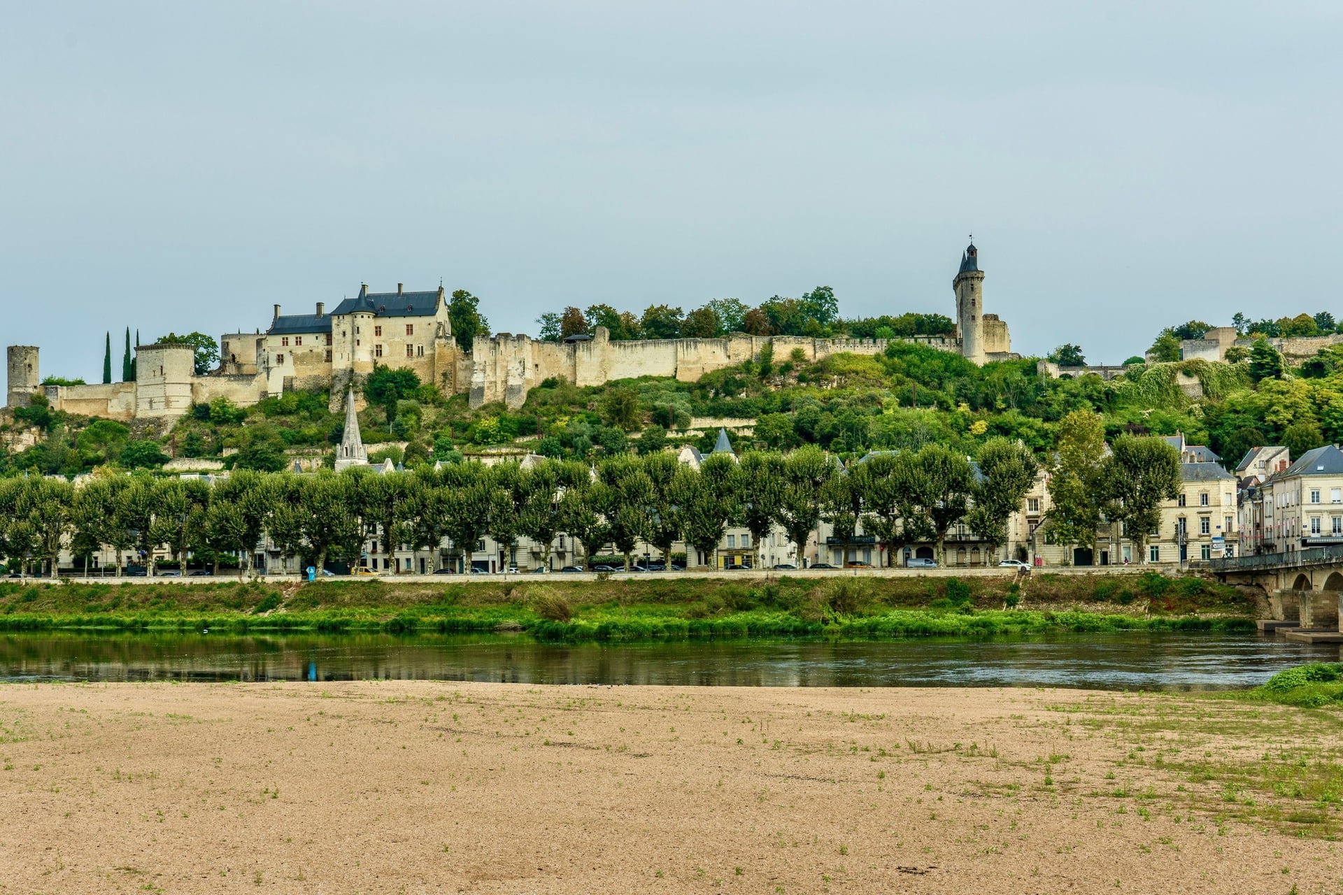
France's first official long-distance path, the GR3, opened its first section in 1947 and now follows the Loire for more than 1,200 km. In Touraine it leaves the big river to link the châteaux on its tributaries. The gardens of Villandry are 13.5 km from the moated château of Azay-le-Rideau.
The longest day, 28 km from Azay-le-Rideau to Chinon, crosses the forest to the royal fortress above the Vienne. Plan the trip back from Chinon by coach for now: the Tours–Chinon railway is closed for works until 26 February 2027, and replacement coaches run every day, with a reduced service of about five a day at weekends. Further upstream, 280 km of the Loire valley, from Sully-sur-Loire to Chalonnes, has been on UNESCO's World Heritage list since 2000.
Full guide: Walking in the Loire Valley
5. The Dordogne Valley to Rocamadour
Route: Beaulieu-sur-Dordogne to Rocamadour, along the river and over the causse via Loubressac, Carennac and Lacave
Distance: about 80 km in six stages of 8.5 to 21 km
Elevation gain: about 1,850 m
Terrain: riverside tracks, oak woods and stony paths on the causse, the dry limestone plateau above the valley
Best months: April to June and September to October
Nearest station: Bretenoux-Biars, 6 km from Beaulieu; Rocamadour-Padirac, 5 km from Rocamadour on the Brive–Rodez line
Best for: cliff villages and river views
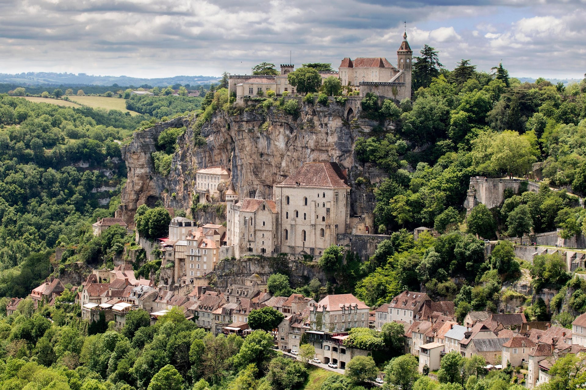
From Beaulieu-sur-Dordogne the path follows the river downstream, then climbs onto the causse and drops back to the water. On or near the route, five villages carry the Plus Beaux Villages de France label: Beaulieu-sur-Dordogne, Loubressac, Autoire, Carennac and Rocamadour.
Rocamadour hangs on a cliff above the Alzou canyon, where the GR6, GR46 and GR652 meet, and the 216 steps of its Grand Escalier climb to the sanctuary. The whole Dordogne basin has been a UNESCO biosphere reserve since 2012.
Full guide: Walking in the Dordogne
6. The GR65 From Le Puy-en-Velay to the Aubrac
Route: Le Puy-en-Velay to Aumont-Aubrac via Saint-Privat-d'Allier, Saugues and Les Faux
Distance: 91 km in four stages of 19 to 28 km
Elevation gain: 2,570 m
Terrain: farm tracks and paths over the volcanic Velay, the Allier gorge and the granite plateau of the Margeride
Best months: mid-May to June and September
Nearest station: Le Puy-en-Velay, about 2 h 15 from Lyon with one change; Aumont-Aubrac, on the Clermont-Ferrand–Béziers line
Best for: fit walkers who like long days and shared dinners in walkers' hostels
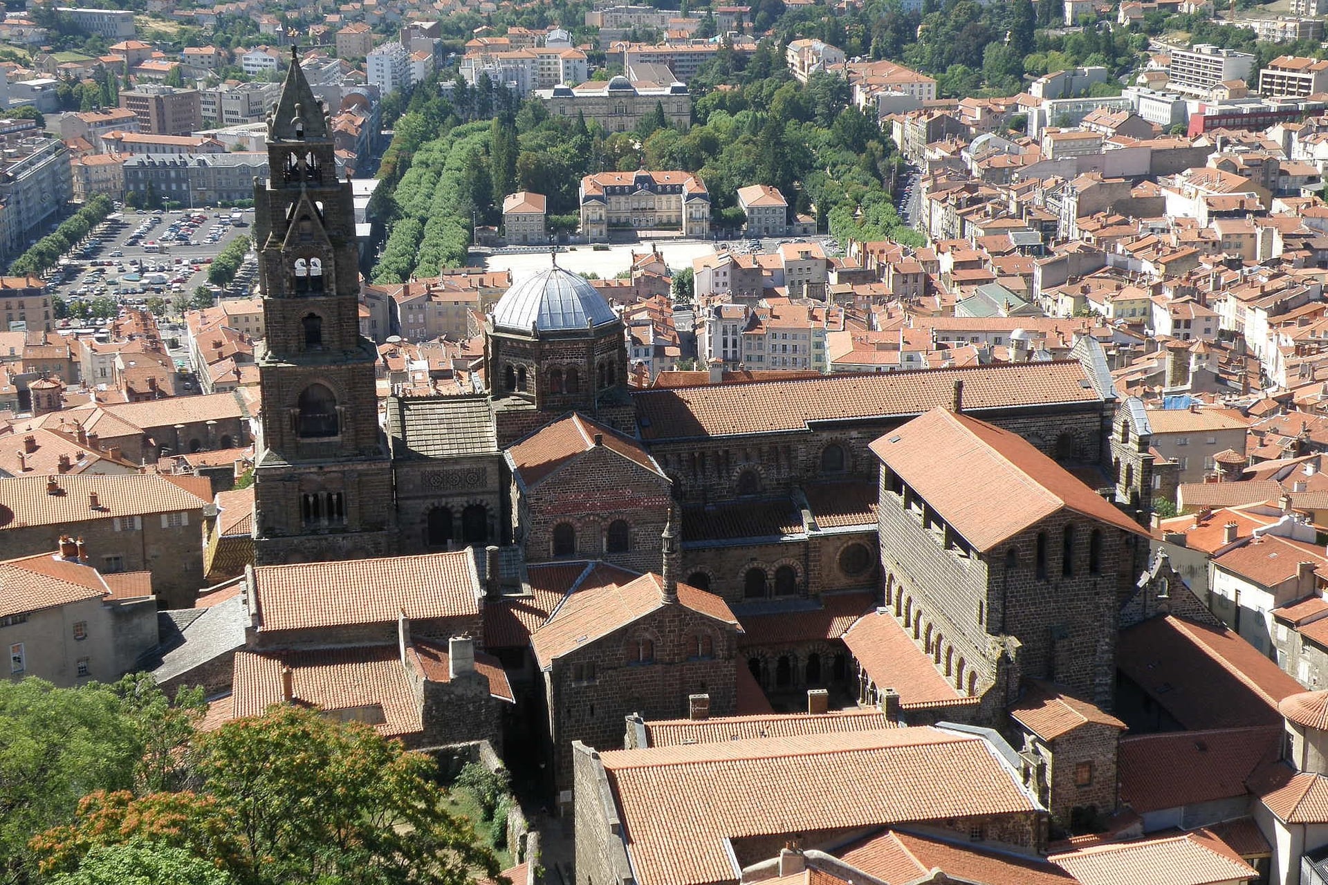
Le Puy-en-Velay's cathedral is the start of the GR65, a path of about 750 km to the Pyrenees, first waymarked in 1972. From April to October a 7:00 mass ends with a blessing for walkers. On the second day the path drops into the Allier gorge at Monistrol.
On this stretch expect long days and steady climbs: the four stages run 19 to 28 km, with 2,570 m of elevation gain in all. Most walkers' hostels on the route, in places such as Saint-Privat-d'Allier, Saugues and Aumont-Aubrac, open from April to mid-October.
7. The Stevenson Trail Through the Cévennes
Route: Le Puy-en-Velay to Alès on the GR70, via Le Monastier, Langogne, Le Pont-de-Montvert and Florac
Distance: 272 km in 12 to 14 stages; 19 km for the Mont Lozère stage from Le Bleymard to Le Pont-de-Montvert
Elevation gain: 630 m from Le Bleymard to the 1,699 m summit of Finiels, the highest point
Terrain: forest tracks, open moorland on Mont Lozère and stony paths in the chestnut valleys
Best months: May, June and September
Nearest station: Le Puy-en-Velay at the start, Alès at the end and La Bastide-Puylaurent, on the Clermont-Ferrand–Nîmes line, in between
Best for: two weeks on one trail, with a donkey if you like
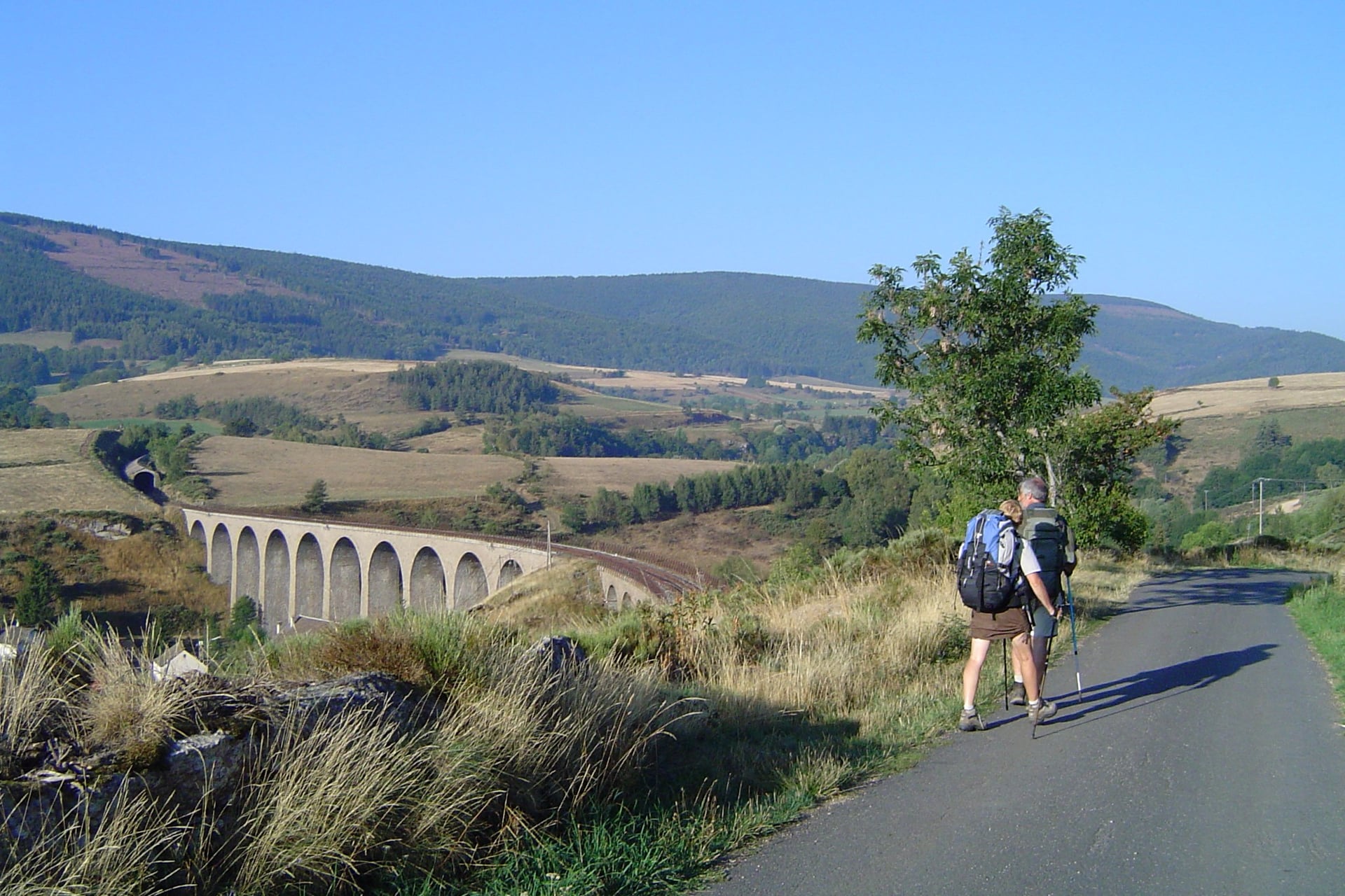
Robert Louis Stevenson walked from Le Monastier to Saint-Jean-du-Gard in 12 days in 1878, with a donkey called Modestine. He published Travels with a Donkey in the Cévennes the next year, and the GR70 follows his route from Le Puy-en-Velay to Alès.
The big day crosses Mont Lozère, climbing 630 m to the summit of Finiels before the descent to the stone bridge of Le Pont-de-Montvert. Walkers can still hire a donkey to carry the bags: the trail association lists six hirers, for trips of 3 to 12 days.
8. The Côte Vermeille: Collioure to Cadaqués
Route: Collioure to Cadaqués in Spain, via Banyuls-sur-Mer, Portbou, Llançà and El Port de la Selva
Distance: about 54 km in five stages of 7.5 to 14.5 km; the climb to Tour Madeloc adds a 14 km loop from Collioure
Elevation gain: about 2,050 m, plus 780 m for the Tour Madeloc loop
Terrain: steep, stony paths through terraced vineyards and over the headlands
Best months: April to June and September to October
Nearest station: Collioure, about 20 minutes from Perpignan by TER; Banyuls, Cerbère and Portbou are on the same line
Best for: fit walkers who want the sea in view all day
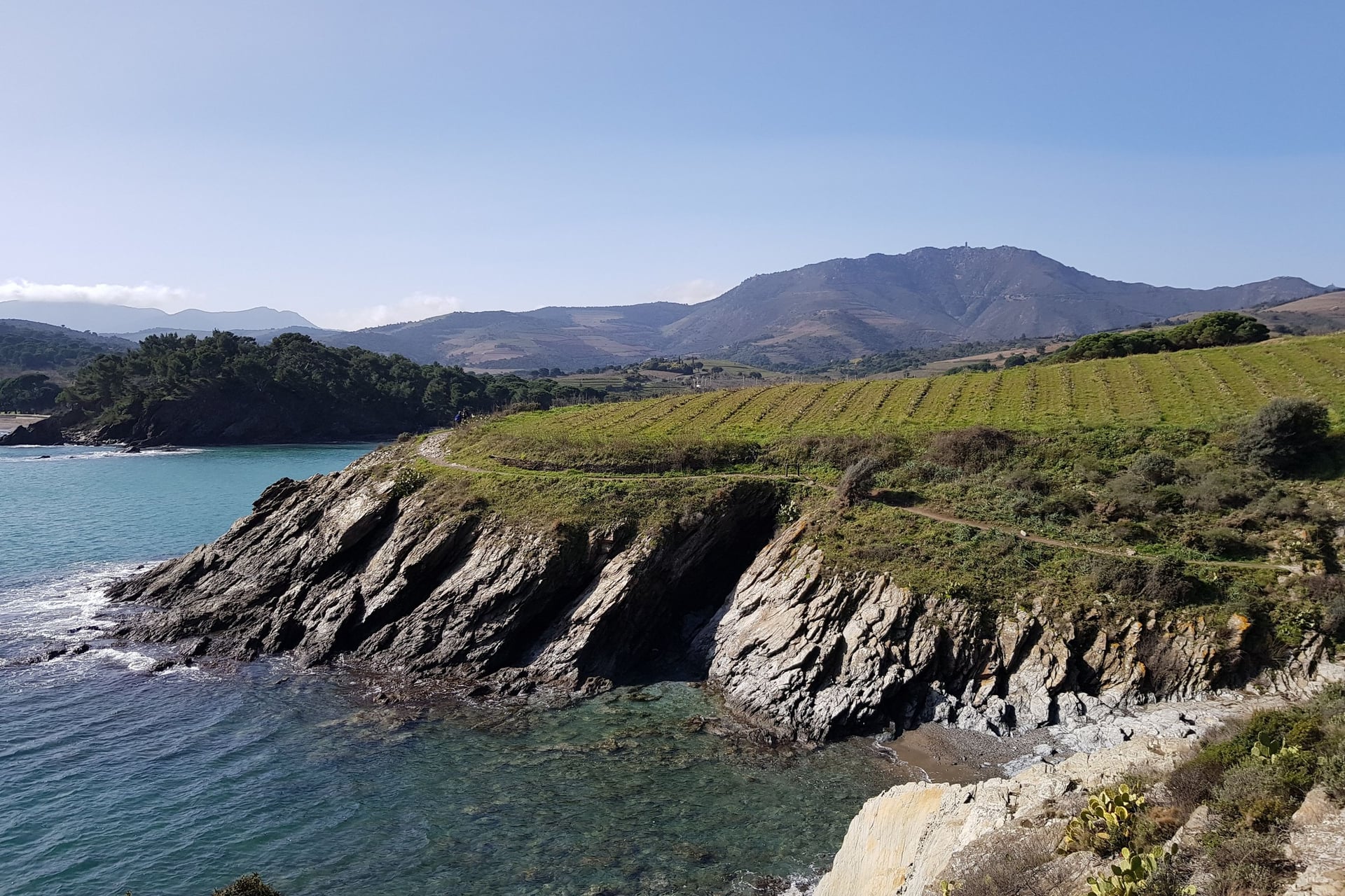
Here the Pyrenees meet the Mediterranean. The path climbs through the terraced vineyards above Banyuls-sur-Mer, where the GR10 ends its crossing of the range from Hendaye, a walk of 65 to 70 days. It then follows the coast over the border to Portbou and the bays of Catalonia.
On this coast the stages are short but steep: Banyuls to Portbou is 11 km with 530 m of climbing. At Portbou, Dani Karavan's Passages memorial of 1994 remembers the writer Walter Benjamin. The walk ends near Cap de Creus, the easternmost point of the Iberian Peninsula.
9. Van Gogh's Provence: Saint-Rémy and the Alpilles
Route: a loop from Saint-Rémy-de-Provence over the Alpilles to the col above Les Baux-de-Provence and back, partly on the GR6
Distance: 15.5 km, about 5 hours
Elevation gain: 392 m
Terrain: stony limestone paths, pine woods and olive groves
Best months: April, May and October
Nearest station: Avignon, then Zou! bus 707 to Saint-Rémy in about 50 minutes
Best for: a day walk through the landscapes Van Gogh painted
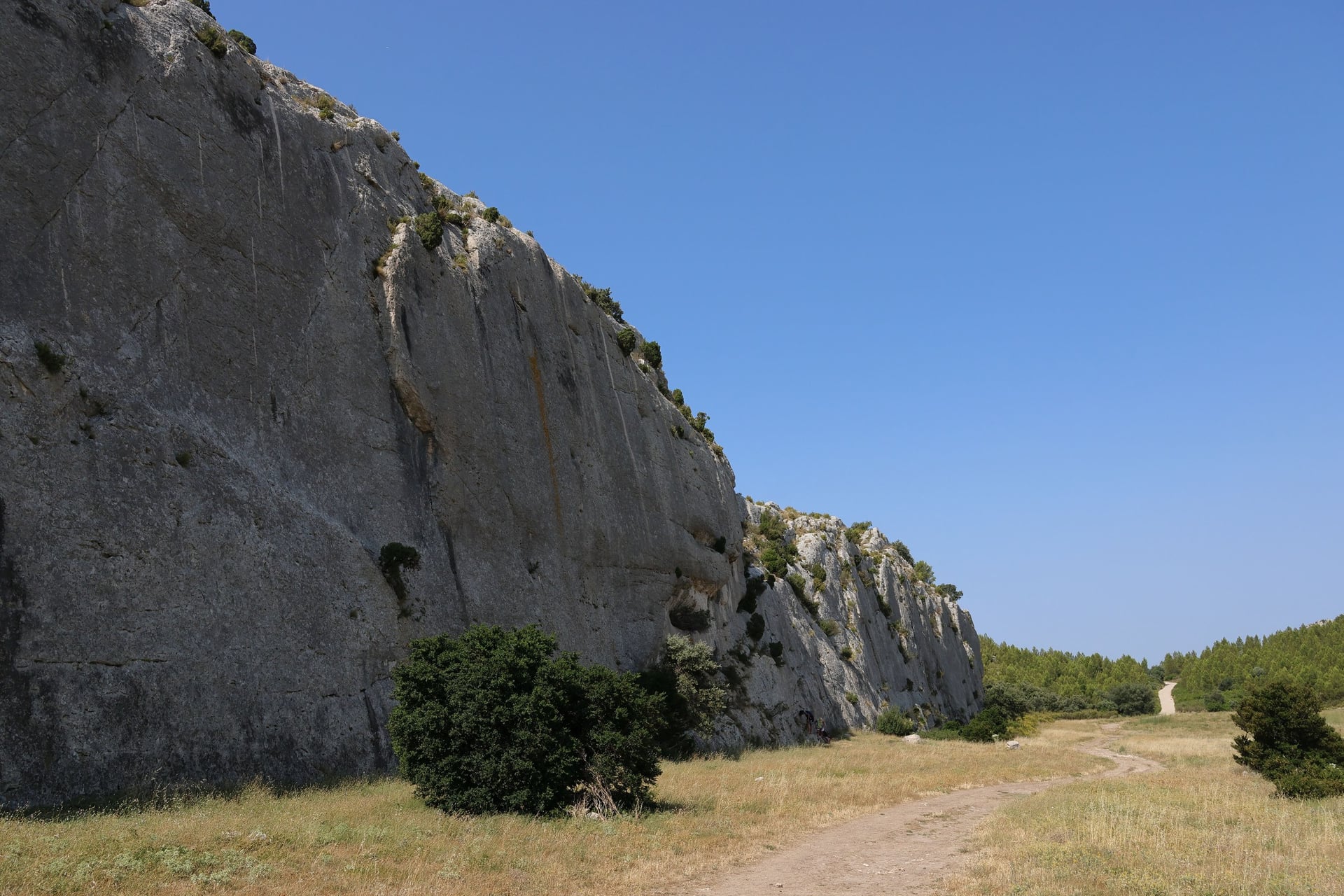
Van Gogh spent a year at the Saint-Paul-de-Mausole asylum in Saint-Rémy, from May 1889 to May 1890. He painted about 150 works there, among them The Starry Night, and a 1.5 km trail through the town shows 19 of the scenes where he set up his easel.
The regional park's 15.5 km loop climbs south from the town over the limestone ridge to the col above Les Baux, a village on a rock crowned by its ruined castle about 1 km further south. In summer, check the fire map the evening before: from 1 June to 30 September the Bouches-du-Rhône closes its massifs on high-risk days.
10. The Luberon Villages and the Ochre Trail
Route: Apt to Fontaine-de-Vaucluse via Bonnieux, Roussillon and Gordes
Distance: about 51 km in four stages of 11 to 16 km
Elevation gain: about 1,300 m
Terrain: stony tracks, oak woods, vineyards and the ochre sand of Roussillon
Best months: April to June and September to October
Nearest station: Avignon, then Zou! bus 915 to Apt in about 70 minutes
Best for: hilltop villages and market days
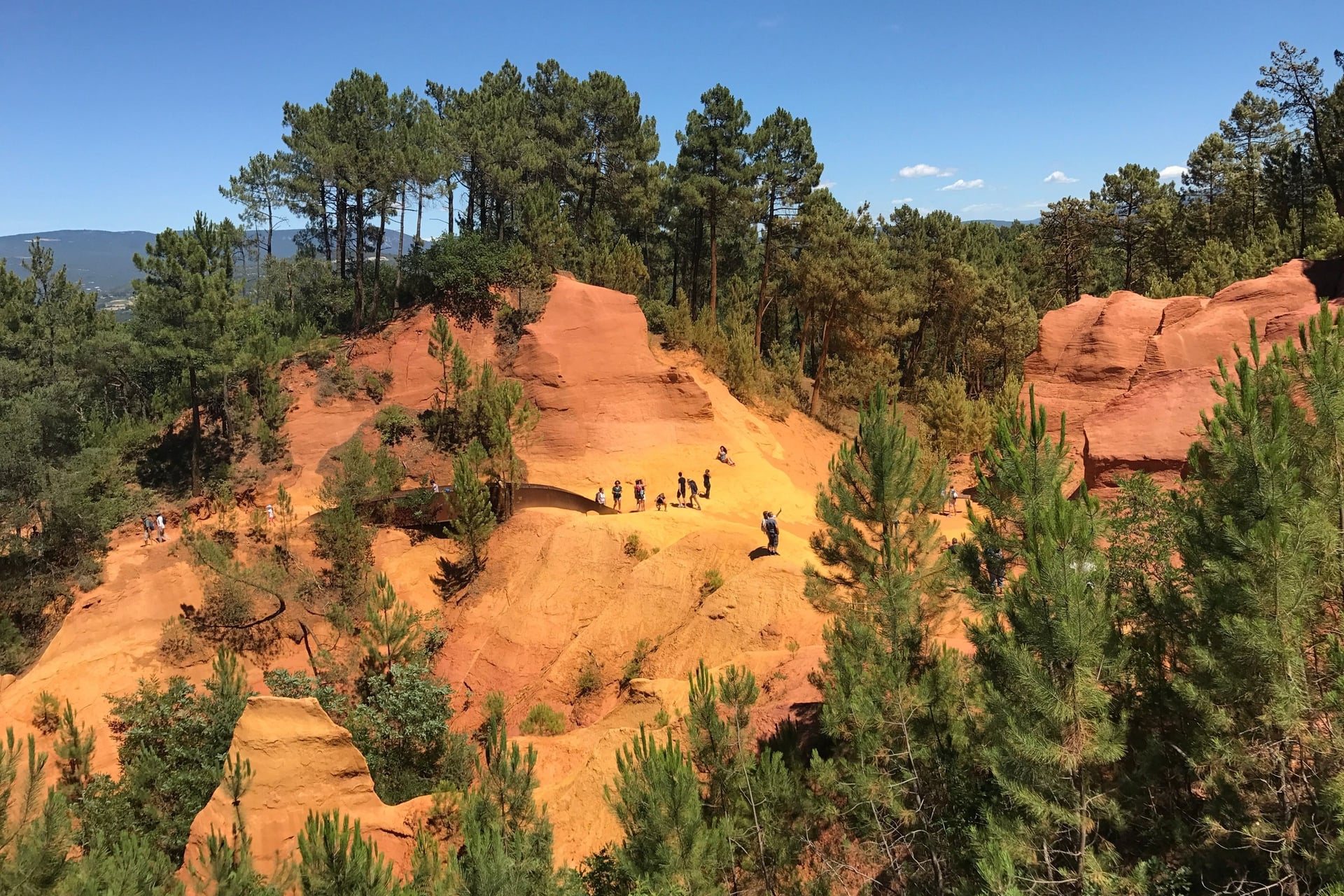
Walking in the Luberon means going from one hilltop village to the next. Roussillon and Gordes on this route, and Ménerbes and Lourmarin nearby, are Plus Beaux Villages de France. They lie inside a regional park of 185,000 ha, created in 1977.
At Roussillon, the Sentier des Ocres follows old ochre quarries in loops of 30 or 50 minutes. Summer heat can close the forest paths: from 15 June to 15 September the Vaucluse publishes a fire map at 18:00 for the next day. Only the highest level closes the ochre trail.
Full guide: Walking in Provence
11. The Riviera Coast Paths: Menton to Nice
Route: Menton to Nice on the coast paths round Cap Martin, Cap Ferrat and Villefranche, with a train from Monaco to Beaulieu
Distance: about 35 km in three days: 12.5 km from Menton to Monaco, 14.5 km from Beaulieu to Villefranche and 8.5 km on to Nice
Elevation gain: about 430 m; the Nietzsche path from Èze-sur-Mer adds 400 m
Terrain: rocky shore paths, steps and seafront promenades
Best months: October to May
Nearest station: Menton, Monaco, Beaulieu, Villefranche and Nice, all on the coast line, about 45 minutes from end to end
Best for: winter walking, when Nice averages 13 °C in January
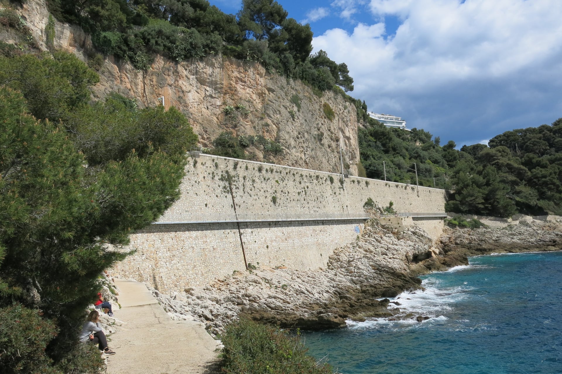
Between Menton and Nice, coast paths run just above the sea round each headland. On Cap Martin the Sentier Le Corbusier passes the Cabanon, the one-room seaside cabin, 3.66 m square, that the architect built in 1952. It has been part of a UNESCO World Heritage listing since 2016.
On Cap Ferrat, part of the coast path is closed: the stretch from the lighthouse to the Plage de Passable is shut for safety works. Above Èze-sur-Mer, the Nietzsche path climbs 400 m in about an hour. The philosopher worked on Thus Spoke Zarathustra there in the winter of 1883 to 1884.
12. The Sentier des Douaniers on Cap Corse
Route: Macinaggio to Centuri round the northern tip of Cap Corse, via Barcaggio
Distance: 19 km, more than 8 hours in all; Macinaggio to Barcaggio takes 3 to 3.5 hours
Elevation gain: short, repeated climbs over rocky headlands between the coves
Terrain: a narrow path through maquis, the dense Mediterranean scrub, with little shade
Best months: April to June and September to October; avoid windy days
Nearest station: Bastia, on the Corsican railway, then the bus to Macinaggio on Tuesdays and Fridays, and daily except Sundays in July and August
Best for: a wild coast with Genoese towers
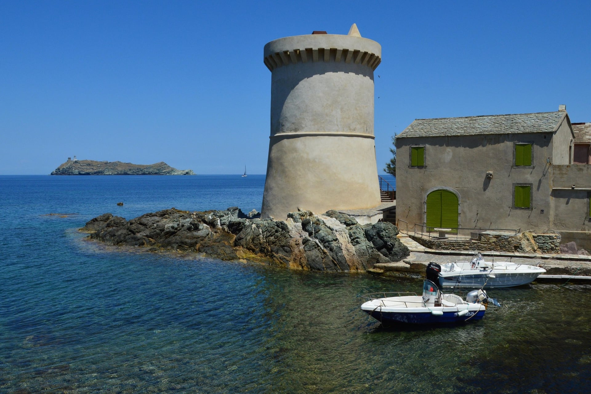
At the tip of Cap Corse, the old customs officers' path passes three of the Genoese watchtowers that ring the island: Agnellu, Santa Maria and Tollare. Offshore, the Finocchiarola islands are a nature reserve, and landing on them is forbidden.
The path runs one way for 19 km, so plan the return before you set off. In summer the San Paulu boat links Barcaggio with Macinaggio and Centuri, and local taxis cover the road. Camping and bivouacking are banned along the path.
Full guide: Walking in Corsica
13. Lac Blanc and the Chamonix Balcony Paths
Route: La Flégère lift station to Lac Blanc and back, in the Aiguilles Rouges facing Mont Blanc
Distance: 7 km return, about 3 hours
Elevation gain: 500 m, from 1,877 m to the lake at 2,352 m
Terrain: rocky mountain path, steep in places, with snow patches early in the season
Best months: late June to mid-September, while the La Flégère lift runs
Nearest station: Chamonix-Mont-Blanc, 45 minutes from Saint-Gervais-Le Fayet on the Mont-Blanc Express
Best for: high mountain views without mountaineering
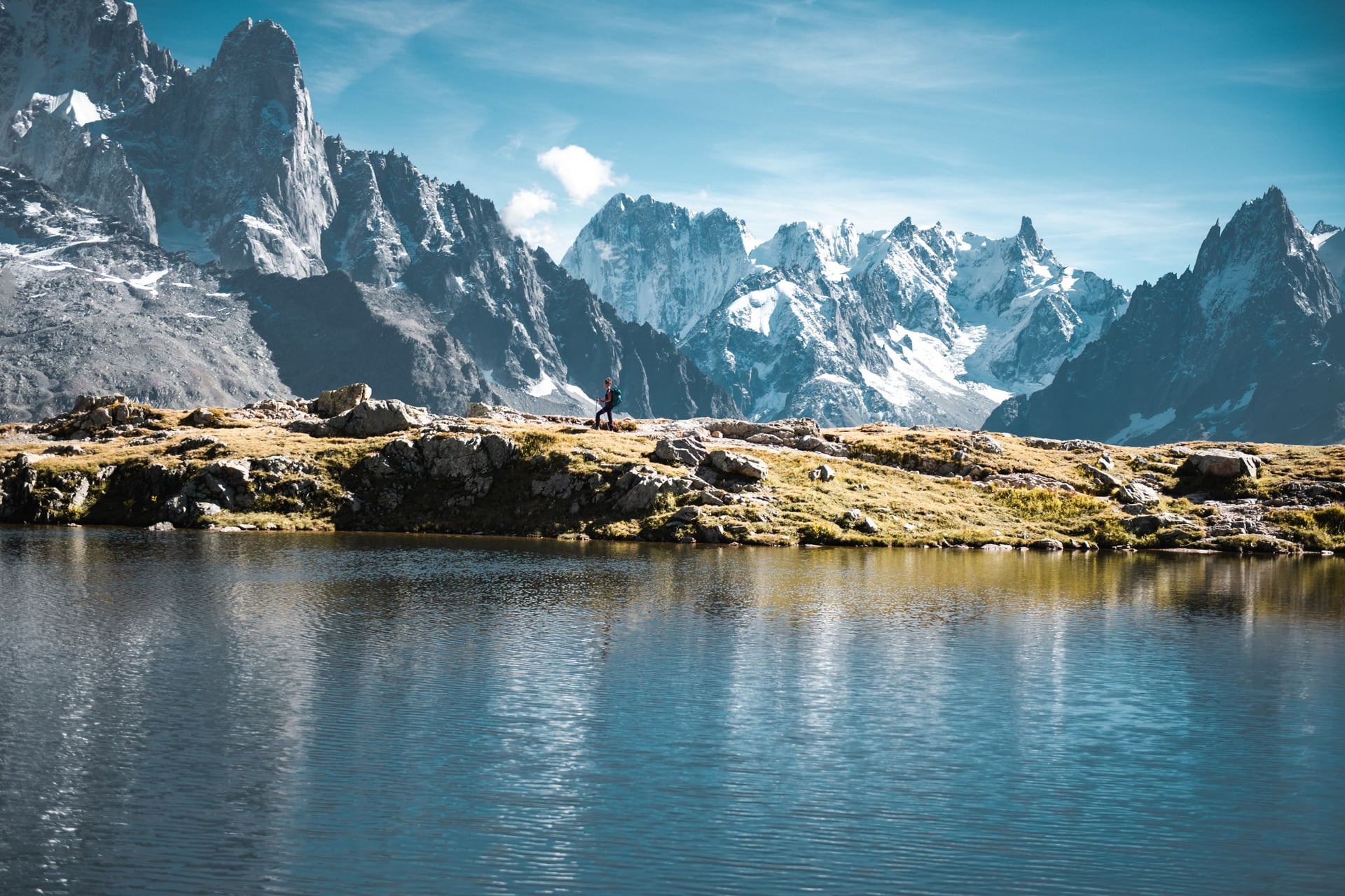
Chamonix's balcony paths cross the mountainside facing Mont Blanc, high above the valley, and lifts do the first part of each climb. The Grand Balcon Sud links La Flégère with Planpraz in 5.5 km. The path to Lac Blanc climbs 500 m from La Flégère to the lake.
In practice the lift sets the season: in 2026 La Flégère ran from 20 June to 13 September. Lac Blanc lies in the Aiguilles Rouges nature reserve, created in 1974, where dogs are banned and swimming in the lake is forbidden.
14. The Alsace Wine Route on Foot
Route: Thannenkirch to Eguisheim through the vineyards, via Ribeauvillé, Kaysersberg and Turckheim
Distance: about 39 km in four stages of 8 to 11.5 km; the Géovino loop round Riquewihr adds 35.77 km
Elevation gain: about 965 m
Terrain: vineyard tracks, forest paths on the lower slopes of the Vosges and village lanes
Best months: April to October, with the harvest usually from mid-September
Nearest station: Colmar, 2 h 20 from Paris by TGV, then Fluo buses 816 to Riquewihr and Ribeauvillé, 813 to Kaysersberg and 830 to Eguisheim
Best for: wine villages and short days of 8 to 11.5 km
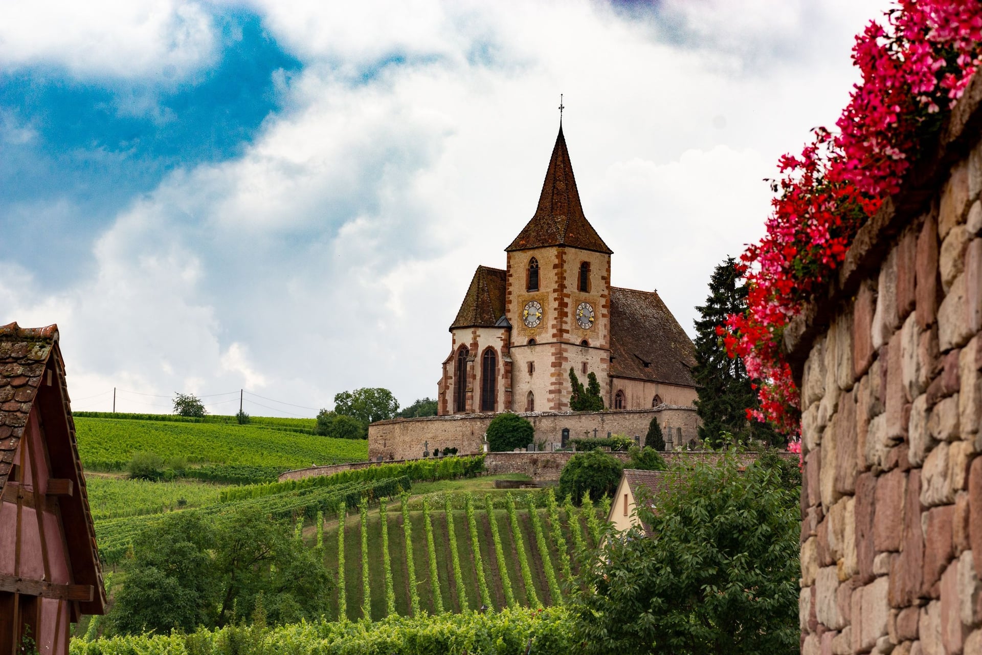
Along the foot of the Vosges, the Alsace Wine Route runs 170 km from Marlenheim to Thann, past 51 Grand Cru vineyards. Walking it means vineyard tracks between half-timbered wine villages. Riquewihr, Hunawihr and Eguisheim carry the Plus Beaux Villages de France label.
The Club Vosgien, founded in 1872, marks more than 20,000 km of paths in the region. Near Riquewihr, the Géovino trail loops for 35.77 km past 11 villages and 13 Grand Cru hillsides, and it stays open during the harvest if you keep to the marked paths.
Full guide: Walking the Alsace Wine Route
How Hard Is Walking in France?
Walking in France is mostly moderate: marked paths, days of 10 to 20 km and a bed at the end of each one.
Terrain and Daily Distances
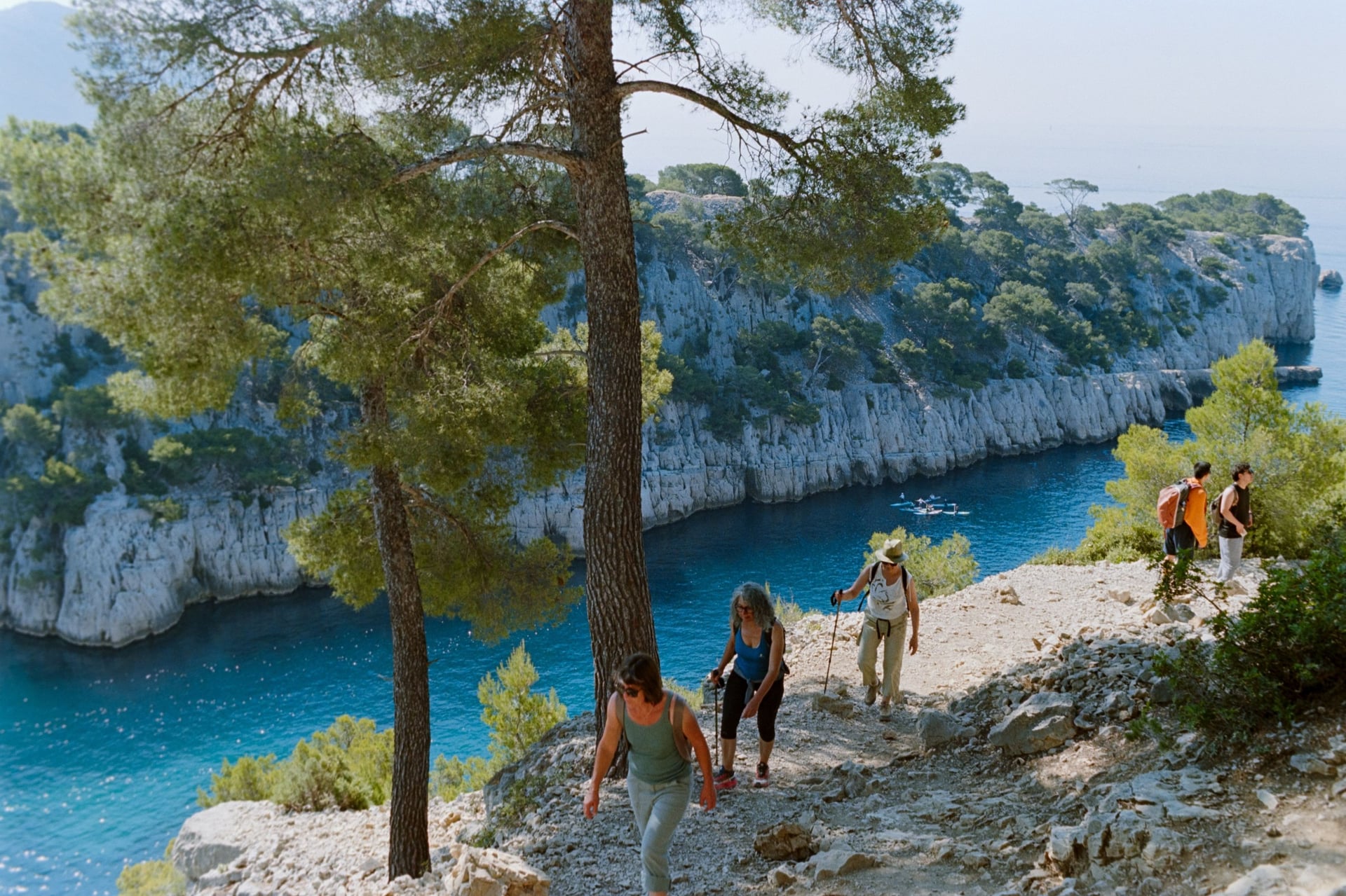
A typical day on these walks covers 10 to 20 km with 100 to 600 m of elevation gain, about four to six hours of walking. Coast paths such as the GR34 rise and fall in short steps between coves. Limestone paths in the south, as in the Calanques near Cassis, are loose and stony underfoot.
Of the multi-day walks, the Côte Vermeille has the steepest days: the 11 km from Banyuls to Portbou climb 530 m. Lac Blanc is the only walk on the list above 2,000 m, and the La Flégère lift does most of the climb from the valley. Trail shoes or light boots are enough for every walk here.
France's big mountain treks, such as the GR20 across Corsica and the Tour du Mont Blanc, are a different kind of trip, with huts and long days above 2,000 m. Our sister site covers them in its guide to hiking in France.
Waymarks and Maps
French paths are painted to one national code, so you can follow them without reading French. The Fédération Française de Randonnée (FFRandonnée) counts about 254,000 km of marked routes in 2026. Nearly 10,000 volunteers repaint them.
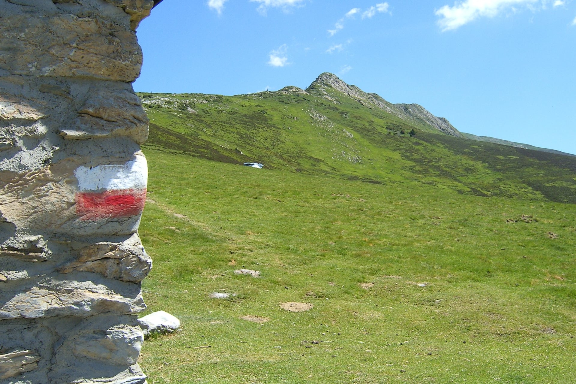
The FFRandonnée waymarking code is the same from the Pyrenees to Brittany:
GR (Grande Randonnée): white over red, on long-distance paths such as the GR34 and GR70
GR de Pays: yellow over red, on regional loops of several days
PR (local walks): a single yellow bar
Turn: the same colours with an arrow pointing the new way
Wrong way: a cross in the same colours
IGN's 1:25,000 maps, sold as TOP Rando 25 sheets, show every path. The free Cartes IGN app shows the same map on a phone, but it cannot store the 1:25,000 map offline. Download a GPX file of your walk before you set off; the old IGNrando' app was replaced by WeTrek on 20 November 2025.
Is It Safe to Walk in France?
France is a safe country to walk in, and the main risks come from fire, tides, heat and mountain weather.
Each risk has a simple rule:
Summer fire closures: in the south, each prefecture publishes a map at 18:00 for the next day showing which forest massifs are open, from 1 June in the Bouches-du-Rhône and mid-June in the Vaucluse, the Pyrénées-Orientales and Corsica
Tides: in the Mont-Saint-Michel bay the sea comes in over 15 km of sand, so cross only with a certified guide
Cliff edges: at Étretat, stay at least 5 m from the edge; the town order carries fines
Heat: Avignon averages 32 °C in July, so start early and carry 2 litres of water
Mountain storms: above Chamonix, come down from ridges and high points when a storm builds
Hunting: from September to the end of February, mostly at weekends; stay on the path and watch for "chasse en cours" signs
Ticks: active from March to November; check your legs after walking through long grass
Emergencies: call 112 from any phone
Best Time to Walk in France
Spring and autumn suit most of France, and what changes through the year is the heat in the south, the crowds on the coast and the snow in the Alps.
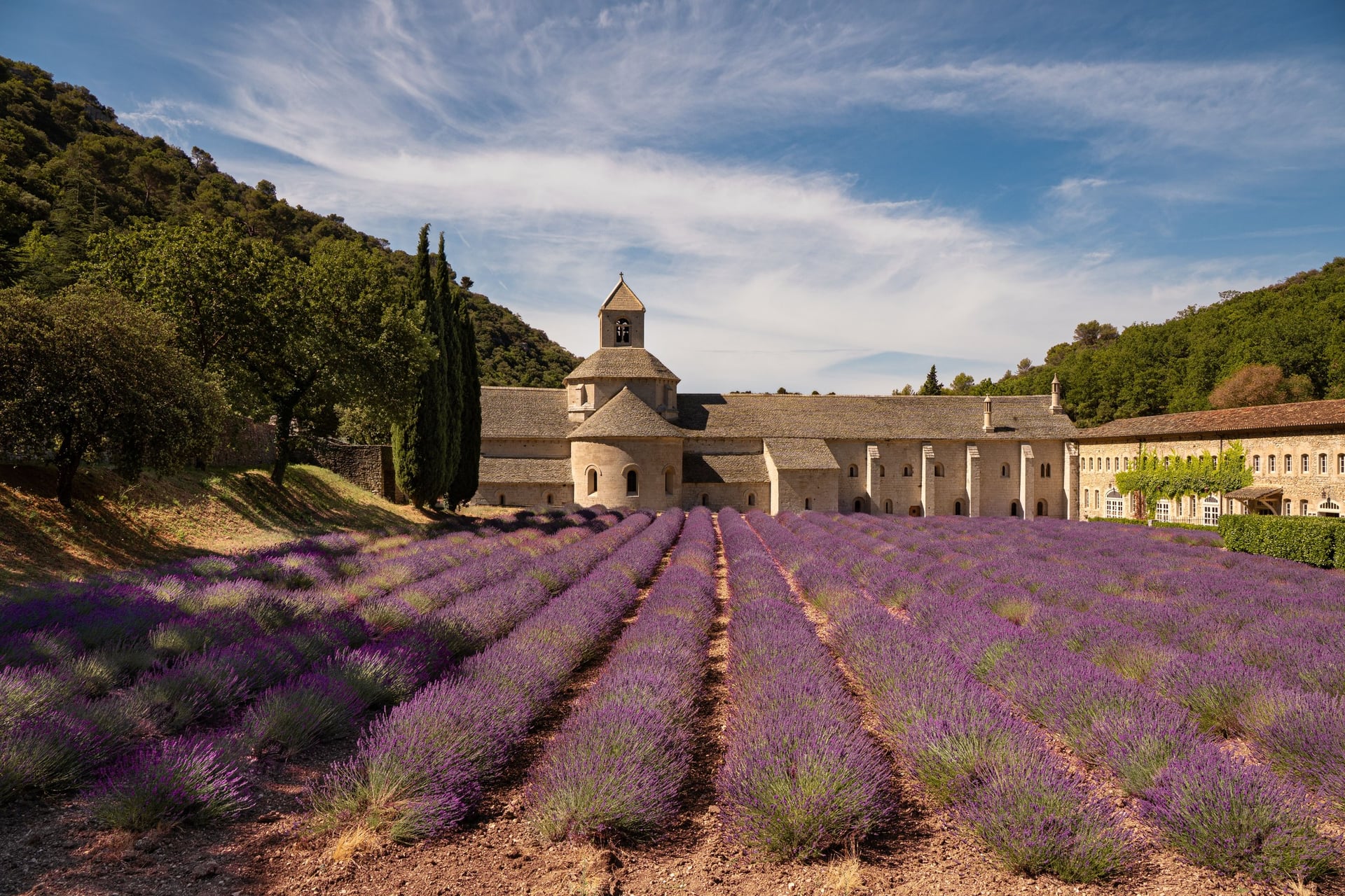
April to June and September to October suit every walk on the list except Lac Blanc. In July and August the south is too hot for long days on foot, with average highs of 32 °C in Avignon and 28 °C in Nice. Early summer is when the lavender around Sénanque Abbey, near Gordes, is in flower.
Average daily high (°C), Météo-France normals for 1991 to 2020:
Month | Brittany (Dinard) | Loire (Tours) | Provence (Avignon) | Riviera (Nice) | Alps (Chamonix) |
April | 15 | 16 | 20 | 17 | 14 |
May | 17 | 20 | 24 | 21 | 18 |
June | 20 | 23 | 29 | 25 | 22 |
July | 22 | 26 | 32 | 28 | 24 |
August | 22 | 26 | 31 | 28 | 24 |
September | 20 | 22 | 26 | 25 | 20 |
October | 17 | 17 | 21 | 21 | 15 |
In summer, Chamonix and the Brittany coast are the places to walk: the Chamonix lifts are running, and Dinard stays near 22 °C. The fire rules in the south end on 15 September in the Vaucluse and 30 September in the Bouches-du-Rhône.
In winter the Riviera is the place to walk, with average highs of 13 °C in January in both Nice and Menton. Snow can cover the high ground of the Alps, the Aubrac and Mont Lozère from late autumn to spring.
Know Before You Arrive
Most of the planning for a walking trip in France comes down to trains, beds and the distance between villages.
Getting There and Around by Train
Eurostar takes 2 h 16 from London to Paris, and TGVs fan out from there to every region: Saint-Malo in 2 h 29, Colmar in 2 h 20 and Avignon TGV in 2 h 33. From the USA you can board at Aéroport Charles de Gaulle 2 TGV, the airport's own station, with trains to more than 50 cities.
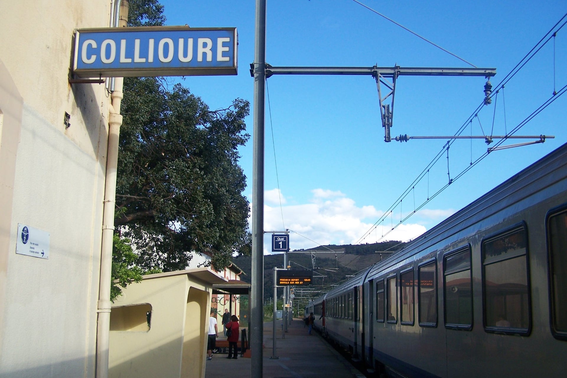
Regional TER trains and buses cover the last stretch, and you do not need a car for any walk on the list. The TER from Perpignan reaches Collioure in about 20 minutes, and from Lyon, Le Puy-en-Velay takes about 2 h 15 with one change. Book trains on SNCF Connect.
Regional buses have their own networks: Zou! in Provence and on the Riviera, BreizhGo in Brittany, Fluo in Alsace and liO in Occitanie. Each region guide linked from the list gives the local lines.
Where to Sleep
Most nights on these walks are spent in the villages themselves, in small hotels, chambres d'hôtes or walkers' hostels called gîtes d'étape.
Family-run village hotels give you a private room with breakfast, and many serve dinner. A chambre d'hôtes, the French bed and breakfast, may have at most five rooms and 15 guests by law, so book small villages well ahead, as a village can run out of rooms on a busy weekend.
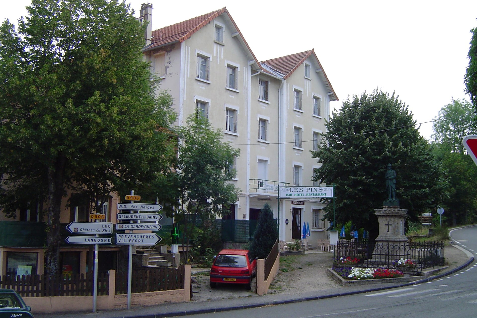
On the GR65 and the GR70, walkers also sleep in gîtes d'étape, hostels built for walkers. They take 12 to 50 people in dormitories or small rooms, and most open from April to mid-October. Many serve dinner and breakfast as half board.
Bedding varies from one gîte to the next, so bring a sheet sleeping bag. Even small villages on the trails, such as La Bastide-Puylaurent on the Stevenson Trail, usually have a hotel too.
Regional Food on the Way
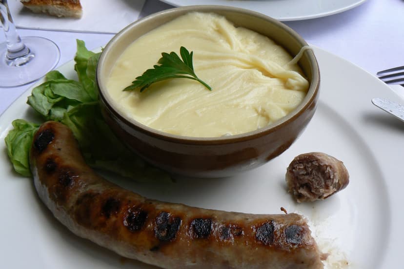
Each region on the list has a dish worth planning a day around, and these four come from the walks above.
How Much Does It Cost?
The paths are free, so a walking trip costs what its beds, meals and trains cost. These are prices from 2026:
Gîte d'étape: €13 to €33 for a bed, €33 to €62 with dinner and breakfast
Chambre d'hôtes: about €70 to €110 a night for two, with breakfast
Tourist tax: €0.20 to €0.80 per person per night in a gîte or chambre d'hôtes, €0.50 to €1.70 in a 3-star hotel before local surcharges (€1.76 in Sarlat)
Trains: Eurostar from £39 one way; OUIGO from Paris to Avignon from €16
Luggage transfer: €8 to €10 a bag per stage on the GR65 and GR70
Donkey hire on the GR70: about €495 for seven days in 2026
Sights on the walks: Mont-Saint-Michel abbey €16 from April to September, the Sentier des Ocres €3.50, the La Flégère lift €25 return
Maps: €14.30 for an IGN 1:25,000 sheet
What to Pack
Southern France and Corsica are hot and dry from June to September, while wind and rain can reach the Brittany coast and the Alps in any season.
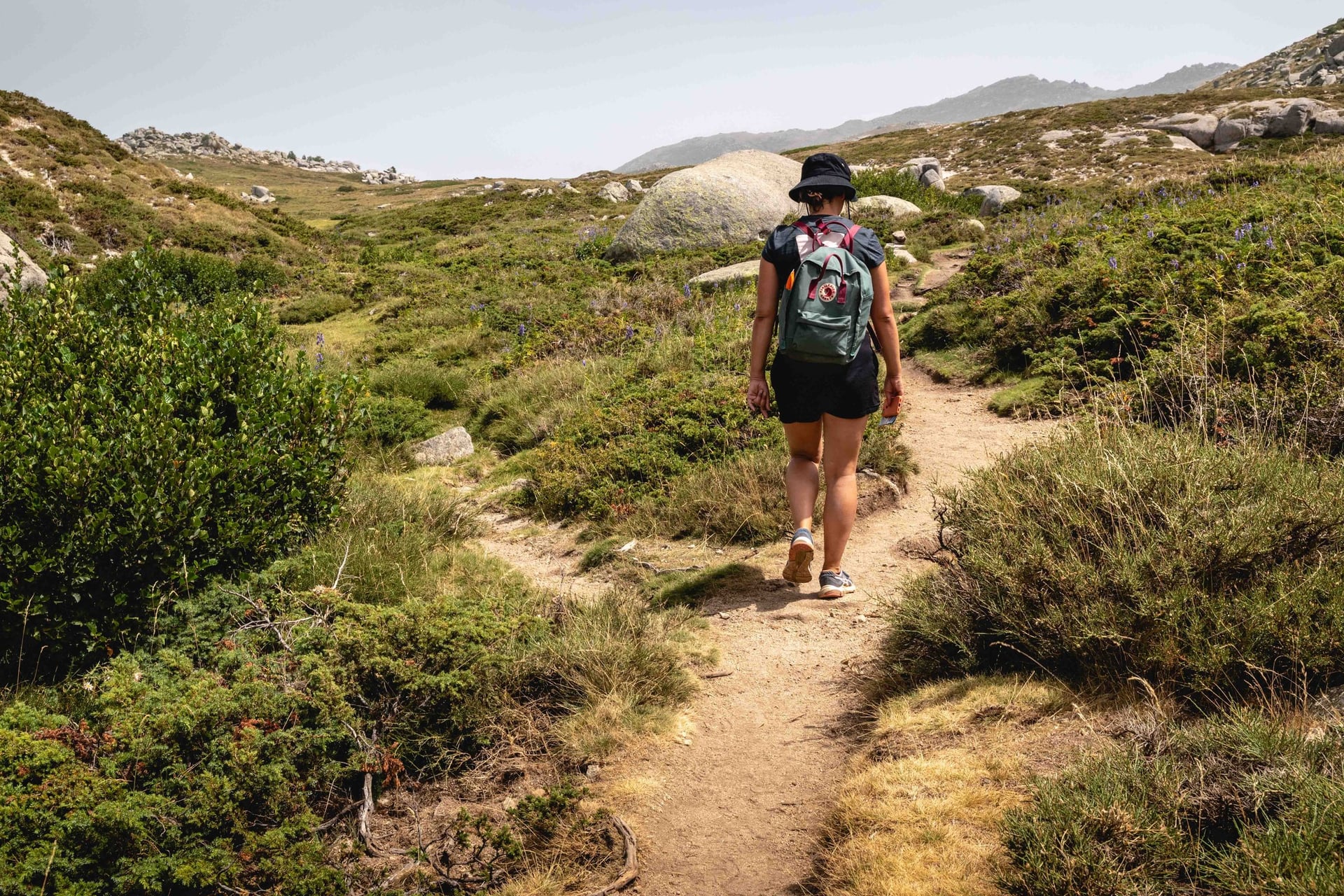
Start with a normal day-walk kit, then add what your region and season need.
For any walk in France:
Trail shoes or light boots that you have already worn in
A 25 to 35 litre day pack with a rain cover
Waterproof jacket and a warm layer
Sun hat, sunglasses and sun cream
Water bottles for at least 1.5 litres
Phone with offline maps and a power bank
Blister plasters and a small first-aid kit
For particular walks:
Chamonix: a windproof jacket and gloves, as Lac Blanc lies at 2,352 m
Provence, the Côte Vermeille and Cap Corse in summer: 2 litres of water each and an early start
The Brittany and Normandy coasts: a windproof layer and a tide table
Gîtes on the GR65 and GR70: a sheet sleeping bag, earplugs and a head torch
September to February: bright clothing in the hunting season
Which Region for Your First Walking Week?
The best first week in France depends on the month you can travel and how much climbing you want.
Spring or autumn: Provence, the Dordogne or the Loire, with 10 to 20 km days between villages
September: Alsace, when the harvest begins in the vineyards
July and August: Chamonix or the Brittany coast, away from the southern heat
February, March or November: the Riviera, where the coast paths stay walkable outside summer
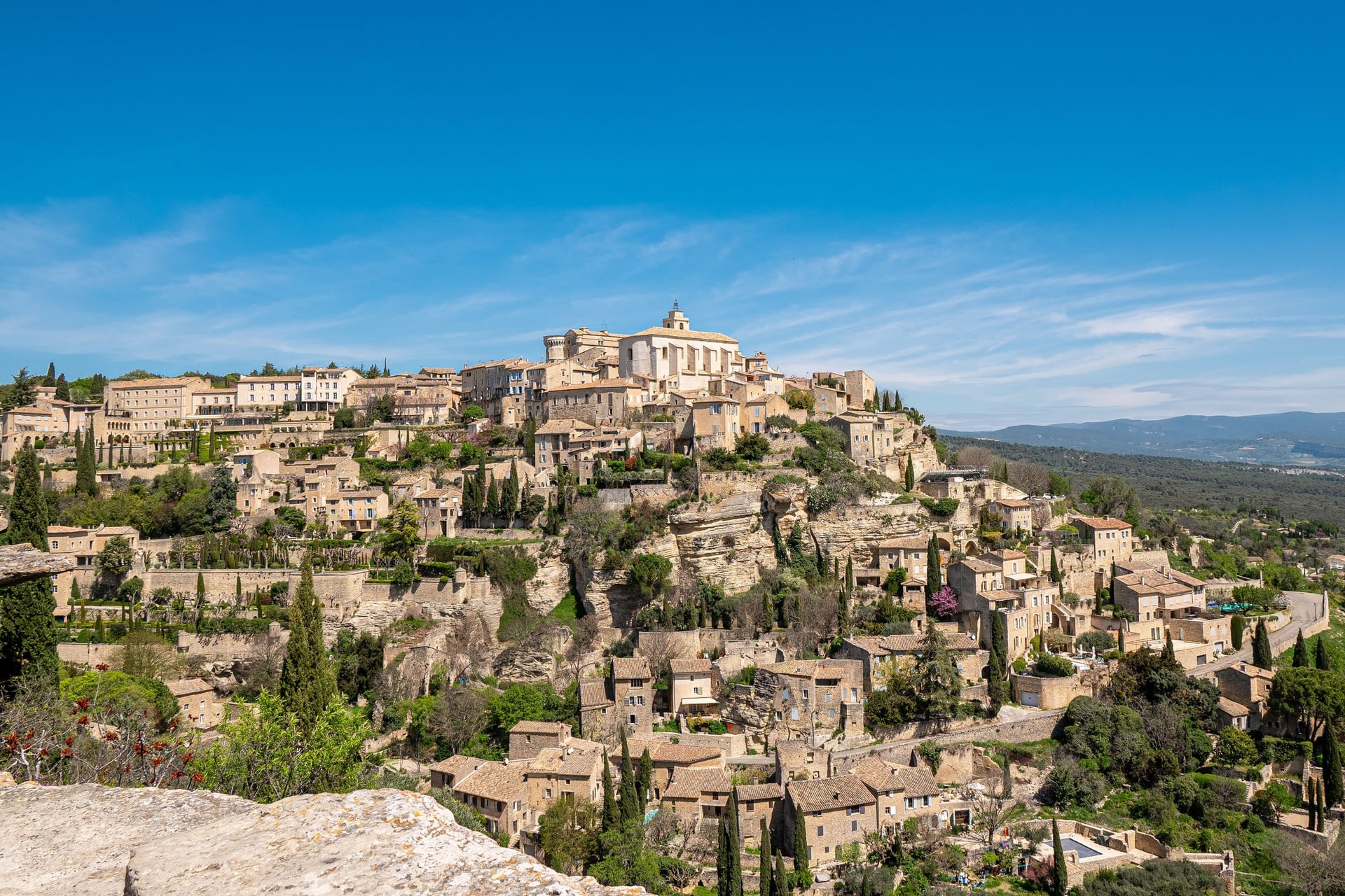
A week on foot means a different bed most nights and bags to move between villages, and a small village may have only a handful of rooms. Our self-guided walking holidays book every night and move your luggage while you walk with a day pack, and three of them match the seasons above.
Provence: Walking Holidays in Provence, 8 days / 7 nights from Apt to Fontaine-de-Vaucluse, 6 walking days of 8 to 16 km and 2,010 m of elevation gain in all, April to October
Alsace: Alsace Walking Holidays, 8 days / 7 nights from Thannenkirch to Eguisheim, 6 walking days of 8 to 19 km and 2,375 m in all, April to October
Riviera: French Riviera Hiking Holidays, 7 days / 6 nights from Menton to Nice, 4 walking days of 7 to 14.5 km and 630 m in all, February to November
Each tour includes 3-star hotels with breakfast, luggage transfers, a digital guidebook, a GPS navigation app and support while you walk; the tourist tax is not included. Ask us about dates for next season. The full list of our walking holidays in France has more regions.
In the Luberon, the last path of that week drops from Gordes to Fontaine-de-Vaucluse, where the river Sorgue rises from a spring at the foot of the cliffs.
Frequently Asked Questions



Plan with a hiking expert
Free advice from a team that knows these routes inside out - real people, not a bot

HASSLE-FREE
We handle itineraries, accommodations, and anything else you prefer not to deal with, so you can enjoy a carefree hike.

TRUSTED BY MANY
We are a financially protected company, fully bonded and insured, keeping your money safe and allowing you to travel with confidence.

TRIED & TESTED ADVENTURES
Only the best walking tours in France, cherry-picked by our team with an in-depth knowledge of the region.

UNBEATABLE SUPPORT
Our 24/7 customer support is where we show our passion, bringing you a better experience by making your well-being our number one priority.