Walking in the Dordogne: 8 Best Walks, From Sarlat to Rocamadour
Eight walks in both Dordognes, the Périgord Noir around Sarlat and the Lot valley around Rocamadour, with distances, climbs and car-free access.
Quick links
Don't want to read all this?
We've planned 2,000+ hiking trips. Send your dates, fitness and group size — we'll map the route and book every night.



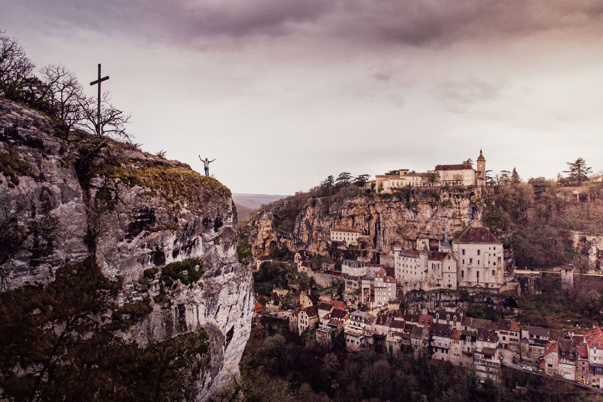
Walking in the Dordogne means following a green river through limestone country, from one cliff village to the next. Castles face each other across the water at Beynac and Castelnaud, and Rocamadour stacks its chapels up a cliff above the Alzou canyon. Canoes drift past below the paths all summer.
The name covers two walking areas: the Périgord Noir around Sarlat and, upstream, the valley in the Lot around Rocamadour. Most walks here are loops of 6 to 13 km that climb 150 to 280 m from the river to a village or a viewpoint.
May, June and September suit every walk, and trains reach both areas. The Dordogne is one of the regions in our guide to walking in France.
The 8 Best Walks in the Dordogne
The eight walks below are marked loops and paths from 5.7 to 27 km long. Five are in the Périgord Noir and three in the Lot.
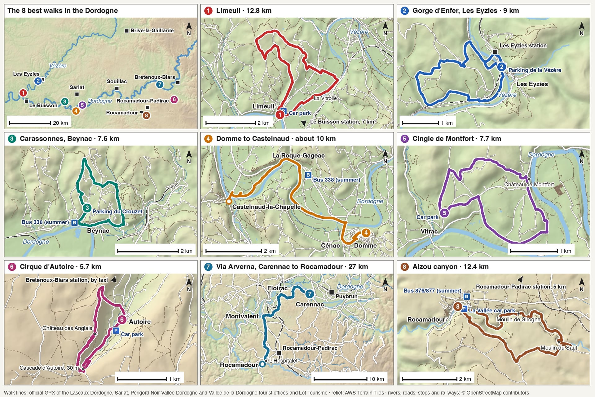
Every figure comes from the tourist office or park that publishes the walk, except two climbs measured on the official GPS tracks.
Walk | Distance | Elevation gain | Time | Start |
Limeuil | 12.8 km loop | 149 m | 3 h 50 | Limeuil, Place du Port |
Gorge d'Enfer, Les Eyzies | 9 km loop | 200 m | 3 h 20 | Les Eyzies, Vézère car park |
Carassonnes, Beynac | 7.6 km loop | About 220 m | 2 h 10 | Beynac, Parking du Crouzet |
Domme to Castelnaud | About 10 km one way | 92 m | 3 h 30 | Domme |
Cingle de Montfort | 7.7 km loop | 240 m | 2 h 15 | Vitrac, town hall |
Cirque d'Autoire | 5.7 km loop | About 260 m | 2 h 30 | Autoire |
Via Arverna, Carennac to Rocamadour | 27 km one way | 626 m | 5 h 30 | Carennac |
Alzou canyon | 12.4 km loop | 280 m | 4 h | La Fajadou car park, Rocamadour |
Choose by the day you have in mind:
A short morning: the Cirque d'Autoire, 5.7 km in about 2 hours 30, or the Cingle de Montfort, 7.7 km in about 2 hours 15
A full day: the Via Arverna stage, 27 km and 626 m of climbing from Carennac to Rocamadour
No car at all: Les Eyzies from its own station all year, or walks 3 to 5 by bus 338 in July and August
With children: Les Gabarres at La Roque-Gageac, 3.2 km in about 1 hour and graded very easy
A rest day: Sarlat's greenway, 23.4 km of tarmac on the old railway to Cazoulès, where you can walk any section and turn back
Walks 1 to 5 are in the Périgord Noir, the south-east corner of the Dordogne département, numbered west to east.
1. Limeuil, Where the Vézère Meets the Dordogne
Route: the Grande boucle de Limeuil (no. 38), from the Place du Port up through the village and the woods above it, back along the Vézère
Distance: 12.8 km loop, about 3 hours 50
Elevation gain: 149 m
Highest point: about 205 m
Terrain: village lanes, woodland paths and farm tracks, then 2 km of riverbank; graded medium
Getting there: Le Buisson station, on the Bordeaux to Sarlat and Périgueux to Agen lines, about 7 km away on foot
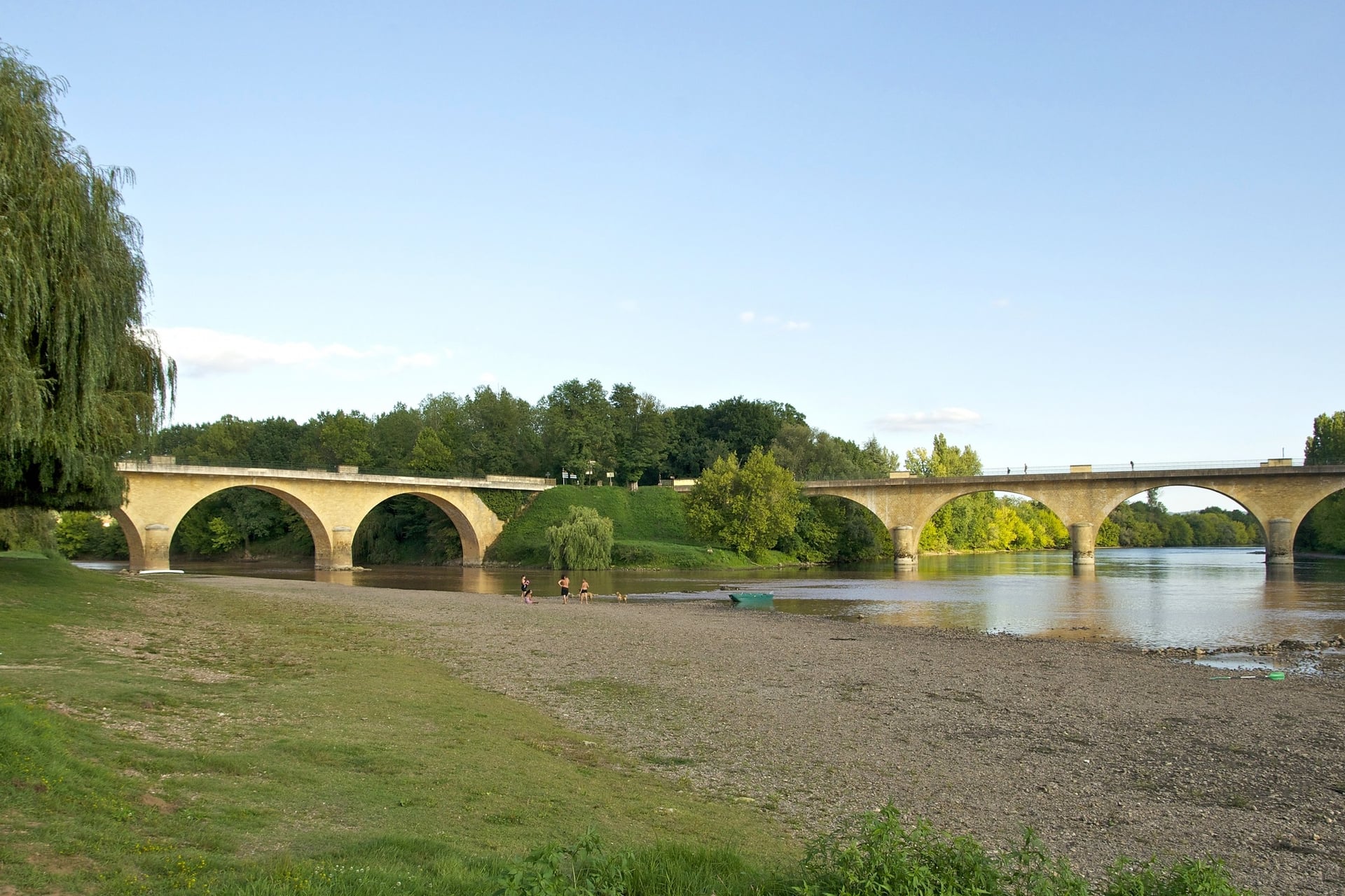
Limeuil stands on a hill where the Vézère flows into the Dordogne, and it has carried the Plus Beaux Villages label since 1990. Its lanes climb from the old river port through a medieval gate to the church of Sainte-Catherine.
The tourist office's long loop leaves by the Porte du Marquisat on yellow and red-and-white waymarks, then crosses wooded side valleys and passes the apple orchards of La Vitrolle. The last 2 km follow the Vézère back to the port on the flat. The shorter Lac Rouge loop covers 5 km with 132 m of climbing in about 1 hour 30.
2. Les Eyzies and the Gorge d'Enfer Loop
Route: the Boucle de Gorge d'Enfer (no. 12), from the Vézère car park over the river, up a side valley and back through the hamlet of Le Peuch
Distance: 9 km loop, about 3 hours 20
Elevation gain: 200 m
Highest point: about 165 m
Terrain: short road sections, woodland paths and farm tracks on yellow waymarks; graded medium
Getting there: Les Eyzies station, 29 to 35 minutes from Périgueux on TER line 34
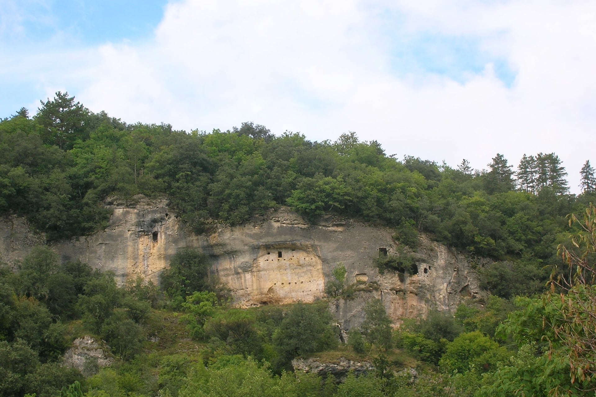
Les Eyzies lies under overhanging cliffs in the Vézère valley, which holds 147 prehistoric sites and 25 decorated caves. Fifteen of those sites have been on UNESCO's World Heritage list since 1979. The Musée national de Préhistoire is built into the cliff above the village and opens daily in July and August.
The loop crosses the Vézère footbridge and climbs the side valley opposite the great Gorge d'Enfer rock shelter, on a stretch of the GR 6. It passes old kaolin quarries and the cave houses of Le Peuch. Book Font-de-Gaume online before you arrive, as places are limited each day, visits inside last 30 minutes and the cave closes on Saturdays.
3. Beynac and the Carassonnes Loop
Route: the Boucle des Carassonnes (PR 12), from the Parking du Crouzet into the farmland behind Beynac and back through the village
Distance: 7.6 km loop, about 2 hours 10
Elevation gain: about 220 m, measured on the official GPS track
Highest point: about 220 m
Terrain: country paths and tracks, then the steep cobbled lanes of the village; graded medium
Getting there: summer bus 338 from Sarlat station, daily from 4 July to 31 August 2026
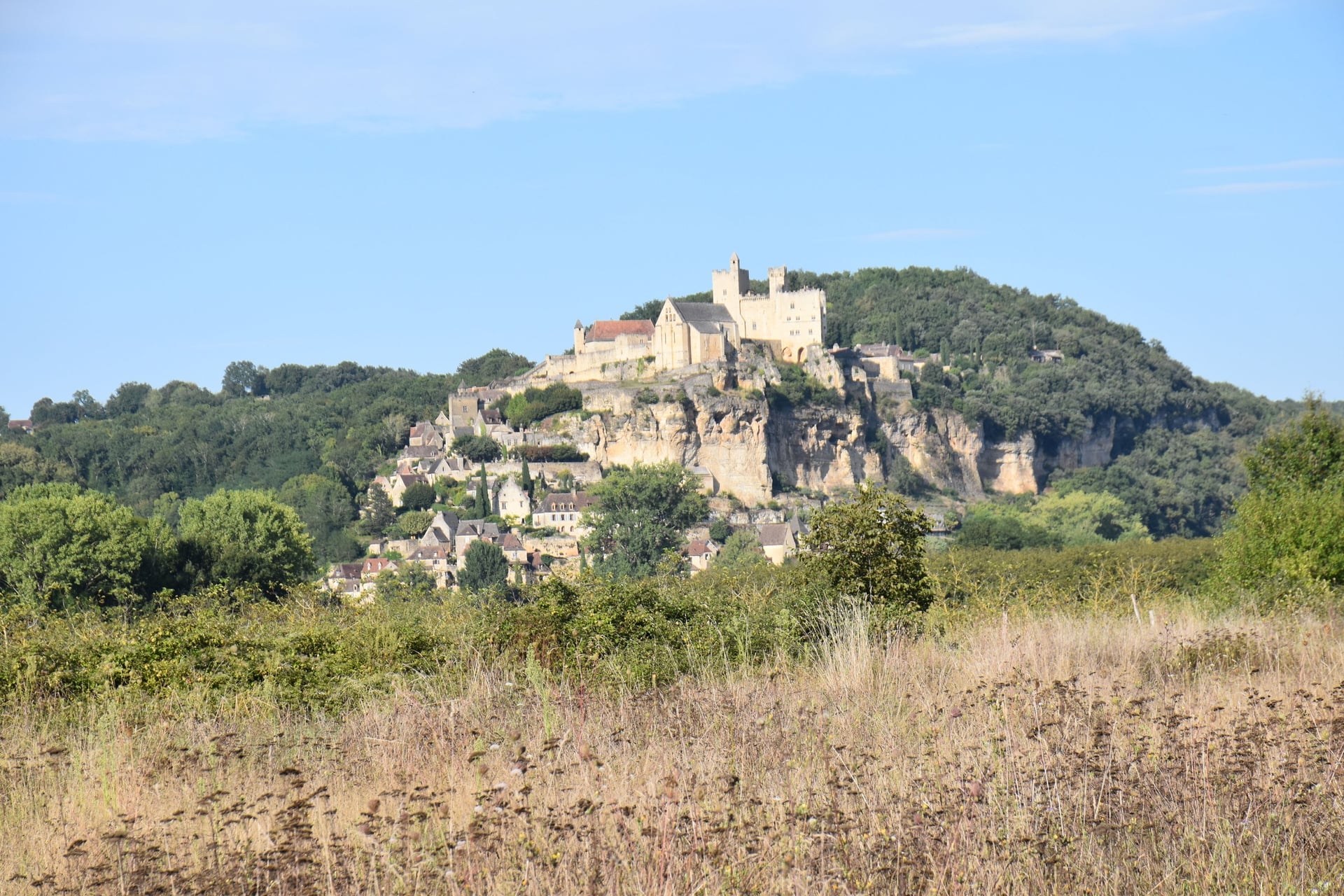
Beynac's castle stands on a cliff above the Dordogne, with the village stepping down from its walls to the water. Across the river, Castelnaud's lords sided with the English from 1337, and the French king only took their castle for good in 1442. Beynac itself was taken and retaken by both armies.
The Carassonnes loop heads out into the country behind the village, then ends with a stroll down Beynac's cobbled lanes. The castle is 15 minutes' climb from the village. For a second day, the Vitraux loop via Cazenac has one of the widest views over the Dordogne and Céou valleys, with 303 m of climbing in 7.2 km.
4. Domme to Castelnaud via La Roque-Gageac
Route: De Domme à Castelnaud en écomobilité, down from Domme to the river at Cénac, then along the north bank through La Roque-Gageac to the Castelnaud bridge
Distance: about 10 km one way, about 3 hours 30
Elevation gain: 92 m, with 215 m of descent
Highest point: about 210 m, in Domme
Terrain: steep lanes down from Domme, then riverside paths and quiet roads
Getting there: summer bus 338 to Domme, and back to Sarlat from Castelnaud, daily from 4 July to 31 August 2026
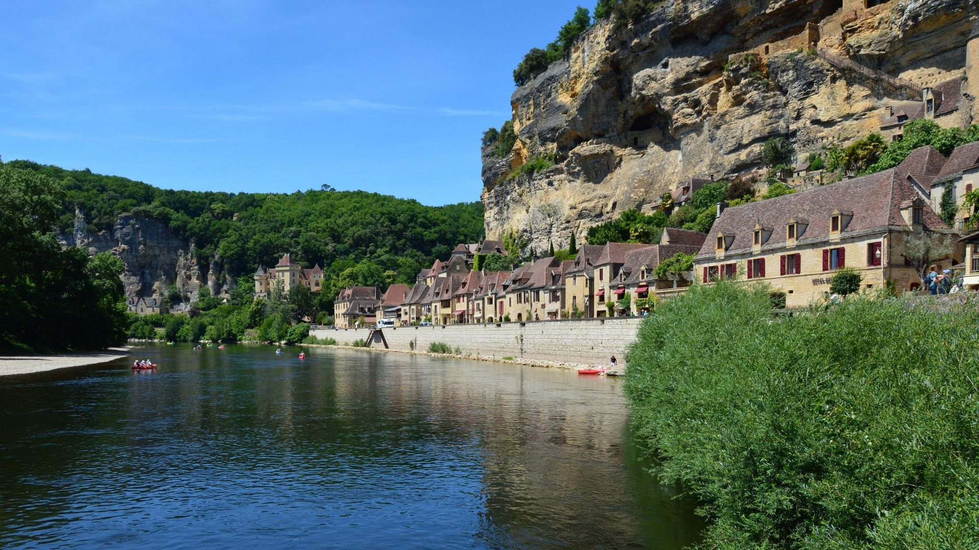
Domme was founded as a bastide, a planned medieval town, by Philip III in 1281, on a cliff that drops 150 m to the river. Three of its gates survive, and the Sarlat tourist office says the towers of the Porte des Tours held 70 Templars from 1307 to 1318.
The tourist office's route drops 2 km to the river at Cénac, crosses the bridge and follows the bank under the cliffs to La Roque-Gageac, about 5 km from Domme. There, a fort sits 40 m up the cliff, reached by a stair on the rock face. Above the path, the Jardins de Marqueyssac add more than 6 km of box-lined walks, and all four villages on the route carry the Plus Beaux Villages label.
5. The Cingle de Montfort From Vitrac
Route: the Boucle de Montfort, from Vitrac's town hall to the hamlet and castle of Montfort and back
Distance: 7.7 km loop, about 2 hours 15
Elevation gain: 240 m
Highest point: 192 m
Terrain: lanes and woodland paths; the tourist office grades it easy
Getting there: summer bus 338 to Vitrac, 7 km south of Sarlat, daily from 4 July to 31 August 2026
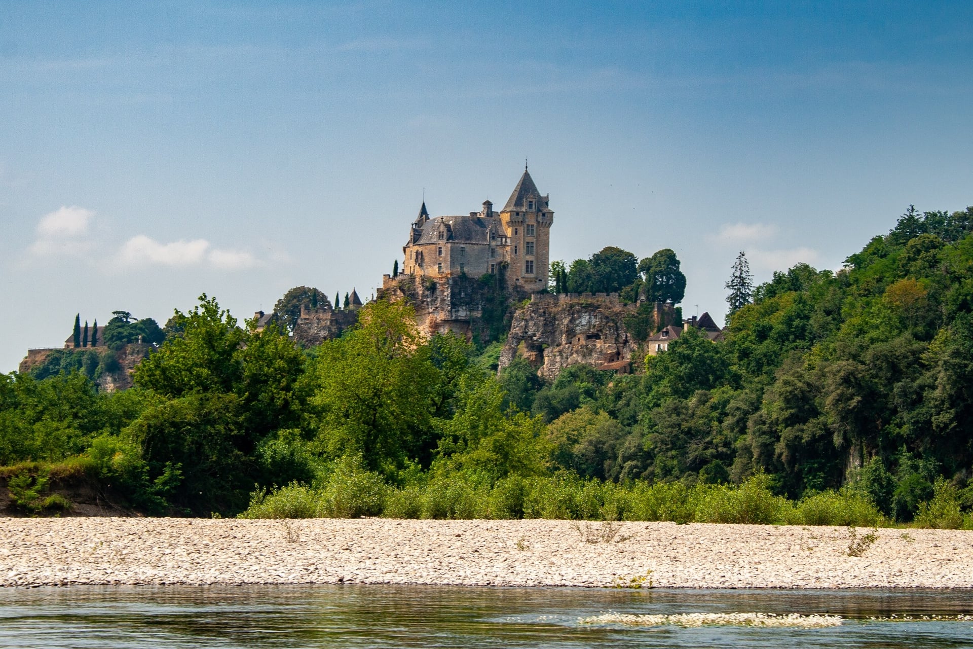
A cingle is a tight meander, and at Montfort the Dordogne loops round a rocky spur crowned by a castle. The castle is private and closed to the public, but the loop passes through the medieval hamlet below its walls.
The Montfort loop starts by the church and town hall of Vitrac on their plateau. It drops through woods to Montfort and the river, about 120 m below, and climbs back the same height to finish. An optional detour leads down to the river at Le Port, where a stone bridge crosses to Vitrac's beach.
Walks 6 to 8 are upstream in the Lot, in the stretch the local tourist office sells as the Vallée de la Dordogne.
6. The Cirque d'Autoire and Its Waterfall
Route: the Circuit de la reculée d'Autoire, from the village to the foot of the waterfall, up past the Fontaine de Siran to the cliff top and back by the Château des Anglais
Distance: 5.7 km loop, about 2 hours 30
Elevation gain: about 260 m, measured on the official GPS track
Highest point: about 380 m
Terrain: steep, rocky paths below and along cliffs 150 to 200 m high; graded medium
Getting there: no bus; a taxi from Bretenoux-Biars station, 1 hour 8 minutes from Brive by TER
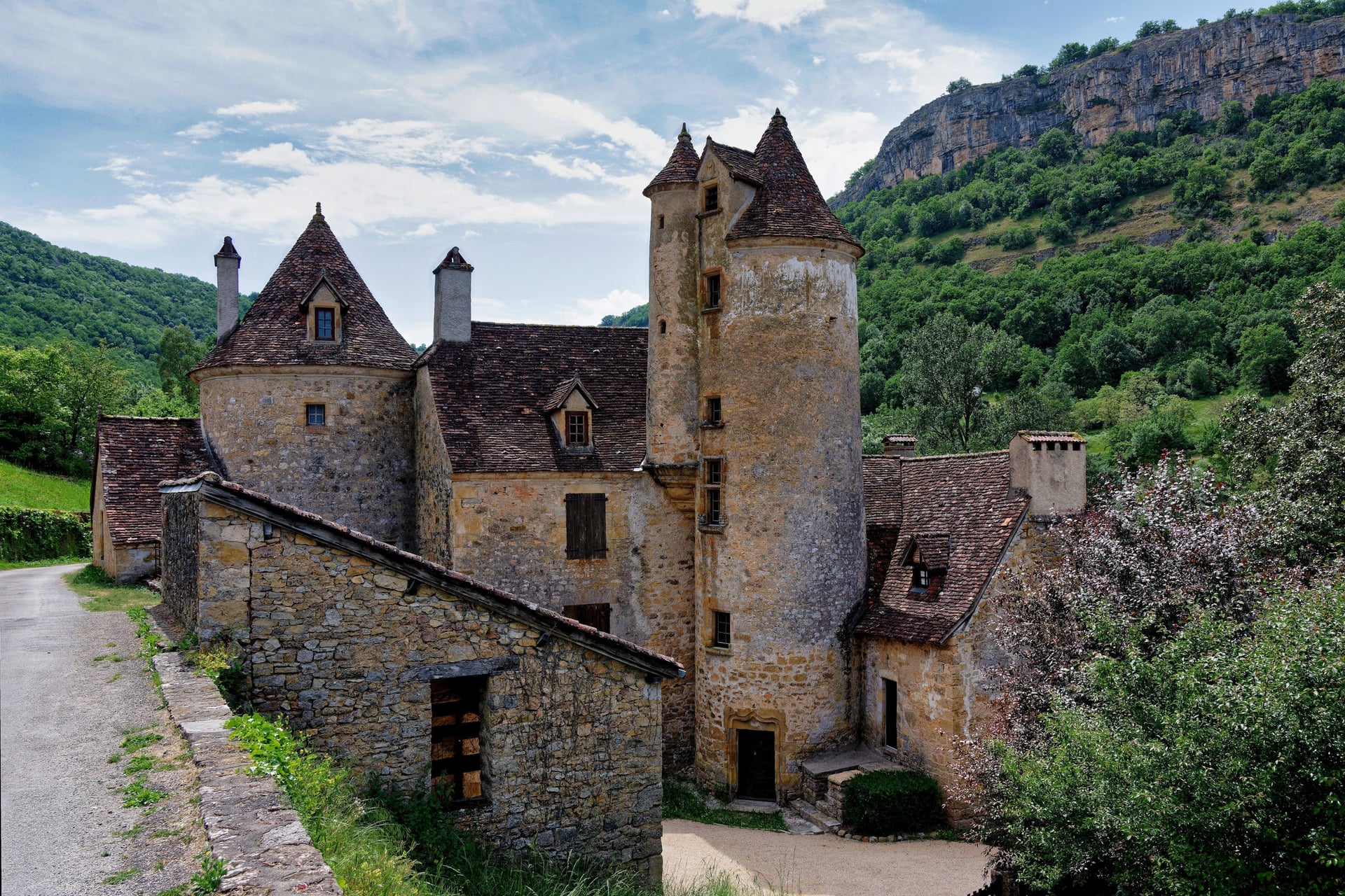
Autoire is a Plus Beau Village at the mouth of a cirque, a dead-end valley closed by limestone cliffs. Its waterfall drops 30 m, the highest in the Lot, and lies 1.2 km from the car park at the edge of the village.
The Autoire loop climbs past a spring 150 m above the stream that never runs dry. It then reaches the Château des Anglais, a fortress built against the foot of a cliff 40 to 50 m high. Avoid the path during a thaw, storms or strong wind, when the Lot warns of rockfall, and do not swim in the cirque, where it is banned.
7. The Via Arverna From Carennac to Rocamadour
Route: stage 17 of the Via Arverna, the GR 652 pilgrim path, from Carennac through Floirac and Montvalent to L'Hospitalet and Rocamadour
Distance: 27 km one way; the tourist office allows 5 hours 30 of walking
Elevation gain: 626 m
Highest point: about 310 m
Terrain: woodland paths, tracks over the causse and quiet lanes, marked with a yellow shell on a blue plaque
Getting there: Puybrun station, on the Brive to Aurillac line, is about 4 km from Carennac; Rocamadour-Padirac station is 5 km from the finish
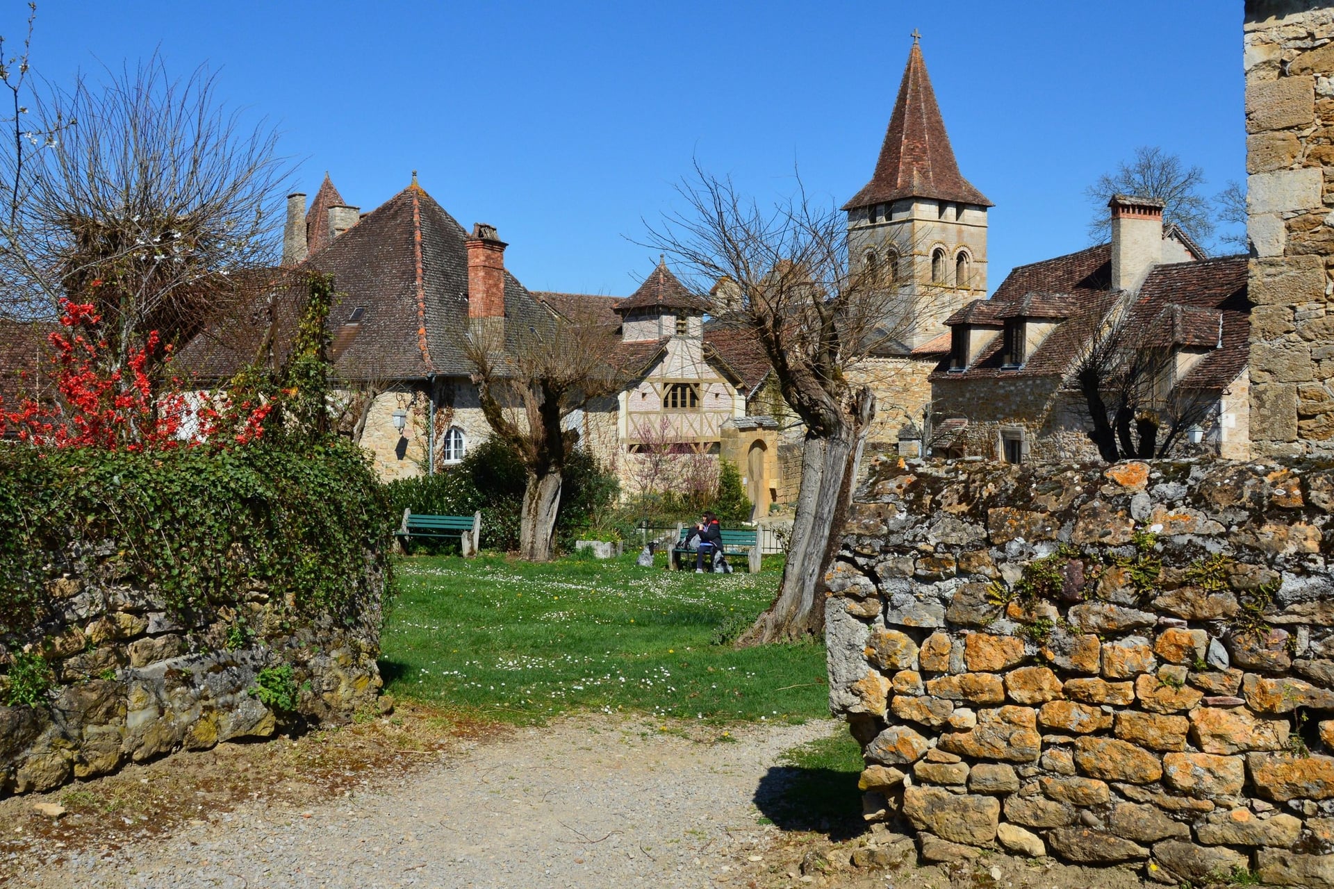
The Via Arverna is a pilgrim route to Santiago that runs about 500 km from Clermont-Ferrand to Cahors. Stage 17 leaves Carennac, a Plus Beau Village that grew up around an 11th-century Cluniac priory, where the writer and archbishop Fénelon lived. The stage before it, from Bretenoux, is 31 km with 666 m of climbing, and the tourist office suggests splitting it at Loubressac.
The Via Arverna stage follows the valley through the cirques of Floirac and Montvalent, mostly in woodland for the first 10 km to Floirac. Above Montvalent, about 16 km in, it opens onto a wide view of the Dordogne. At 27 km it takes a full day on foot, and the stage has no gîte d'étape, so book your bed in Rocamadour ahead.
8. The Alzou Canyon Below Rocamadour
Route: Le canyon de l'Alzou (no. 29), from the La Fajadou car park on the valley floor, up the canyon past four mills and back into Rocamadour
Distance: 12.4 km loop, about 4 hours
Elevation gain: 280 m
Highest point: 328 m
Terrain: valley paths with fords, a steep stretch of about 650 m early on and the GR into Rocamadour, on yellow waymarks
Getting there: Rocamadour-Padirac station is 5 km away, and liO buses 876 and 877 stop in Rocamadour in July and August
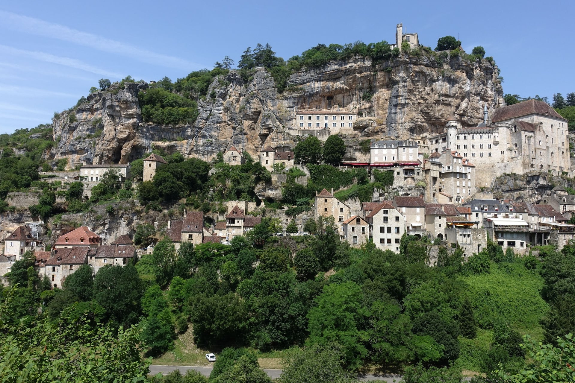
Rocamadour clings to the side of the Alzou canyon, 120 m above the valley floor. A basilica and seven chapels stand above the village, and the château 80 m higher again; the inclined lift between them takes 1 minute. Pilgrims have climbed its 216 steps since the 12th century, to a Black Virgin carved in walnut.
The park's loop follows the Alzou upstream past the mills of La Mouline, Sirogne, Le Saut and Tournefeuille. The path fords the stream, so the valley is impassable when water flows under the first bridge. The last 1.3 km climbs back into Rocamadour on the GR.
How Hard Is Walking in the Dordogne?
Walking in the Dordogne is easy to moderate, with short, steep climbs out of the valleys rather than long ascents.
Climbs and Ground
Most loops here climb 150 to 280 m, usually in one or two pulls from the river to a village or a cliff top. Domme, Beynac and Rocamadour all stand on cliffs above their rivers, so the steepest ground comes at the start or the end of a walk.
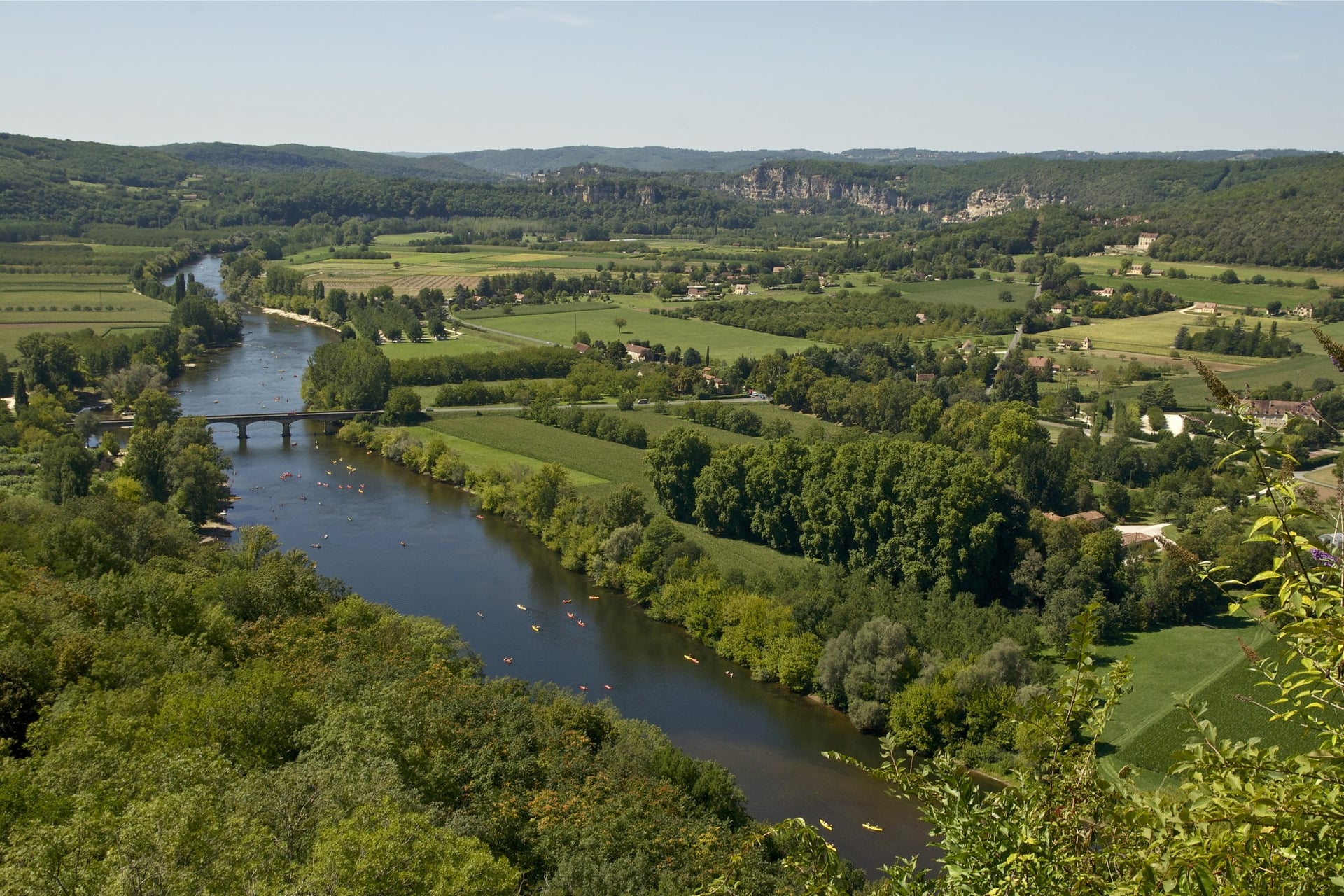
The rock is limestone, and worn paths turn slippery after rain, especially on the steep ground at Autoire and the climb out of the Alzou valley. The Via Arverna stage is long rather than steep, with its climbing spread over a full day.
Heat and Shade
Summer heat matters more than the hills. Gourdon, the Météo-France station between the two areas, averages 28 °C in July and August, with about 10 days a month above 30 °C.
The causse, the dry limestone plateau above the valleys, has little shade, so start early and carry 1.5 litres of water each. The caves stay cool all year: the Gouffre de Padirac is a constant 13 °C.
Waymarks and Maps
Local loops follow the French code: a yellow bar for a PR walk and white over red for a GR such as the GR 6, which passes Les Eyzies and Rocamadour. The Via Arverna adds its own yellow shell on a blue plaque.
The tourist offices publish a GPS track for every walk on the list, so download it before you set off. On paper, IGN's 1:25,000 sheets are 1936 ET for Les Eyzies and Beynac, 2036 ET for Sarlat and Domme, and 2136 ET for Rocamadour.
Best Time to Walk in the Dordogne
Spring and early autumn are the walking seasons in the Dordogne, when the days are warm but rarely hot and the paths are quiet.
Average highs and rainy days come from Météo-France's Gourdon station, 1991 to 2020:
Months | Average high | Rainy days | What changes |
April and May | 18 to 22 °C | 11 a month | 180 to 210 hours of sunshine; Padirac opens in late March |
June | 25 °C | 9 | The longest days, and about 5 days above 30 °C |
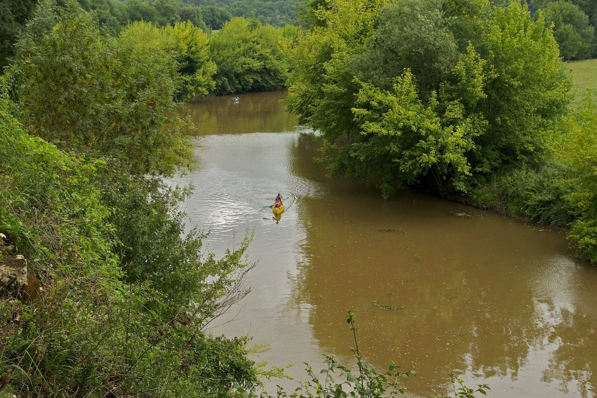
July and August | 28 °C | 7 to 8 | About 10 days above 30 °C a month; canoes on the Dordogne and Vézère |
September | 24 °C | 9 | Walnut harvest from mid-month; hunting opens on 13 September 2026 |
October | 19 °C | 10 | The Lot tourist office suggests autumn or winter for the Autoire waterfall |
November to March | 9 to 15 °C | 9 to 11 | Short days; the Rocamadour lift closes 16 November 2026 to 7 February 2027 |
For most walkers, May, June and September are the best months. Hunting drives can take place on any day of the season, which runs to 28 February 2027 in both the Dordogne and the Lot, so stay on marked paths.
Know Before You Arrive
Both walking areas are on the railway, so you can reach them without a car, although the last few kilometres often need a summer bus or a taxi.
Getting There and Around Without a Car
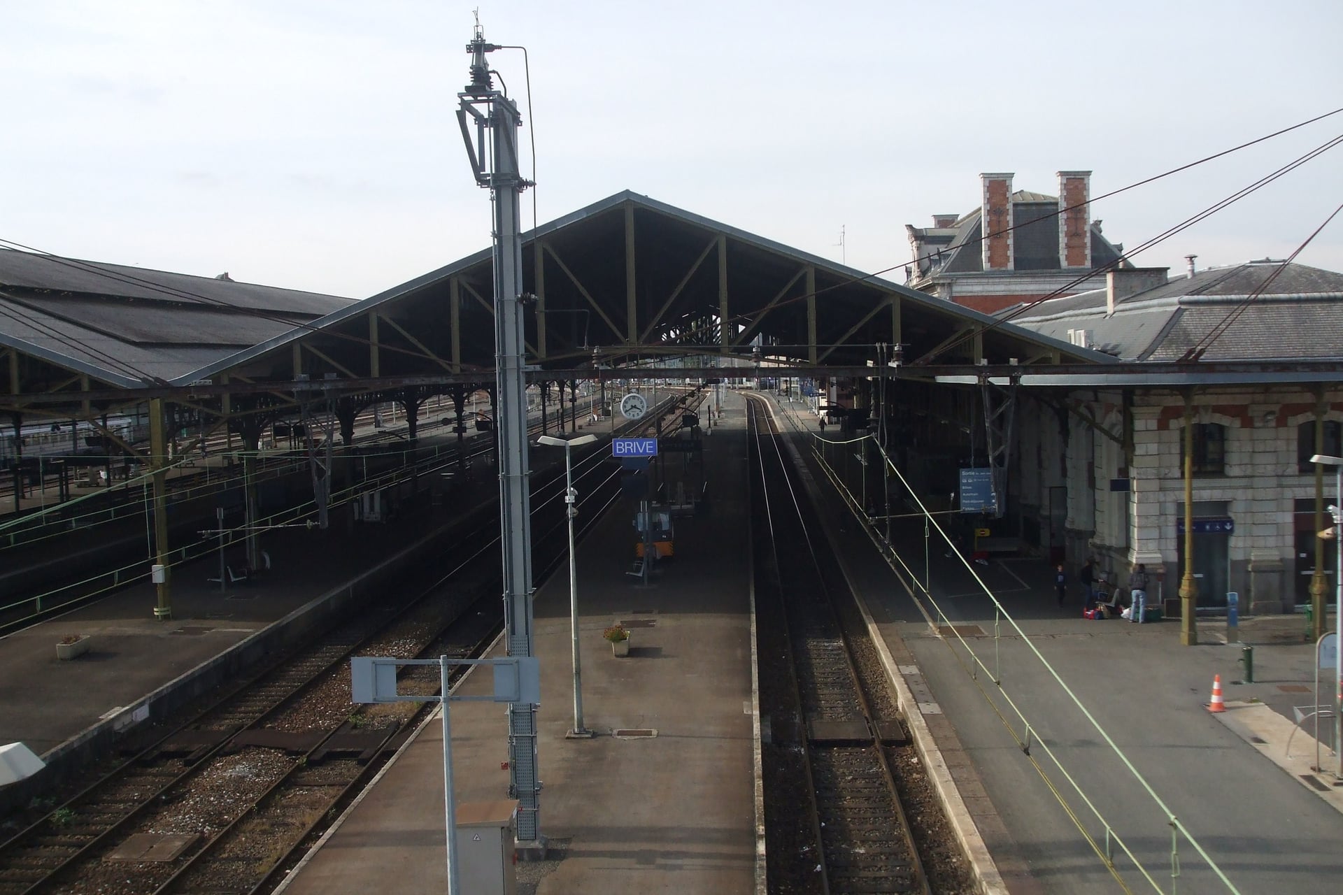
The train journey from Paris takes four and a half hours to Brive, the rail hub for the Lot side, and Sarlat has direct trains from Bordeaux.
By train and coach:
London to Paris: Eurostar in 2 hours 16
Paris Austerlitz to Brive-la-Gaillarde: 10 direct Intercités a day, the fastest in 4 hours 30
Paris Austerlitz to Souillac: Intercités in about 5 hours
Brive to Rocamadour-Padirac: 7 TER a day, 39 to 52 minutes
Bordeaux to Sarlat: direct TER in about 2 hours 20 to 2 hours 35
Périgueux to Les Eyzies: TER line 34 in 29 to 35 minutes
Souillac to Sarlat: coach 335 in about 40 minutes
Local buses fill the gaps, but most of them run only in summer:
Bus 338: Sarlat station to Beynac, Castelnaud, La Roque-Gageac, Vitrac and Domme, six times a day from 4 July to 31 August 2026
liO buses 876 and 877: Figeac and Souillac to Rocamadour and Padirac, at weekends in June and September and daily in July and August
Rocamadour-Padirac station: 5 km from Rocamadour, with a waymarked 3.3 km path to L'Hospitalet and no taxi rank
Flights: Ryanair flies from London Stansted to Bergerac, daily from April 2027, and to Brive on Mondays and Thursdays from 29 March to 28 October 2027
Bergerac airport: coaches to Bergerac station must be booked by 17:00 the day before, and trains to Sarlat take 1 h 06 to 1 h 34
From the USA: fly to Paris and cross the city to Paris Austerlitz for the Brive and Souillac trains
Where to Base Yourself
Where you sleep decides which walks you can reach without a car, and Sarlat is the easiest base for the Périgord walks.
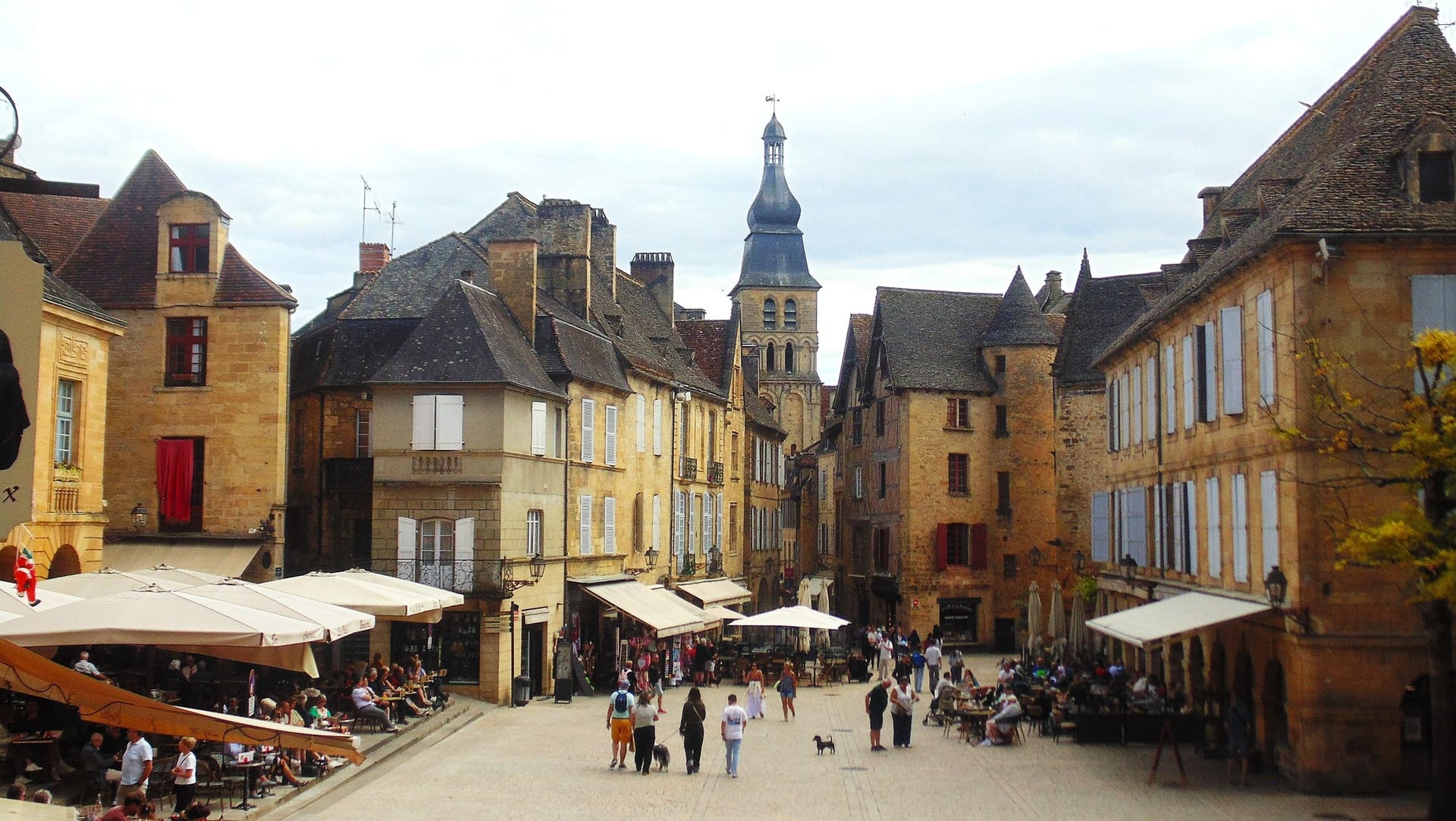
Sarlat: direct trains to Bordeaux, markets on Wednesday and Saturday mornings, bus 338 to walks 3 to 5 in summer and the greenway from the edge of town
Beynac, La Roque-Gageac or Domme: walk 3 starts in Beynac and walk 4 in Domme, by way of La Roque-Gageac; all three are Plus Beaux Villages
Les Eyzies: a station in the village, walk 2 from the door and the caves of the Vézère valley
Carennac: the start of walk 7; Hôtel Le Fénelon has 15 rooms and opens from 4 April to 1 November 2026
Rocamadour: the end of walk 7 and the start of walk 8, with two pilgrim hostels, Le Cantou and the Relais du pèlerin, both offering dormitories and single rooms
French law limits a chambre d'hôtes, the local B&B, to five rooms and 15 guests. In the small villages that means few beds, so book July and August early.
Food and Wine on the Way
Market mornings set the walker's lunch: Sarlat and Martel hold markets on Wednesday and Saturday mornings, and Gramat on Tuesday and Friday mornings, but Rocamadour has no weekly market. These four local products turn up on menus between Sarlat and Rocamadour.
How Much It Costs
Walking costs nothing here, so the money goes on castles, caves, buses and beds.
These are 2026 prices for adults:
Castles: Castelnaud €13.60, Beynac €12.50
Jardins de Marqueyssac: €12.90 from 7 February to 11 November
Fort de La Roque-Gageac: €7
Font-de-Gaume: €13 per cave, booked online; the Musée national de Préhistoire charges €10 until 8 November
Gouffre de Padirac: €24 in high season, €20 in low season
Rocamadour: €4.40 return on the inclined lift, €2 for the château ramparts
Buses: €2 on liO 876 and 877, €2.50 on coach 335
Canoe hire: €22 to €24 from Carsac to La Roque-Gageac, with the drive upstream included
Tourist tax: €1.44 to €1.76 a night in a 3-star hotel in Rocamadour and Sarlat
Maps: €14.30 for an IGN 1:25,000 sheet
What to Pack
Summer sun on the open causse, limestone that turns slippery after rain and caves that stay at 13 °C set the kit here.
For any walk:
Trail shoes or light boots with a good grip
A sun hat and sun cream for the open plateaus
A 20 to 25 litre day pack with a rain jacket
A phone with the GPS track and a power bank
For the Dordogne:
1.5 litres of water each, more on the causse in summer
A warm layer for Padirac and the decorated caves
Walking poles for the 27 km Via Arverna stage and the descent at Autoire
Spare socks for the fords in the Alzou valley
A dry bag if you add a canoe trip
Long, light-coloured trousers against ticks in the long grass
One Base in Sarlat, or Inn to Inn in the Lot?
The Périgord walks are short loops that suit one base, with bus 338 linking them in summer.
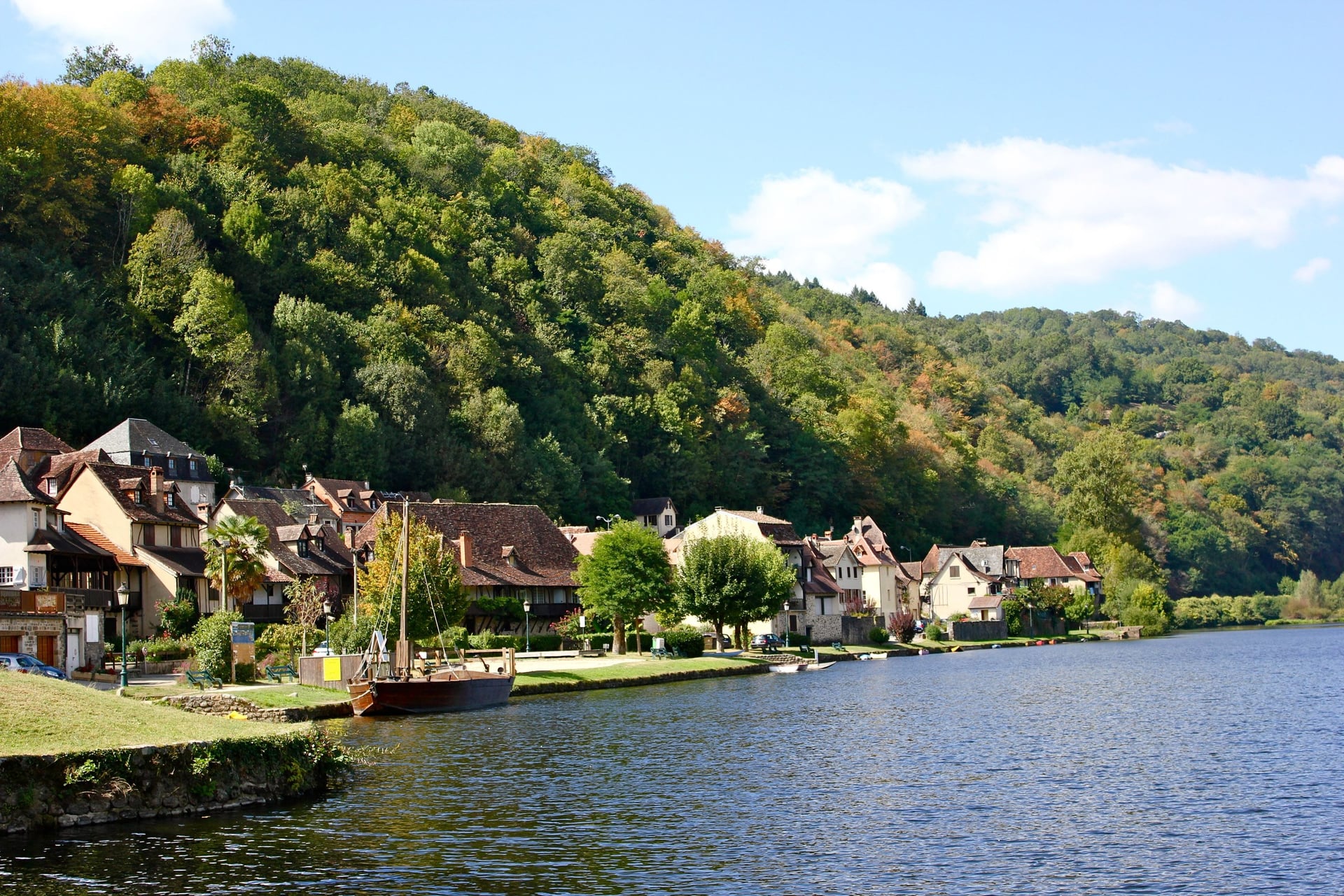
The Lot valley is better walked from village to village, but that is harder to arrange. The Via Arverna stage has no gîte d'étape, and the tourist office notes there is no luggage service on the route.
Our self-guided Dordogne Walking Tour solves that. We book the hotels, move your luggage each day and give you a GPS app, a digital guidebook and support while you walk:
Duration: 10 days / 9 nights, April to October
Route: Beaulieu-sur-Dordogne to L'Hospitalet above Rocamadour, through Loubressac, Carennac, Meyronne and Lacave
Walking: eight days of 8.5 to 21 km, 101.5 km and 2,440 m of climbing in all, with two nights in Loubressac for the Autoire loop
The nights are in 3-star hotels with breakfast, and the tourist tax is paid locally. Ask us about dates for next season. The full list of our walking holidays in France has more regions.
On the last walking day the path leaves Rocamadour for L'Hospitalet on the rim of the Alzou canyon, with a final view back to the chapels stacked on the cliff.
Frequently Asked Questions



Plan with a hiking expert
Free advice from a team that knows these routes inside out - real people, not a bot

HASSLE-FREE
We handle itineraries, accommodations, and anything else you prefer not to deal with, so you can enjoy a carefree hike.

TRUSTED BY MANY
We are a financially protected company, fully bonded and insured, keeping your money safe and allowing you to travel with confidence.

TRIED & TESTED ADVENTURES
Only the best walking tours in France, cherry-picked by our team with an in-depth knowledge of the region.

UNBEATABLE SUPPORT
Our 24/7 customer support is where we show our passion, bringing you a better experience by making your well-being our number one priority.